
What the day feels like
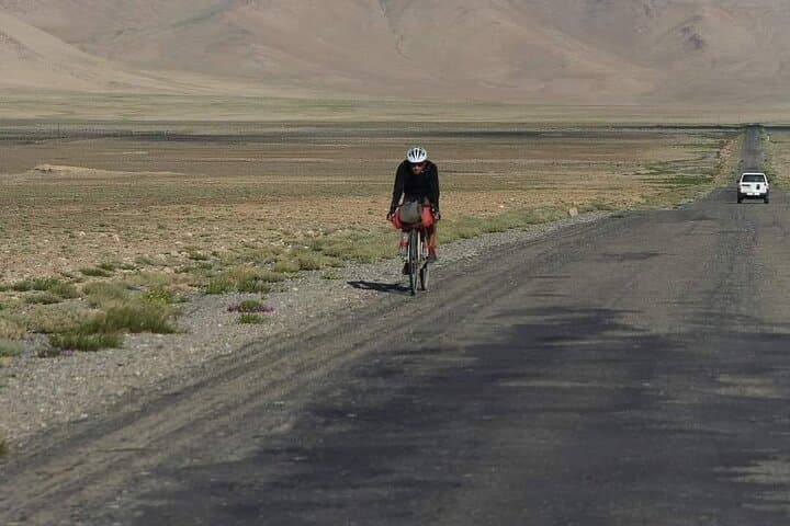
At dawn the road is a ribbon of grey clinging to the mountains like a stubborn rumor. Dust rises in pale columns as the minivan threads hairpins and stretches across wide plateaus; outside the window, the Pamirs—spiked, wind-polished, and vast—seem simultaneously ancient and immediate. Within hours you move from the cultivated green terraces around Hulbuk Castle into a landscape that feels, not foreign, but profoundly older: high alpine desert, rivers that dare you with white teeth, and villages where goats and time keep similar rhythms.
This is a compressed Pamir Highway experience—48 hours of M41 mileage, culture, and geology. It’s not the full overland epic that takes weeks, but in two days the route directs you to the essentials: Hulbuk Castle’s ruined keep and its medieval echoes; the Mir Saeed Alii Hamadoni Complex’s quiet spirituality; the border-draped village of Qal'ai Khumb; and the glacial-tinged Childukhtaron Valley. Each stop offers a different note—history and faith, community and highland topography—and the pace is brisk enough that the trip never feels like a checklist.
Geology here is legible. The Pamirs are the collision zone where the Indian plate pushed north and folded the earth upward into a plateau of serrated ridgelines and alluvial terraces. Roads curve where glaciers once bulldozed valleys; shale and granite surface like exposed ribs. Rivers—most importantly the Panj—slide along the Afghan border with a steady authority, their currents pushing you along the narrative of borderlands and the Silk Road’s long routes. In the afternoon light, cliffs take on the colors of dried blood and tea—ochres, russets, and the pale blue of limestone.
History follows the road. Hulbuk Castle is a reminder that Central Asia’s medieval polities were not peripheral but centers of trade, learning, and art. Mir Saeed Alii Hamadoni’s complex draws on centuries of Sufi presence in the region. Qal'ai Khumb, perched where the Panj widens, still carries the atmosphere of a frontier village—markets that trade for miles around, chaikhanas (teahouses) where conversations orbit the day’s weather and the next harvest.
The cultural exchanges are tangible: Uzbek-style plov and Tajik shashlik are both present; you’ll drink green tea from glass bowls in places that haven’t changed their etiquette for centuries. Local hosts tend to be quietly proud and practical, and language gaps are bridged with smiles and steaming cups.
Practical realities matter on this route. Expect long stretches of unpaved road and slow averages—240–300 km can take most of a day because of elevation changes and narrow passes. The tour’s 48-hour schedule is intense: plan for several short walks, time at archaeological sites, and a couple of long drives. Elevations regularly climb above 2,500–3,000 meters; everyone is advised to move deliberately, hydrate, and sleep well the night before. The weather is famously changeable—blistering sun can flip to wind and rain in an hour—so layers are essential.
Guides are not optional here. Beyond logistical convenience, they add context—telling you which stones in a ruin were recycled from older structures, or where a river gorge was a historical crossing. A local driver and guide mean access to villages that might be closed to independent travelers and ensure awareness of sensitive border regions near Afghanistan.
Costs are straightforward: the base booking price shown is modest for two days of private touring and transport (from about USD 220), though expect additional charges for some site entries, accommodation upgrades, or meals—budget an extra USD 75+ depending on choices.
For those who’ve never been to Tajikistan, there is a practical learning curve: limited cell service beyond major towns, simple guesthouses (comfortable but not luxurious), and a pace that privileges adaptation over control. That’s part of the draw. The Pamirs demand attention; they reward it with expansive skies, the occasional chase of wild laughter from a mountain village, and a tangible sense of place where road, river, and culture meet.
If you go, approach with curiosity and respect. Learn a few phrases in Tajik, carry out your trash, and let the river and road set the tempo. Two days will not unravel everything about the Pamirs, but it offers a precise, concentrated taste—an invitation to return for a longer passage.
Trail wisdom
Small choices, better day.
Hydrate for altitude
Start hydrating 24 hours before the trip and drink often on the road to reduce altitude-related fatigue.
Layer for shifting weather
Temperatures swing quickly—pack a windproof shell, insulating mid-layer, and sun protection.
Carry local cash
Many small sites and chaikhanas accept only cash—ATMs are rare outside Dushanbe.
Respect border etiquette
The route skirts sensitive areas; follow your guide’s instructions and don’t photograph border posts.
Local knowledge
Read the place, not just the route.
Watch for native species including Marco Polo sheep, Golden eagle.
Keep an eye out for wildlife during the transition between areas and habitats. Respect distance guidelines.
The Pamir plateau is ecologically fragile—stay on established paths, minimize waste, and support local guides and businesses to sustain communities.
Follow the guide's instructions on size limits, ethical handling, and leave-no-trace practices.
Childukhtaron Valley’s lesser-visited side trails. Small chaikhanas in Qal'ai Khumb for authentic plov and conversation
Locally recommended viewpoints and quiet spots known best to local operators.
Sections of the M41 follow ancient Silk Road corridors; Hulbuk Castle dates to medieval principalities that connected trade and scholarship.
Maritime roots and regional tradition shape the waterways and working coasts.
Seasonal guide
Four versions of the same landscape.
Spring
Best forWildflower displays · Lower crowds
ChallengesVariable snowmelt · Muddy secondary roads
Spring brings thawing valleys and blossoming steppe, but late snow and mud can slow travel—check road updates.
Summer
Best forWarmest temperatures · Long daylight hours
ChallengesAfternoon storms · Peak travel demand
Summer is the most comfortable driving season with high passes largely clear, though afternoon storms can occur.
Fall
Best forCrisp skies and colors · Stable weather
ChallengesShorter daylight · Colder nights
Late summer into early fall is ideal for clear skies and dramatic light; bring warm night layers.
Winter
Best forSnowscapes for experienced travelers · Low crowds
ChallengesClosed passes · Severe cold
Winter travel is possible only for experienced, well-equipped groups; many roads and sites are inaccessible.
Operator details
What the booking data adds.
Included
- ✓Permission to visit GBAO (however, the tourist must send us a copy of the passport 10 days before the start of the tour).
- ✓The condition of the cars is good, but not all are equipped with air conditioning.
- ✓Entrance fee
Not included
- —Meals, lunhc, dinner own
- —Tour-gude
- —Accommodation
Good to know
- ✓Not recommended for pregnant travelers
- ✓Travelers should have at least a moderate level of physical fitness
Pack with intention
What to bring.
Good to know
Common questions.
If your route goes into Gorno-Badakhshan (GBAO), a regional permit is commonly required for foreign visitors—your tour operator typically arranges this.
Plan the edges
The details that make the day easier.
The Pamir Highway (M41) is one of the highest international roads in the world, with sections that climb above 4,000 meters—its construction followed centuries-old caravan routes.
After a day on the road, seek out a chaikhana for steaming plov and tea—locally made naan, skewered shashlik, and conversation make for the best souvenirs. In Dushanbe, sample market-bought apricots and look for small bakeries selling non (bread).
- trailhead
- Dushanbe International Airport (DYU); Driving distance from Dushanbe to Qal'ai Khumb ~240 km (7–9 hours due to mountain roads); Cell service: Good in Dushanbe and major towns, limited in the highlands; Permits: GBAO permit may be required for travel into Gorno-Badakhshan.
Support local guides and guesthouses, pack out all trash, avoid single-use plastics, and avoid disturbing fragile alpine vegetation and riverbanks.
Explore by topic
Follow the threads.
Keep exploring
Make the story part of the trip.
In four hours you can move from shaded canyon ferns to wind-scoured coastal ridgelines, guided by someone who knows where the light—and the hidden views—live. This private half-day hike on the Monterey Peninsula or Big Sur is compact, curated, and perfect for travelers who want depth without a multiday commitment.
 Related story
Beneath a sky of shifting light, Skaftafell’s ice reads like a map of time. This three-hour guided glacier hike mixes technical instruction with geology and culture: compact, safe, and unforgettable.
 Related story
Lose the city for a few hours without leaving it: this 5-mile, 900-foot-gain Forest Park loop threads old-growth pockets, city viewpoints, and cultural landmarks for a compact taste of Portland’s wild side. Expect moss, roots, and stories.