
What the day feels like
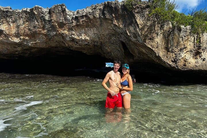
The river narrows, the sound of the surf fades, and the trail becomes a ribbon of slick limestone and mangled roots. You climb for a few minutes up a steep, rocky bank and then pause at an opening in the jungle: a bowl of water so clear it looks like someone hauled a piece of the Caribbean inland and set it into a hollow of the earth. Light filters through a break in the canopy and gilds the pool, and when the first person steps off the stone ledge and drops into the lagoon, the surface answers with a single, clean ring.
This is the tempo of the north coast of Puerto Rico—a compact, salty, karst-carved landscape that moves fast from inland river canyons to secluded Atlantic beaches. On the Lagoon Cave and Secluded Beaches Tour in Puerto Rico you string those moments together: a hike through a shallow river to a hidden waterfall, a cliff-side plunge into Charco Azul, and a late afternoon spent on a broad, uncrowded beach in Vega Baja. The day is long—roughly six to seven hours of moving, scrambling, and swimming—but it’s stitched together by uncluttered scenery and a local guide who knows where the good jumps are and which tide windows make each stop safest.
Geology gives this place its personality. Northern Puerto Rico sits on the island’s Northern Karst Zone—limestone bedrock pounded and dissolved over millennia by rain and underground streams. The result is a patchwork of sinkholes, caves, and natural pools hidden under forest canopies. Locals have long used these charcos—deep, clear pools in river bends—as places to cool off and to gather, and the tour threads through towns with histories shaped by agriculture, coastal trade and a resilient island culture.
Culturally, this route feels island-quiet. You’ll pass through or near Arecibo—whose limestone interior shelters caverns and waterfalls—and the small coastal towns of Vega Alta and Vega Baja, where roadside frituras and seaside kiosks sell fried fish, empanadillas, and cold Medalla beer to workers and tourists alike. Guides often point out roadside fruit stands selling passion fruit and coconut; the food is unfussy and immediate, and the breeze from the Atlantic gives even a simple plate a memorable context.
The logistics are straightforward but require some preparation. The tour runs about 6–7 hours (360–420 minutes) and is rated intermediate: expect stretches of river walking, a steep incline to and from certain lagoon entrances, and short sections of scrambling over wet, uneven rock. You should be comfortable moving on variable terrain and be able to manage repeated short climbs. The swim sections are optional in spots, but many people want to jump in, so bring quick-drying clothes and a sense of adventure.
Safety and timing matter. Mornings are cooler and the water runs clearer earlier in the day; after heavy rains the river will darken and currents strengthen, so operators monitor weather and adjust the route accordingly. Guides who run the <a href="https://app.advcollective.com/local-experts/lagoon-cave-and-secluded-beaches-tour-north-puerto-rico-adventure">Lagoon Cave and Secluded Beaches Tour</a> read those conditions and time the Charco Azul stop for tide windows that make cliff jumping safe and beach access easy. If you’re booking independently, confirm pick-up times, ask about fitness expectations, and tell your guide about any mobility concerns.
What to expect on the trail: waterproof pack or dry bag, sturdy trail sandals or lightweight hikers with good tread, and at least 1–2 liters of water per person for the day. Sunscreen and a hat are essential; the north coast’s sun can be relentless on exposed limestone and beaches. If you want photos, bring a compact waterproof camera or a secure phone housing—there are better opportunities for close-water photography than for wide coastal panoramas, though the final beach stop offers long, empty horizons at golden hour.
Local stewardship is subtle but important. The karst pools and their shorelines are sensitive: avoid taking rocks or shells, keep to obvious paths, and carry out anything you brought in. Guides on the tour operate small, often family-run operations that depend on repeat visitors and quiet word-of-mouth; tipping and a respectful attitude go a long way.
Practical booking notes: the tour is typically sold with instant confirmation and includes swimming stops and guide support; private-tour options are sometimes available for groups who want a less-crowded, custom schedule. If you’re based in San Juan, plan for a 45–60 minute drive to the north coast meeting points—many operators provide pick-up and drop-off. If you’re staying closer to the west (Arecibo or Vega Baja), travel times shrink significantly.
Why go? This day trip compresses the best of Puerto Rico’s lesser-seen north coast into a single, earned day: river hikes and hidden pools that feel remote, a local guide who knows how to read the landscape, and a final long beach that rewards the effort with space and quiet. For anyone who wants a mix of moderate hiking, cliff-edge adrenaline, and saltwater cooling off, it’s one of the island’s most satisfying way-to-spend-a-day itineraries. Ready to book? Learn more about the full itinerary and reserve a spot through the local expert listing for the <a href="https://app.advcollective.com/local-experts/lagoon-cave-and-secluded-beaches-tour-north-puerto-rico-adventure">Lagoon Cave and Secluded Beaches Tour</a>.
Trail wisdom
Small choices, better day.
Wear grippy footwear
Use sturdy water-ready shoes or trail sandals with good tread to handle slick limestone and river crossings.
Bring a dry bag
Keep phone, snacks, and a spare top dry; pockets or open packs are risky near jumps and waves.
Time for tides
Ask your guide about tide and recent rainfall—they’ll optimize stops for swimming and safety.
Hydrate early
Start with plenty of water—you’ll burn fluids on the hike and in the sun even if you’re in the water.
Local knowledge
Read the place, not just the route.
Watch for native species including Common coastal shorebirds and herons, Freshwater fish and native frogs (coquí audible at dusk).
Keep an eye out for wildlife during the transition between areas and habitats. Respect distance guidelines.
These karst pools and coastal dunes are fragile—avoid trampling shoreline vegetation, pack out all trash, and use reef-safe sunscreen to reduce impact.
Follow the guide's instructions on size limits, ethical handling, and leave-no-trace practices.
A narrow, shaded river walk upstream of the main waterfall with small pools ideal for a quiet dip. A rock shelf at the Vega Baja beach that offers long views at sunset and seals itself from crowds
Locally recommended viewpoints and quiet spots known best to local operators.
The north coast’s karst terrain has long influenced settlement and agriculture; caves and pools provided freshwater and shelter to pre-Columbian Taíno communities and later coastal settlements.
Maritime roots and regional tradition shape the waterways and working coasts.
Seasonal guide
Four versions of the same landscape.
Spring
Best forClear river water · Comfortable temperatures · Fewer afternoon storms
ChallengesVariable early-season rain · Busy holiday weekends
Spring (Mar–May) often delivers clear pools and warm, manageable air—one of the best windows for this tour.
Summer
Best forWarm seawater · Extended daylight · Fruit stands in peak season
ChallengesHigher heat and humidity · Hurricane season begins mid-summer
Summer brings hot, swimmer-friendly conditions but watch for increased rain and tropical storm risk starting late season.
Fall
Best forFewer visitors · Warm seas · Late-season bird activity
ChallengesPeak hurricane season (Aug–Oct) · Increased rainfall risk
Fall can be a quiet, rewarding time—subject to wider weather variability and storm advisories.
Winter
Best forCooler inland hikes · Lower humidity · Good visibility
ChallengesOccasional northerly swell · Shorter daylight hours
Winter is mild and less humid, with crisp air for hikes; ocean and river conditions can be changeable after northerly swells.
Operator details
What the booking data adds.
Included
- ✓Private transportation
- ✓Bottled water
- ✓Snacks
Not included
- —Gratuity
Good to know
- ✓Not recommended for travelers with spinal injuries
- ✓Not recommended for pregnant travelers
- ✓Not recommended for travelers with poor cardiovascular health
- ✓Travelers should have a high level of physical fitness
- ✓Please reconfirm your reservation with the local operator 24 hours prior to your experience. If you do not contact the operator they will attempt to reach you via phone or email to confirm your reservation. Please ensure you have provided a valid phone number when booking.
Pack with intention
What to bring.
Good to know
Common questions.
It’s intermediate—expect steep short climbs, river walking, and scrambling over wet rock; participants should be comfortable on uneven terrain.
Plan the edges
The details that make the day easier.
Puerto Rico’s north coast lies within the island’s Northern Karst Zone—an extensive limestone region with caves and sinkholes that carved the hidden lagoons you’ll visit.
After the hike, head to a beachfront kiosk in Vega Baja for fried fish or empanadillas and an ice-cold local beer; town plazas often have live music on weekend nights and small bakeries selling tropical pastries.
- Closest airport
- Luis Muñoz Marín Intl (SJU); Driving distance from San Juan: ~45–60 minutes to north-coast meeting points; Cell service: generally good on roads, patchy inside caves and heavy canopy; Permits: none required for day tours—private operators manage access.
This tour visits sensitive karst pools and coastal zones—pack out your trash, avoid collecting shells or rocks, and use reef-safe sunscreen to protect marine and freshwater ecosystems.
Explore by topic
Follow the threads.
Keep exploring
Make the story part of the trip.
Set out from Bass Harbor for a private, customizable day on Blue Hill Bay — lighthouses, puffins, seals, and the chance to feel Acadia from the water. Small groups, local captains, unforgettable views.
In four hours you can move from shaded canyon ferns to wind-scoured coastal ridgelines, guided by someone who knows where the light—and the hidden views—live. This private half-day hike on the Monterey Peninsula or Big Sur is compact, curated, and perfect for travelers who want depth without a multiday commitment.
 Related story
Beneath a sky of shifting light, Skaftafell’s ice reads like a map of time. This three-hour guided glacier hike mixes technical instruction with geology and culture: compact, safe, and unforgettable.