
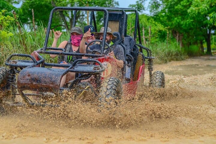
What the day feels like
You kick gravel and spray dust as the buggy lurches into the green: waist-high cane fields arcing like the teeth of a comb, palms leaning over a single-track that narrows into a ribbon of mud. The engine chews, you grin, and for a few loud, sunlit minutes the organized world of resorts and airport shuttles slips away. What remains is immediate — the scent of rain-warmed earth, coconut husks clacking in the wind, and the steady rhythm of tires finding purchase on sand and stone. Then the path opens and the ocean arrives, sudden and blindingly blue, a hidden cove wrapped in limestone and mangrove where the tour pauses for a swim and to catch your breath.
This three-and-a-half-hour off-road loop out of Punta Cana is an uncomplicated thrill: drive your own two-seater buggy through rural Dominican landscapes, cross small streams and mud flats, and end the day cooling off at a tucked-away beach or sea cave that few independent travelers find. It’s not a polished safari. It’s a contact sport with landscape — equal parts kid-on-a-bike glee and archetypal Caribbean ease.
Geology and landscape here are subtle but telling. The eastern tip of the Dominican Republic is low and coral-derived: sugary white sands owe their color to ground coral and shells; limestone stretches inland and has been sculpted into shallow caves and sinkholes over millennia. Along the route you’ll see coastal scrub give way to cultivated land: coconut groves, small cacao patches, and the rectangular signatures of sugarcane fields. That mix — karst topography meeting tropical agrarian uses — creates the kind of small-scale diversity that makes each bend in the trail a new snapshot.
The modern story of Punta Cana is also part of the ride. This coastline was transformed into a tourist hub in the 1970s by developers who bought large tracts of coastline and built the resort infrastructure that draws visitors today. The off-road loop threads the tidy edges of that development into areas still used by locals; you’ll pass rural settlements, roadside stands selling fruit and juice, and the occasional working farm. Guides often point out how the economy shifts between tourism and agriculture, a balancing act that shapes local identity and access to land.
Culturally, the trip is an easy lens into daily life. Drivers and local guides are often born and raised in the province of La Altagracia and carry a practical, warm hospitality: they know which mango trees are the sweetest and where the best photo angles are. Small roadside stands selling sweet plantain or freshly cut coconut water become social waypoints. The guides also handle the logistics — helmets, safety briefing, and basic instruction for first-time drivers — so you can focus on the fun without pretending you invented cornering.
Practicalities matter here. The tour is about 210 minutes from start to finish — long enough to feel like an expedition but short enough to fit into a half-day slot. Terrain is variable: compact tracks, soft sand, and muddy sections after rain. Elevation change is minimal (you’re on coastal plains), so fitness is not the barrier — it’s vehicle control and attention. Wear closed-toe shoes, bring a water bottle, and keep a dry bag on hand for phone and sunscreen. Mornings are cooler and less crowded; late afternoons offer softer light for photos but can be windier.
Safety is straightforward: operators supply helmets and run through vehicle basics and hand signals. Drive within your comfort zone; the buggies are forgiving but tricky if you muscle them through ruts. If the weather turns, guides will reroute or pause; local operators know the coastline and tide rhythms well. Pack a sense of adventure and accept a little grime — the better stories always come with a little mud.
For photographers and short-attention travelers, the best frames come from the contrasts: the burr of dust against a cobalt bay, a child waving from a roadside table stacked with mangoes, the cave mouth framing breakers. The hidden beach stop provides time to swim and to explore rock shelves and small caves — a chance to go from throttle hand to towel in minutes.
Why do this and not just lie on a resort beach? Because it stitches context to relaxation. You see how the land is used, meet locals in small ways, and earn the beach at the end. It’s an accessible kind of expedition: hands-on, a little messy, and very Dominican.
If you go: book a morning slot to avoid midday heat; bring ID and a credit card for optional tips or purchases at local stands; and treat the experience as part drive, part cultural snapshot, part seaside escape. The hidden beach is the prize, but the journey through coconut palms and over muddy paths is where the story happens.
This is a trip for anyone who wants a short yet immersive adventure with a salt-water payoff. It’s ideal for couples, families with older kids, or groups looking for a memorable half-day that still leaves room for an afternoon of snorkeling or a sunset at a resort bar. You’ll come back with sand in your shoes, a handful of great photos, and a reminder that some of the best travel memories start with a turn onto an unpromising dirt road.
Trail wisdom
Small choices, better day.
Pick a Morning Departure
Early slots avoid midday heat and offer calmer seas for the beach stop.
Wear Closed-Toe Shoes
Trails include mud, rocks, and skid-prone sand — protect your feet for comfort and control.
Bring a Dry Bag
Keep phone, camera, and small essentials safe from spray and mud.
Follow the Guide’s Pace
If you’re new to buggies, stick to the guide’s recommended speeds and lines through ruts.
Local knowledge
Read the place, not just the route.
Watch for native species including Brown pelican, Juvenile reef fish in tide pools.
Keep an eye out for wildlife during the transition between areas and habitats. Respect distance guidelines.
Respect local ecosystems by keeping to trails, avoiding stepping on coral or marine life during the beach stop, and using reef-safe sunscreen to reduce chemical impacts.
Follow the guide's instructions on size limits, ethical handling, and leave-no-trace practices.
A small roadside mango stand favored by guides for the best sweet fruit. A short tidal rock shelf near the cave that reveals tide pools and small marine life at low tide
Locally recommended viewpoints and quiet spots known best to local operators.
The Punta Cana coastline was largely developed for tourism beginning in the 1970s; much of the modern resort infrastructure was built on former farmland and coastal scrub.
Maritime roots and regional tradition shape the waterways and working coasts.
Seasonal guide
Four versions of the same landscape.
Spring
Best formilder temperatures · fewer tourists · clear morning light
Challengesoccasional rains · muddy trails after storms
Spring (March–May) brings pleasant temperatures and good visibility, but brief showers can make dirt tracks slick—perfect for playful mud splashes if you don’t mind a little mess.
Summer
Best forlush green scenery · calmer shoulder-season crowds · warm ocean swims
Challengeshigh heat and humidity · summer showers
Summer is hot and lush; expect afternoon downpours and plan drives in the mornings to avoid heat and soggy trails.
Fall
Best forfewer crowds · dramatic cloudscapes · late-season deals
Challengeshurricane season peak months · unstable weather windows
Fall can be variable—great for fewer people and dramatic skies, but be aware of hurricane-season advisories and flexible scheduling.
Winter
Best fordry, sunny days · ideal swimming conditions · peak visibility
Challengeshigher demand from tourists · book early
Winter (Dec–Apr) is the dry season and the most reliably sunny time to do the loop; expect crowds but excellent driving and beach conditions.
Operator details
What the booking data adds.
Included
- ✓Private transportation
- ✓Admission fee
- ✓Coffee and/or Tea
Not included
- —Brunch
- —Lunch
Good to know
- ✓Public transportation options are available nearby
- ✓Infants are required to sit on an adult’s lap
- ✓Specialized infant seats are available
- ✓Suitable for all physical fitness levels
Pack with intention
What to bring.
Good to know
Common questions.
Most operators require a valid driver's license to operate the buggy; check the specific tour terms when booking and bring original ID.
Plan the edges
The details that make the day easier.
Punta Cana’s modern resort development began in the 1970s when local developer Frank Rainieri purchased beachfront land and helped transform the area into a major tourism destination.
After the ride, head back toward Bávaro for fresh ceviche or a plate of mofongo and a cold Presidente beer. For a quieter taste of local life, ask your guide for the small family-run stand serving coconut water and fried plantain near the start of the trail.
- Closest airport
- Punta Cana International Airport (PUJ); Typical drive to meeting point: 10–30 minutes from major hotels; Cell service: Good near resorts, spotty by remote beaches; Permits: None—operator provides vehicle, helmet, and waiver.
Support operators who respect local habitats—avoid driving on fragile dunes, use reef-safe sunscreen at the beach stop, and take all trash with you to minimize impacts.
Explore by topic
Follow the threads.
Keep exploring
Make the story part of the trip.
Set out from Bass Harbor for a private, customizable day on Blue Hill Bay — lighthouses, puffins, seals, and the chance to feel Acadia from the water. Small groups, local captains, unforgettable views.
In four hours you can move from shaded canyon ferns to wind-scoured coastal ridgelines, guided by someone who knows where the light—and the hidden views—live. This private half-day hike on the Monterey Peninsula or Big Sur is compact, curated, and perfect for travelers who want depth without a multiday commitment.
 Related story
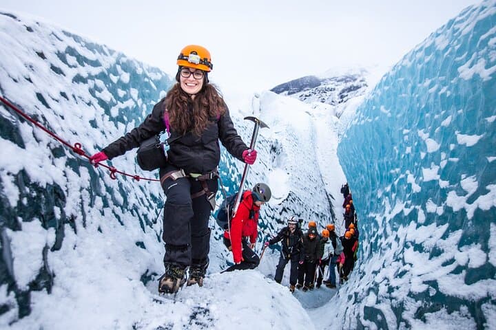
Beneath a sky of shifting light, Skaftafell’s ice reads like a map of time. This three-hour guided glacier hike mixes technical instruction with geology and culture: compact, safe, and unforgettable.