Cascades on the Move: A Jeep-Powered Waterfall Circuit in Pisgah Forest
Four to five waterfalls, rolling forest paths, and backroad jeep miles—Pisgah’s greatest hits in a half day.
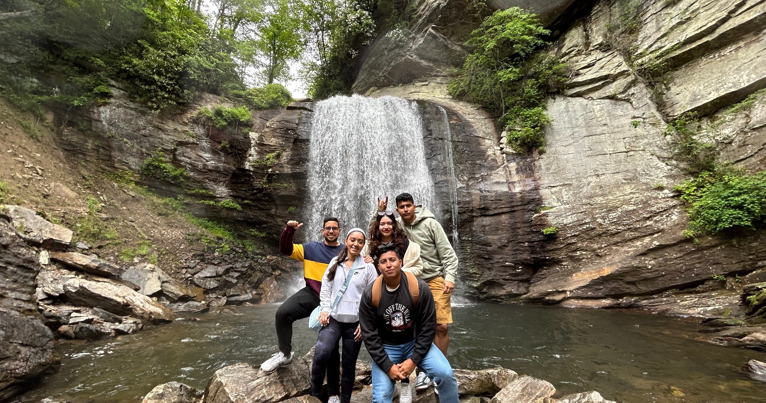
The jeep noses off the pavement and onto gravel, and the forest greets you like an old friend—fragrant, rain-polished, impossibly green. The road narrows and the Blue Ridge folds around you in quiet waves. A creek keeps pace, riffles racing the tires as if daring the group to keep up. Your guide kills the engine at the first pullout, and the forest exhales. In the hush, you can hear it: water doing what it does best, carving patience into rock. The first trail is soft and needled, a quick stroll toward a curtain of white tucked into rhododendron. Spray lifts and catches the light, and just like that, you’re awake to the day—the kind of awake that only cold water and mountain air can deliver.
Trail Wisdom
Wear real traction
Closed-toe hiking shoes with good grip are essential—waterfall spray can turn roots and rock into slick puzzles.
Pack for wet weather
Mountain rain arrives fast; bring a lightweight shell even on sunny mornings. Ponchos are provided, but layers work better for comfort.
Mind the barriers
Stay behind railings and avoid mossy rock near the lip—flows are stronger than they look and rescues are far from instant.
Optimize your photos
Use a polarizer to cut glare on wet rock and water, and try 1/4–1 sec exposures for silky flow—steady your camera on a rock or small tripod.
Local Knowledge
Hidden Gems
- •Log Hollow Falls—quiet and photogenic with a short, mossy approach
- •Slick Rock Falls—often overlooked and atmospheric after rain
Wildlife
Pileated woodpecker, Black bear (rarely seen; store food properly and keep distance)
Conservation Note
Stay on established paths and behind barriers—trampling mossy rock and creek edges accelerates erosion. Pack out all trash and never stack rocks in streams.
Transylvania County’s ‘Land of Waterfalls’ nickname reflects over 250 documented falls; many trails trace 1930s Civilian Conservation Corps routes and early logging grades.
Seasonal Guide
spring
Best for: High flows and fresh greenery, Wildflower spotting
Challenges: Frequent showers, Muddy trails
Creeks run full and the forest glows. Expect cool temps, slick roots, and fast-changing skies—bring layers and a shell.
summer
Best for: Shaded hiking, Family outings
Challenges: Crowds at popular falls, Humidity and afternoon storms
Long days, lush canopy, and warm temps make for relaxed hiking. Start early to beat crowds and keep water handy.
fall
Best for: Peak color photography, Crisp hiking weather
Challenges: Leaf-peeper traffic, Cooler mornings
Maples and oaks light up the slopes. Cooler air sharpens views—pack an insulating layer and plan for busier trailheads.
winter
Best for: Clear views, Low crowds
Challenges: Icy patches near spray, Cold temps
Leaf-off reveals hidden cascades and rock features. Watch for ice around water and bring gloves and a warm hat.
Photographer's Notes
What to Bring
Waterproof Shell JacketEssential
Pisgah’s showers are sudden—staying dry keeps you warm and moving comfortably.
Hiking Shoes with Lug SolesEssential
Traction matters on wet rock and root; sneakers can be dangerously slick.
Compact Trekking Poles
Useful on muddy, slick sections or when leaf litter hides roots.
Polarizing Filter (or Waterproof Phone Pouch)
Cuts glare for better waterfall shots and protects your device from spray.
Common Questions
How much hiking is involved?
Plan on 2–3 miles total, broken up into several easy-to-moderate walks on even and uneven surfaces.
Are tours canceled for rain?
No—rain is common and can enhance the waterfalls. Ponchos are provided. Only dangerous weather (lightning, ice, flooding) triggers a cancellation with a refund.
Can children join the tour?
Children 5 and older are welcome on public tours. Families with younger kids can inquire about a private tour.
Are pets allowed?
No, pets aren’t permitted for safety reasons.
What should I wear and bring?
Closed-toe hiking shoes, a light rain shell, quick-dry layers, and a small daypack with a water bottle. Snacks and water are provided.
Are there restrooms on the route?
Some trailheads have vault toilets, but not all. Use the facilities before departure and take advantage of restroom stops when available.
What to Pack
Hiking shoes with real tread (for slick roots and rock), lightweight rain shell (mountain showers are common), 1–2 liters of water in a small daypack (snacks provided but hydration is on you), polarizing filter or waterproof phone pouch (better photos and device protection near spray).
Did You Know
Transylvania County, home to Pisgah National Forest, contains more than 250 waterfalls—one of the highest concentrations in the United States.
Quick Travel Tips
Arrive 15 minutes early to the Pisgah Forest meet-up to check gear and sign waivers; start times are firm. Weekday mornings offer the best chance at quieter viewpoints. Cell service fades quickly once you leave town—download maps offline. After heavy rain, expect bigger flows and slicker surfaces; guides may adjust the route for safety.
Local Flavor
Post-adventure, head to The Hub & Pisgah Tavern at the forest entrance for a local brew and gear gawking. In downtown Brevard, grab tacos at Quixote or a sit-down meal at The Square Root. Beer lovers should detour to Oskar Blues Brewery’s Tasty Weasel taproom for a pint and food trucks; keep an eye out for the town’s famous white squirrels on side streets.
Logistics Snapshot
Closest airport: Asheville Regional (AVL), ~25 miles (40 minutes). Meet-up: Asheville Jeep Tours HQ, Pisgah Forest (near Brevard). Driving: 10 minutes from downtown Brevard; 45–60 minutes from Asheville. Cell service: Spotty to none inside Pisgah—coordinate plans beforehand. Permits: No permits required for this tour; standard national forest rules apply.
Sustainability Note
Pisgah’s waterfall corridors see heavy use—stay on durable surfaces, skip creek rock-hopping, and keep a full arm’s length from slick edges. Pack out everything and leave logs, rocks, and plants exactly where you found them.