
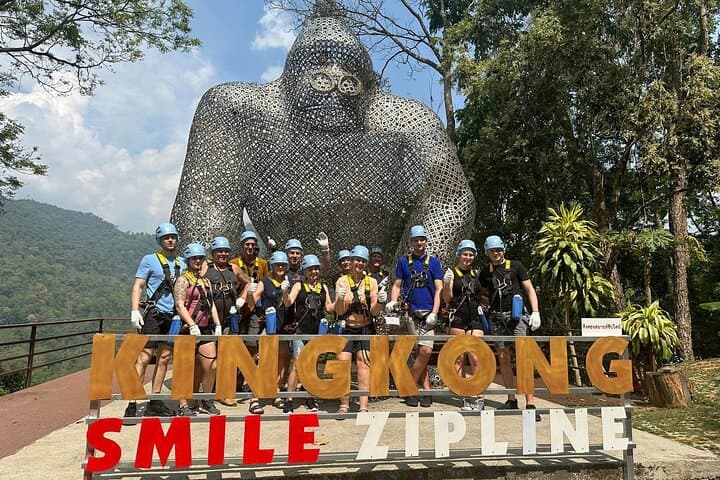
What the day feels like
The first time you step onto the platform at Kingkong Smile, the jungle exhales beneath you—an audible rush of insects, wind through teak leaves and a valley that seems to swallow sound. The zipline waits like a taut promise: twin cables stretching away, vanishing into green folds, 1,200 meters of raw altitude and speed. For about a minute and a half you are intentionally small, a human punctuation mark moving against a sweep of mountains and rice terraces that have kept their rhythms long before the harness clicked into place.
This is not stunt-fueled bravado disguised as tourism. Kingkong Smile, billed as among Asia’s longest and highest lines, is practiced choreography—twin cables for redundancy, guides who repeat safety checks as if reciting scripture, and platforms carved into ridges that look over Mae Taeng’s carved valleys. The full-day package that most visitors book includes round-trip transfers from Chiang Mai, a Thai buffet that tastes of home-cooked spice and lime, and roughly five hours that fold travel, orientation and the main aerial section into one accessible outing.
The land you fly over is northern Thailand in microcosm. Geologically, these ridges are part of the Shan Hills system, folded by ancient forces and softened by monsoon-fed erosion into a pattern of steep valley walls and elongated ridgelines. Ecologically, the canopy is a mix of secondary tropical deciduous forest and planted teak—an environment that supports gibbons and macaques, crested hornbills, and a corrodiate of butterflies in the wet season. Locally, the lift of the land is stitched into centuries of Lanna culture: terraced fields, hill-tribe villages and temples that perch like punctuation marks in the landscape.
There’s a cultural cadence to the day. Guides—many from local communities—open the morning with a safety briefing, then a simple blessing for safe passage. The Thai buffet at midday is less spectacle than sustenance: jasmine rice, a bright papaya salad, grilled fish with herbs, and fresh fruit. The operators emphasize community partnerships and training; zipline platforms can provide steady income for rural families, and responsible outfits here support reforestation and waste management programs in nearby valleys.
On the line itself, you learn how tiny adjustments change the ride. Lean back to watch the world flatten into ribboned greens. Tuck in and feel the rush; let your feet dangle and count the folds in the valley below. Nature acquires agency—wind teases your helmet strap, a river dares you to trace its silver trail, and a distant waterfall seems to applaud your passage. For photographers, the best light is late morning when the mist burns off and colors sharpen; for adrenaline junkies, the pure, steady pull of the twin cables offers that clean, almost meditative speed that becomes addictive after the first run.
Practicalities are refreshingly straightforward. The advertised duration—roughly five hours—includes pickup from Chiang Mai, so factor in travel time (about 45–90 minutes depending on traffic and exact location). Weight and age limits are common—operators enforce them for safety—so check before booking. Wear closed-toe shoes and long pants for rubbing against the harness, and consider a light long-sleeve for sun and insect protection. Bring a small daypack with water, a camera with a secure strap, and a sense of humor for the friendly, jokey encouragement of your guides.
Why travelers choose this over other Chiang Mai activities is simple: perspective. Trekking gives you the intimacy of ground-level discovery; temple-hopping provides history and architecture; but the zipline offers a perspective that is both cinematic and intimate—speed that reveals landscape, and height that reconnects you to the sheer verticality of northern Thailand. It’s family-friendly in the sense that most people in reasonable health can participate, but it still scratches that urgent itch for a physical, unforgettable experience.
If you go, time your visit for the dry season, when visibility is crisp and platforms are less slippery. Go early in the day to dodge afternoon heat and showers, and to get the best photographic light. Trust the guides—safety protocols exist for a reason—but also ask questions. They’ll tell you about the plants and animals you might spot, point out a temple on a distant ridge, and share a preferred local market for sticky rice and mango after your return.
Kingkong Smile is, in the end, a reminder that adventure travel can be both accessible and meaningful. The thrill is real, but so is the quiet that follows a run: the post-flight stillness where the jungle reclaims sound and you feel your pulse gradually settle. It’s a good day in the mountains—one that leaves you with a story, sun on your shoulders, and a sharper sense of how wide a single afternoon can be.
Trail wisdom
Small choices, better day.
Wear closed-toe shoes and long pants
Protect against harness rub and platform surfaces—flip-flops and shorts aren’t allowed.
Secure loose gear
Use a small chest-mounted camera strap or leave phones in lockers; dropped items are gone for good.
Hydrate before you fly
Bring a reusable water bottle and sip throughout the day to avoid lightheadedness after runs.
Arrive early and listen closely
Morning light is better for photos and the full safety briefing will make your runs smoother.
Local knowledge
Read the place, not just the route.
Watch for native species including Long-tailed macaque, Crested hornbill (seasonal).
Keep an eye out for wildlife during the transition between areas and habitats. Respect distance guidelines.
Responsible operators engage local communities and reforestation projects—pack out trash, avoid feeding wildlife, and support community-run stalls.
Follow the guide's instructions on size limits, ethical handling, and leave-no-trace practices.
Mae Taeng valley viewpoints for sunrise photography. Small roadside markets selling grilled sticky rice and local fruits
Locally recommended viewpoints and quiet spots known best to local operators.
Chiang Mai was founded in 1296 as the capital of the Lanna Kingdom; the region’s landscapes have supported teak forestry and hill‑tribe cultures for centuries.
Maritime roots and regional tradition shape the waterways and working coasts.
Seasonal guide
Four versions of the same landscape.
Spring
Best forModerate temperatures · Clear morning light · Fewer crowds than high season
ChallengesOccasional haze from agricultural burning · Early heat by late spring
Spring brings warm, stable days and good visibility early in the season, but regional agricultural burning can reduce air quality—check local conditions.
Summer
Best forLush green canopy · Butterflies and bird activity · Lower prices off-peak
ChallengesAfternoon thunderstorms · Higher humidity and slippery platforms
The rainy season makes the jungle vivid but increases the chance of wet platforms and rain delays—book for mornings and expect weather interruptions.
Fall
Best forClear skies after monsoon · Comfortable temperatures · Great light for photos
ChallengesVariable temperatures at elevation · Shorter daylight hours
Fall offers crisp visibility and comfortable hiking temps; mornings are ideal before any late-afternoon cloud builds.
Winter
Best forCool, dry air · Excellent visibility · Peak tourist season amenities
ChallengesChill in the morning on higher platforms · More crowds during holidays
The cool dry season is the optimal time for clear views and comfortable flights—dress in light layers for cold starts.
Operator details
What the booking data adds.
Included
- ✓All necessary safety equipment, New gloves
- ✓Thai buffet, 1 bottle of drinking water
- ✓Round trip transfer from Chiang Mai city
- ✓Safety training, Professional Staff
- ✓First aid insurance
Not included
- —Round trip transfer outside Chiang Mai city will be charged 1,000THB/Car
Good to know
- ✓Not recommended for travelers with spinal injuries
- ✓Not recommended for travelers with poor cardiovascular health
- ✓Not recommended for pregnant travelers
- ✓Public transportation options are available nearby
- ✓Suitable for all physical fitness levels
- ✓Participants must be between the ages of 10-65 years old in good health there is a maximum weight limit of 120kg
- ✓Participants must have a height of at least 110cm to join the activity
- ✓This activity is not recommended for anyone with impaired physical mobility
- ✓This activity is not recommended for pregnant women
- ✓This activity is not recommended for anyone with certain medical conditions such as high blood pressure, epilepsy, etc.
- ✓On the rare occasion that we should be required to cancel a tour, we will inform you in advance and offer a different tour date, an alternative tour or provide a full refund
Pack with intention
What to bring.
Good to know
Common questions.
Yes—operators typically enforce minimum age (often ~6–8 years) and a maximum weight limit for safety; confirm exact limits when booking.
Plan the edges
The details that make the day easier.
Chiang Mai was founded by King Mengrai in 1296 and served as the capital of the Lanna Kingdom, a cultural center still visible in local architecture and traditions.
After the zipline, head back to Chiang Mai’s Nimmanhaemin area for a craft beer or to the Warorot Market for khao niew mamuang (sticky rice with mango). If you want local contact, ask your guides for a family-run stall—they often recommend simple roadside grilled fish and herbal drinks.
- trailhead
- Chiang Mai International Airport (CNX); Driving distance from Chiang Mai: ~45–90 minutes depending on traffic; Cell service expectations: patchy on ridgelines but generally OK at platforms; Permits
- passes
- none required beyond operator booking.
Choose operators that support local reforestation and community training; avoid plastic waste, respect wildlife, and follow staff instructions to minimize erosion on approach trails.
Explore by topic
Follow the threads.
Keep exploring
Make the story part of the trip.
In four hours you can move from shaded canyon ferns to wind-scoured coastal ridgelines, guided by someone who knows where the light—and the hidden views—live. This private half-day hike on the Monterey Peninsula or Big Sur is compact, curated, and perfect for travelers who want depth without a multiday commitment.
 Related story
Beneath a sky of shifting light, Skaftafell’s ice reads like a map of time. This three-hour guided glacier hike mixes technical instruction with geology and culture: compact, safe, and unforgettable.
 Related story
Lose the city for a few hours without leaving it: this 5-mile, 900-foot-gain Forest Park loop threads old-growth pockets, city viewpoints, and cultural landmarks for a compact taste of Portland’s wild side. Expect moss, roots, and stories.