
What the day feels like
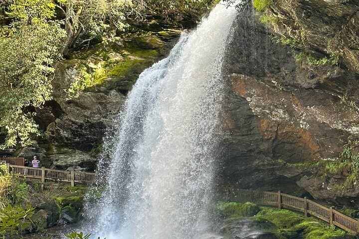
The first time you step out of the van and the air feels like liquid — cool, damp, and sharpened by leaf mold — you understand why locals call this place a rainforest. Ferns unfurl like green hands, moss carpets boulders and roots, and creeks move with the quiet insistence of a plan. For seven hours on a private, curated route from Asheville, this is the rhythm: a short walk, a roar of water, a ledge you can sit on and feel the mist dare you closer. It’s not an adrenaline day; it’s a sensory one, built around waterfalls that shape both the land and the small towns that grew up around them.
This private tour threads Highlands and Brevard—two mountain towns that play by their own clocks—into a single, tidy day. Your guide is equal parts naturalist and local storyteller: they’ll situate each waterfall within the region’s geology, point out how water carved amphitheaters through ancient gneiss and schist, and tell you which mill once used the stream you’re peering at. That context matters because these falls aren’t just pretty; they’re chapters in an old, slow story of uplift, erosion and human occupation. For a deeper overview and to book a private itinerary, learn more about <a href="https://app.advcollective.com/local-experts/exploring-western-north-carolinas-rainforests-and-iconic-waterfalls-a-private-day-tour">Exploring Western North Carolina's rainforests and iconic waterfalls</a>.
Geology here reads like a layered novel. The Blue Ridge uplift exposed crystalline bedrock hundreds of millions of years old; water found weaknesses, and over time those weaknesses deepened into the cataracts and plunge pools you’ll visit. The result is a compressed geography of dramatic drops and quiet pools—perfect for photographers who want the silky-veil look without a multi-mile approach.
Culturally, these waterways have long mattered. Indigenous Cherokee lived and traveled in these valleys long before settlers arrived; later, logging and small-scale milling shaped economies and roads. Today’s mountain towns balance conservation with tourism: DuPont State Forest, the Highlands Plateau and the Pisgah region are protected in varying degrees, and a private guide helps you navigate timing, trail etiquette and the lesser-used vantage points.
What the day actually feels like: mornings often begin crisp and bright in Asheville, but once you punch through a few miles of switchbacks the mountain mesoclimate takes over. Expect soft light and a fine spray that lingers near falls. Walks vary from a few hundred yards of boardwalk or packed dirt to slightly longer loops that might gain a few hundred feet—nothing technical, but the rocks near cascades are often slick. Your guide times stops so you get the best angles and the quietest moments—before mid-day crowds arrive—and can adapt the route if a winter storm has closed a road.
Why book this tour? The curated route of waterfalls, forested ravines, and two classic mountain towns packs a week’s worth of micro-adventures into one seamless day. It’s private—so you and your group move at your pace—and pragmatic: your guide handles permits, parking logistics and the turn-by-turn knowledge of where the best quick hikes are. If you want to photograph silky water and saturated forests, learn local history as you go, and still be back for dinner in Asheville, this is the format that works.
Practical edges: bring a small, waterproof daypack, wear shoes with good traction, and plan for changing temperatures. Spring delivers full-flow falls and neon new growth; fall lights the maples and oaks on fire. Winter can close mountain roads—guides will reroute, but if snow’s in the forecast ask about vehicle capability. And because the area includes protected lands, follow Leave No Trace and keep to designated paths.
If you love short hikes that reward you with cinematic cascades, and you want someone local to handle the route-building, this is a tidy, immersive day in the Southern Appalachians. Book early in high season, and if photography is the objective ask your guide to schedule prime light. For more information about private scheduling and typical stops, see <a href="https://app.advcollective.com/local-experts/exploring-western-north-carolinas-rainforests-and-iconic-waterfalls-a-private-day-tour">Exploring Western North Carolina's rainforests and iconic waterfalls</a>.
By the time you head back to Asheville the van smells faintly of wet earth and adventure. You’ll have walked through a pocket of old temperate rainforest, learned the local geology that shapes the falls, and tasted the deliberate pace of mountain towns where the day’s highlight is as much the view from a café window as it is the next cascade. It’s a short expedition with the leave-behinds of longer trips: a calmer pulse, a sharper eye for detail, and a handful of frames you’ll keep returning to.
Trail wisdom
Small choices, better day.
Grip and Traction
Wear waterproof hiking shoes with good soles—rocks around falls are slick even on dry days.
Pack a Lightweight Rain Shell
Mist from falls and quick mountain showers make a compact waterproof useful year-round.
Time Your Photography
Aim for morning or late afternoon light for softer contrasts and fewer crowds at overlooks.
Respect Closures
Trails and roads can close seasonally—follow guide instructions and posted signs to protect habitat.
Local knowledge
Read the place, not just the route.
Watch for native species including Eastern salamanders (several species), Black bear and white-tailed deer sightings in remote areas.
Keep an eye out for wildlife during the transition between areas and habitats. Respect distance guidelines.
Many waterfalls lie within protected forests such as DuPont and Pisgah—stay on trails, pack out trash, and follow local rules to protect fragile streamside ecosystems.
Follow the guide's instructions on size limits, ethical handling, and leave-no-trace practices.
The Bascom - Center for the Visual Arts (Highlands) for local exhibitions and a quiet gallery stop. Less-trafficked viewpoints in DuPont State Forest for intimate waterfall angles
Locally recommended viewpoints and quiet spots known best to local operators.
These mountains were long used by the Cherokee and later shaped by logging and small mills; mountain towns grew around the resources and routes the rivers provided.
Maritime roots and regional tradition shape the waterways and working coasts.
Seasonal guide
Four versions of the same landscape.
Spring
Best forHigh water flow · Wildflowers · Cool temperatures
ChallengesMud and swollen streams · Variable weather
Spring brings the most dramatic flows and fresh green canopies; expect boggy conditions on side trails after rains.
Summer
Best forLush rainforest feel · Evening golden hour · Extended daylight
ChallengesHigher humidity · Afternoon storms · More visitors
Summer is verdant and warm—great for long daylight hours, but plan early starts to avoid crowds and storms.
Fall
Best forFall foliage · Crisp air · Photogenic color contrasts
ChallengesHigher demand and limited vehicle parking · Cooler mornings
Autumn combines peak color with manageable flows; book ahead and bring layers for sudden temperature swings.
Winter
Best forQuiet trails · Snow-dusted vistas · Unique ice formations
ChallengesRoad closures and icy surfaces · Reduced daylight
Winter can be beautiful but unpredictable—guides will reroute if roads are impassable; traction devices may be required.
Operator details
What the booking data adds.
Included
- ✓Private transportation
- ✓Bottled water
- ✓High End SUV
- ✓Entrance fee
- ✓Snacks
- ✓Pickup and Drop Off within 10 Miles of Asheville NC
Not included
- —Lunch
- —Gratuities
Good to know
- ✓Infants and small children can ride in a pram or stroller
- ✓Service animals allowed
- ✓Public transportation options are available nearby
- ✓Suitable for all physical fitness levels
Pack with intention
What to bring.
Good to know
Common questions.
The private itinerary is approximately seven hours (420 minutes) and is designed as a full-day outing from Asheville.
Plan the edges
The details that make the day easier.
Mount Mitchell in Western North Carolina is the highest peak east of the Mississippi River at 6,684 feet—part of the same Blue Ridge uplift that sculpted the region’s waterfalls.
After a day of falls and forest, head back through small-town Main Streets for farm-to-table fare, craft beer, or a wood-fired pizza—mountain hospitality runs strong here and local cafés often feature trout, seasonal sides and regional craft brews.
- Closest airport
- Asheville Regional Airport (AVL). Typical driving time: downtown Asheville to Brevard ~45 minutes; to Highlands ~1.5–2 hours. Cell service: intermittent in forested gorges. Permits
- passes
- no central permit for this private tour, though some state forest parking fees may apply.
These waterways run through protected lands—stay on designated trails, carry out all trash, and support local guides who help manage visitor impact.
Explore by topic
Follow the threads.
Keep exploring
Make the story part of the trip.
Set out from Bass Harbor for a private, customizable day on Blue Hill Bay — lighthouses, puffins, seals, and the chance to feel Acadia from the water. Small groups, local captains, unforgettable views.
In four hours you can move from shaded canyon ferns to wind-scoured coastal ridgelines, guided by someone who knows where the light—and the hidden views—live. This private half-day hike on the Monterey Peninsula or Big Sur is compact, curated, and perfect for travelers who want depth without a multiday commitment.
 Related story
Beneath a sky of shifting light, Skaftafell’s ice reads like a map of time. This three-hour guided glacier hike mixes technical instruction with geology and culture: compact, safe, and unforgettable.