Skip to main content
Hiking the Pohono Trail along Glacier Point Road
Glacier Point Road
•8.0/10
•Hard
Hiking the Pohono Trail along Glacier Point Road
Category
Natural Landmark
Typical Duration
7-9 hours
Difficulty
Hard
Photo Gallery
Hiking the Pohono Trail along Glacier Point Road - Glacier Point Road
Hiking the Pohono Trail along Glacier Point Road - Glacier Point Road
Hiking the Pohono Trail along Glacier Point Road - Glacier Point Road
About This Landmark
Hiking the Pohono Trail along Glacier Point Road
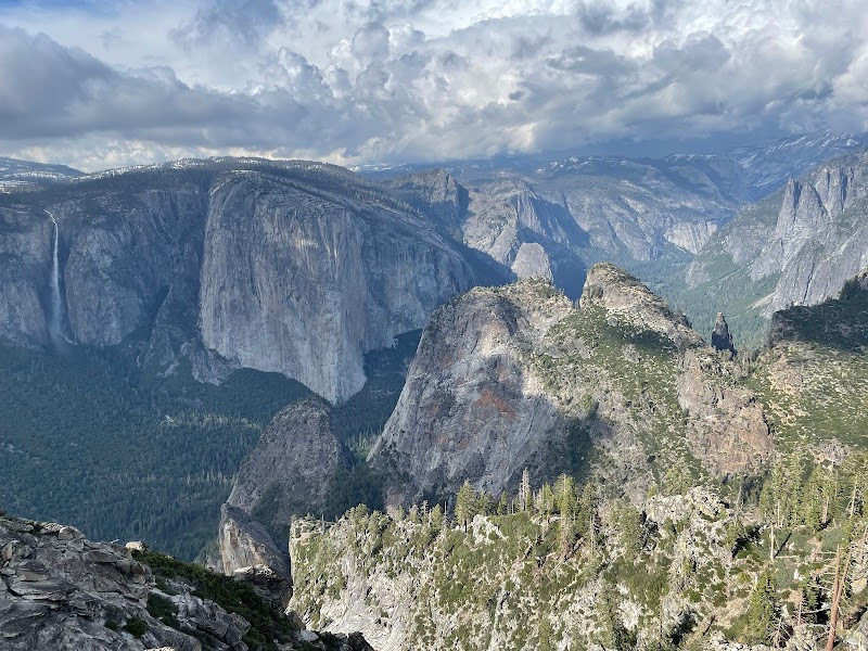
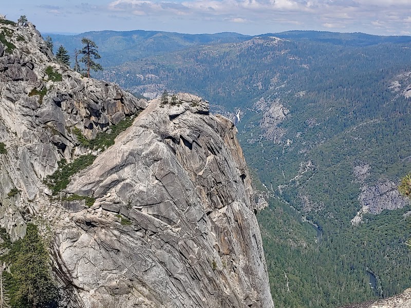
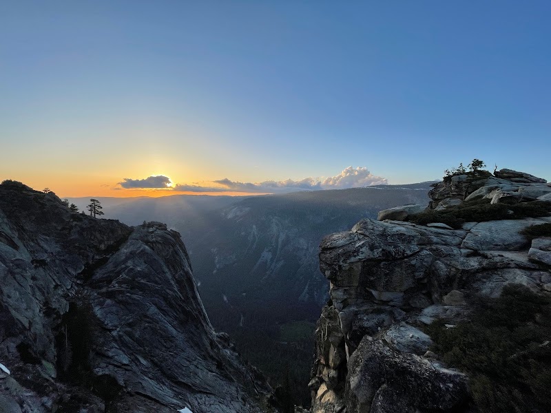
The Pohono Trail, spanning approximately 13 miles one way, is a challenging yet rewarding hike located along Glacier Point Road in Yosemite National Park. This trail provides hikers with some of the most sweeping views of Yosemite Valley, along with access to famous lookouts like Tunnel View, Dewey Point, and Taft Point. The trail is perfect for those seeking a mix of solitude, breathtaking scenery, and immersion in Yosemite’s natural beauty. It’s an essential hike for anyone visiting the area with a passion for adventure and photography.
Adventure Guide to Hiking the Pohono Trail
-
Glacier Point Trailhead: The trail begins (or ends) at Glacier Point, offering a panoramic view of landmarks such as Half Dome, Vernal and Nevada Falls, and the Yosemite Valley floor. Glacier Point’s unique location makes it an ideal starting point to tackle the Pohono Trail. Its high elevation sets the stage for breathtaking vistas right from the beginning.
-
Dewey Point: Found roughly mid-hike, Dewey Point is one of the most captivating viewpoints on the Pohono Trail. Here, hikers are rewarded with uninterrupted vistas of El Capitan and other granite formations. This serene spot provides a great place to rest and absorb the grandeur of the valley.
-
Tunnel View Exit: The Pohono Trail’s western endpoint is near Yosemite’s famous Tunnel View. By hiking in this direction, you’ll descend noticeably in elevation. Tunnel View offers an iconic snapshot of Yosemite Valley, with striking views of El Capitan, Bridalveil Fall, and Half Dome.
Visitor Tips
- Best Time to Hike: Late spring through early fall is optimal. Snow can linger at higher elevations, particularly in spring, so check trail conditions beforehand.
- What to Bring: Pack plenty of water, sturdy trail shoes, snacks, sunscreen, and layers, as temperatures often fluctuate.
- How to Get There: From Yosemite Valley, drive along Wawona Road to Glacier Point Road. It’s about a one-hour drive to Glacier Point. Alternatively, shuttle services may be available seasonally.
Local Insights
The name “Pohono” comes from the Miwok word for "spirit of the waterfall,” reflecting its deep Native American connections.
Visitor Tips:
- Best Times: Spring and Fall for cooler temperatures and amazing lighting.
- What to Bring: Water, sunscreen, and a camera!
Ratings
Overall
8.0/10User rating
Experience Level
Hard
Experience Needed: This natural landmark is recommended for those with significant outdoor experience. Best for experienced adventurers.