Skip to main content
Hiking to Mount Conness in Tuolumne Meadows
Tuoulumne Meadows
•9.4/10
•Hard
Hiking to Mount Conness in Tuolumne Meadows
Category
Natural Landmark
Typical Duration
20 minutes
Difficulty
Hard
Photo Gallery
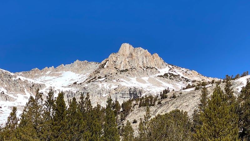
Hiking to Mount Conness in Tuolumne Meadows - Tuoulumne Meadows
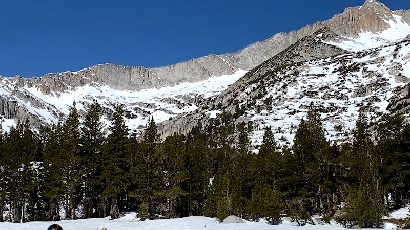
Hiking to Mount Conness in Tuolumne Meadows - Tuoulumne Meadows
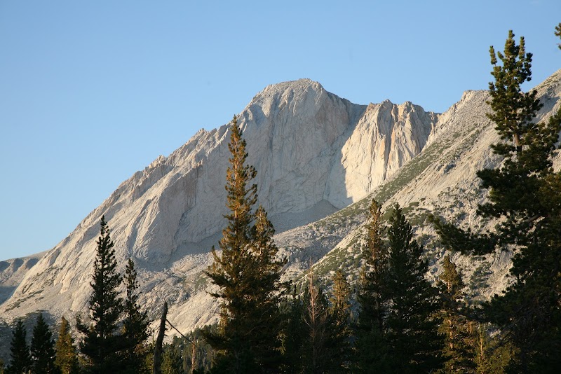
Hiking to Mount Conness in Tuolumne Meadows - Tuoulumne Meadows
About This Landmark
Hiking to Mount Conness in Tuolumne Meadows
Introductory Overview
Hiking to Mount Conness (12,590 feet) from Tuolumne Meadows offers one of the most rewarding alpine adventures in Yosemite National Park and the adjacent Inyo National Forest. This challenging trek combines stunning high-altitude scenery, sweeping granite landscapes, and exhilarating ridge walking. The hike allows you to experience a lesser-traveled but spectacular part of the Sierra Nevada, with panoramic views of Yosemite Valley, Mono Lake, and the Cathedral Range. Hikers should be prepared for steep climbs, route-finding challenges, and possible exposure to high winds.
Adventure Guide To Hiking to Mount Conness
Trailhead and Route Options
-
Saddlebag Lake Trailhead (Easier Route):
- Begins near Saddlebag Lake, outside Tuolumne Meadows.
- 10-12 miles round trip with about 4,000 feet of elevation gain.
- Follows a class 2 route (scrambling but no technical climbing required).
- Key landmarks: Sawmill Campground, alpine meadows, and Conness Lakes before reaching the summit ridge.
-
Young Lakes Route (More Challenging):
- 15+ miles round trip, with complex route-finding and exposed ridges.
- Best for experienced backcountry hikers comfortable with off-trail navigation.
- Spectacular views of Young Lakes and Ragged Peak along the way.
Key Features and Highlights
- Conness Lakes: Crystal-clear alpine lakes below the summit, offering a perfect resting spot.
- Panoramic Summit Views: Includes a full 360-degree perspective of Yosemite high country, White Mountains, and even distant peaks like Mount Ritter.
- Wildlife Sightings: Keep an eye out for marmots, pika, and golden eagles along the way.
Local Insights
- Historic Mining Sites: The area around Mount Conness once hosted early 20th-century mining operations, remnants of which can still be found along old routes.
- Changing Weather: Afternoon thunderstorms are common in summer—plan to summit early and descend before storms build.
Visitor Tips
- Best Time to Hike: July–September, when snow has melted but crowds remain low.
- What to Bring:
- Layers for unpredictable temperatures.
- Plenty of water (no reliable filtering sources near the summit).
- GPS, map, and compass to aid navigation.
- Driving Directions:
- From Tuolumne Meadows, drive 10 miles east on Tioga Road to Saddlebag Lake Road, then another 2 miles to the trailhead. Travel time: 20 minutes.
Visitor Tips:
- Best Times: Spring and Fall for cooler temperatures and amazing lighting.
- What to Bring: Water, sunscreen, and a camera!
Ratings
Overall
9.4/10User rating
Experience Level
Hard
Experience Needed: This natural landmark is recommended for those with significant outdoor experience. Best for experienced adventurers.