Mastering Shallow Water Navigation Near Atlantic Beach: Essential Tools and Tips
Navigating the shallow waters around Atlantic Beach demands a precise blend of technology and local know-how. This guide provides practical tools and advice for boaters eager to explore safely amid shifting tides and hidden channels.
Check and Cross-Reference Tide Charts
Plan your boating excursions around tide schedules to avoid unexpectedly low water that can strand you or block channels.
Bring Waterproof Marine Charts
Physical charts show depth contours and hazards that digital devices may miss or misinterpret in shallow, shifting waters.
Use a Handheld Depth Sounder
Constantly monitor water depth to detect sandbars, oyster beds, and changing bottom conditions as you move.
Know Basic Navigation Tools
Master plotting courses with tools like parallel rulers and dividers for manual checks against your GPS readings.
Mastering Shallow Water Navigation Near Atlantic Beach: Essential Tools and Tips
Local Knowledge for Mariners
New to boating in the area? Captain Mark is here to help you!
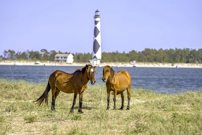
Join H2O Captain Eco-Tour in Morehead City for a practical, skills-focused boat trip that helps new boat owners confidently navigate the area’s shallow waters. Gain hands-on knowledge from Captain Mark while enjoying stunning coastal views and landmarks like Cape Lookout Lighthouse. Perfect for anyone looking to upgrade their maritime skills in a relaxed, guided setting.
Boating near Atlantic Beach offers a unique challenge: shallow waters that shift with tides, currents that coax your path, and hidden channels waiting to be found. Navigating here demands more than just a compass; it requires a strategic blend of tools and local knowledge that keep you safe and on course.
The waters around Atlantic Beach dance with a restless energy—sandbars emerge like secrets below the surface, while oyster beds lay low, daring your keel to pass carefully. Traditional GPS devices sometimes falter amid the salt spray and intricate waterways, so pairing digital devices with tangible skills and physical navigational aids is crucial.
Start with a detailed, waterproof chart of the area. NOAA charts cover the inlets, marsh creeks, and shallow bays, highlighting depths, hazards, and navigation markers. These charts become your roadmap in the liquid wilderness, helping you recognize safe passages as tides reshape the coastline.
Complement your charts with a hand-held depth sounder. This tool reads the water beneath your vessel moment by moment, letting you sense the riverbed’s push and pull. Depth readings are your first defense against grounding on unseen shoals. Combine this with a quality GPS that supports marine mapping—one with detailed bathymetry layers to visualize bottom contours.
Local tide charts are your compass to timing. Water levels can swing dramatically, turning open channels into obstacle courses or revealing safe shortcuts through creeks. Checking tide times before departure and planning your route around these windows ensures smoother passage.
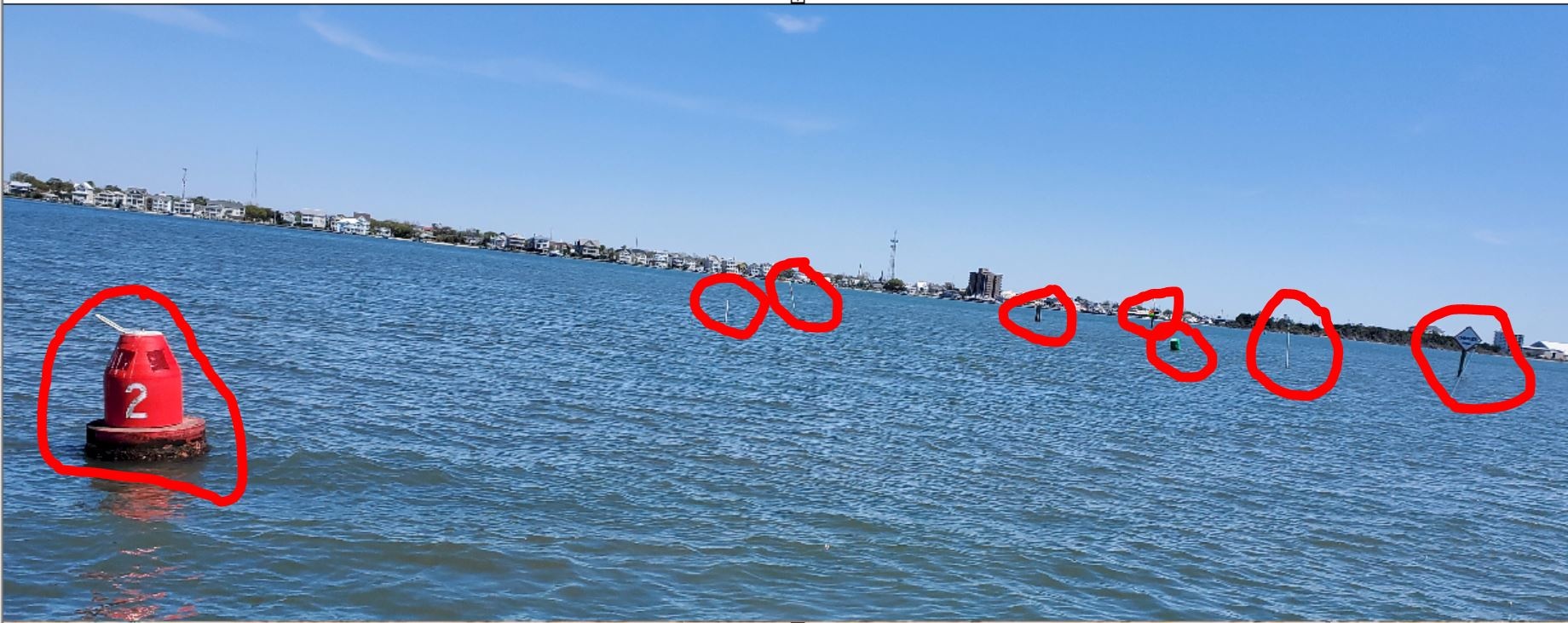
Don’t underestimate the power of onboard binoculars to scan ahead. Markers, buoys, and even wildlife—like feeding birds or waterfowl—signal underwater features or channels. Each ripple and reflection is part of the water’s language, urging attention.
Practice plotting your course with simple tools like a parallel ruler and dividers on your charts. GPS is helpful, but these classics demand you engage fully with the geography, reading waves and winds rather than relying solely on technology.
Safety gear is non-negotiable: charts, sounder, GPS, and tide tables, backed by practical seamanship. Mind the wind’s shift and watch how currents tease you off track.
Navigating shallow waters near Atlantic Beach is a dynamic engagement with a landscape that’s fiercely itself. Tools guide you, but your judgment earns the passage. Equip well, learn the waterways, and every trip becomes a confident adventure at the edge of land and sea.
Nearby Trips
All Adventures
Boat Charters
Water Activities
Adventures near Morehead City
Discover the unique and memorable adventures that make Morehead City special.
Frequently Asked Questions
How do tides affect navigation near Atlantic Beach?
Tides significantly influence water depths, exposing or submerging sandbars and oyster beds. Planning around tide schedules is essential to avoid grounding or blocking key passages.
Are there any common navigation hazards to watch for?
Shifting sandbars, oyster reefs, and submerged debris are the main hazards. In combination with current changes, these require constant vigilance and depth monitoring.
Is GPS alone reliable for shallow water navigation in this area?
GPS is helpful but not foolproof, especially in shallow, shifting terrain. Combining GPS with physical charts and depth sounders gives the safest results.
What local wildlife might I encounter while boating here?
Herons, osprey, and migrating shorebirds often signal safe channels. Keep an eye out for bottlenose dolphins that occasionally visit these waters.
Can I navigate these waters year-round?
Yes, but seasons bring different challenges—summer heat, winter cold, and storm potential vary. Adjust gear and timing accordingly.
Are there any environmentally sensitive areas to know about?
Yes, local marshes and oyster beds are vital ecosystems; boating regulations often restrict speeds and access near protected zones to prevent damage.
Recommended Gear
Waterproof Marine Charts
Durable, moisture-proof charts detailing depth contours and navigation hazards are fundamental near Atlantic Beach.
Handheld Depth Sounder
Real-time depth readings prevent grounding and help track shifting shoals in shallow waters.
Portable GPS with Marine Capabilities
A GPS that supports bathymetry maps guides you accurately through complex shallow channels.
Binoculars
Inspect buoys, landmarks, and surface clues for hidden hazards or channels from a distance.
Local Insights
Hidden Gems
- "The quiet southern stretch of Bogue Sound offers serene, less trafficked waterways perfect for mindful navigation."
- "The narrow marsh creeks east of the main channel provide unexpected wildlife encounters and peaceful passages."
Wildlife
- "Osprey"
- "Great blue heron"
- "Bottlenose dolphins"
- "Various migratory shorebirds"
History
"Atlantic Beach has a rich maritime history shaped by fishermen and boaters who pioneered navigating these tricky shallow waters. Remnants of old fishing docks dot the shoreline, reminding visitors of its working waterfront heritage."