Mastering GPS Routes and Respectful Trail Use on Westcreek’s UTV Adventures
Westcreek’s UTV trails offer an exciting blend of technical GPS navigation and essential trail etiquette that transforms your ride into an effective wilderness experience. Navigate rugged terrain, respect the environment, and prepare smartly to fully engage with this spirited Colorado playground.
Update GPS Maps Before You Go
Ensure your GPS device includes the latest Westcreek trail updates to avoid dead ends or restricted areas. Offline map files provide crucial backup when signals fade.
Yield Uphill Riders
Always yield to riders climbing uphill. This respect avoids conflicts and protects trail integrity on challenging inclines.
Pack Hydration and Electrolytes
Carry at least two liters of water per rider along with electrolyte snacks to maintain focus and stamina throughout the ride.
Avoid Off-Trail Driving
Stick strictly to marked trails to prevent damaging sensitive vegetation and causing erosion on fragile slopes.
Mastering GPS Routes and Respectful Trail Use on Westcreek’s UTV Adventures

Four Day - UTV Adventure Rental
Explore the Rockies!
Experience the thrill of exploring Colorado's stunning landscapes on a private four-day UTV rental in Westcreek. Perfect for adventure lovers seeking off-road excitement and scenic vistas, this trip offers a unique way to discover Colorado’s wilderness. Keep reading to find out what makes this adventure unforgettable!
Westcreek’s rugged trails call to those eager to leave pavement behind and tackle the wilderness in a UTV, where every turn tests your navigation skills and respect for the wild. This guide cuts through the noise—highlighting how to efficiently read GPS signals on narrow, sometimes shifting routes while ensuring your presence leaves the environment undisturbed and the experience positive for all.
The GPS routes at Westcreek typically stretch between 10 to 20 miles per loop, with elevation gains averaging around 500 feet. The terrain is a blend of packed dirt, rocky stretches, and occasional mud pits—a ride that demands attentiveness to trail markers and constant recalibration of your device. Trees lean forward purposefully, as if to challenge your path, while winds push against your progress in open meadows where views unfold like quiet rewards.
Prior preparation is key: sync your GPS device charts with the latest Westcreek map files and download offline navigation apps. Signal interruptions are common in denser forest pockets, where thick branches clutch signals as fiercely as the soil clutches your tires. Carry a physical map as backup, and know basic compass use to avoid needless backtracking or unintended trail trespasses.
Trail etiquette here is not mere courtesy but critical survival. Yield to uphill travelers; UTVs are powerful but the trail’s integrity demands slowing down or stopping to let others pass safely. Avoid skidding or plowing off the designated path—each wheel tread elsewhere drags erosion threats. Keep noise levels in check; wildlife is alert and nearby streams dare you to listen closely to their crossings.
Timing your adventure early or late in the day minimizes heat exposure and often gives you secluded stretches to savor—the forest seems to hold its breath in these hours, challenging and welcoming at once. Hydration is essential; at least two liters per rider paired with snacks that replenish salt and energy keep focus sharp in this untamed classroom. Footwear? Durable boots with deep tread for any unexpected dismounts or trail explorations on foot.
Westcreek’s UTV routes are exercises in balance, a dialogue between machine and earth, marked by respect and savvy navigation. Read the signs nature throws—not just on your device but in wind shifts, track impressions, and wildlife cues. This is an adventure that’s spirited, practical, and fiercely itself—ready for you to answer its call.
Nearby Trips
All Adventures
Boat Charters
Water Activities
Adventures near Durango
Discover the unique and memorable adventures that make Durango special.
Frequently Asked Questions
What is the best way to handle GPS signal loss on Westcreek trails?
When GPS signals fade, rely on your physical map and basic compass skills. Look for trail markers—paint blazes or cairns—placed at critical junctions, and use natural bearings such as the sun or distinctive landmarks to maintain direction.
Are there any local wildlife precautions when riding through Westcreek?
Yes, keep noise moderate to avoid startling deer, elk, and occasional black bears. Feeding wildlife is prohibited; store food securely and be alert during dawn and dusk when animal activity peaks.
How important is trail etiquette among UTV riders here?
Trail etiquette is crucial. It maintains safety, preserves trail conditions, and fosters community. Always yield to uphill travelers, never shortcut or widen trails, and communicate clearly with riders ahead or behind.
Can I access gas or repair services nearby?
Durango, about 35 miles away, is your nearest hub for refueling, mechanical repairs, and supplies. Prepare accordingly, as options near Westcreek itself are limited.
What are some lesser-known viewpoints along Westcreek trails?
Look for the rocky outlook near the south loop where the forest opens abruptly, revealing sweeping views of the La Plata Mountains. It’s quieter than main pullouts and perfect for breaks or photography.
Are there any environmental considerations to keep in mind while riding?
Avoid riding during wet conditions that cause trail damage, respect designated quiet zones especially near streams, and pack out all trash. Erosion control and habitat protection rely on respectful use.
Recommended Gear
Handheld GPS Device
Reliable navigation tool that supports offline maps and tracks your route accurately through dense forest and variable terrain.
All-Terrain Boots
Durable, treaded boots provide secure footing for unexpected trail-side walks or repairs.
Water Reservoir or Hydration Pack
Keeps you hydrated in dry, warm conditions without needing to stop frequently.
Trail Map (physical copy)
A hardcopy backup to electronic navigation devices—critical when GPS signal drops in thick canopies.
Local Insights
Hidden Gems
- "South Loop Rocky Overlook"
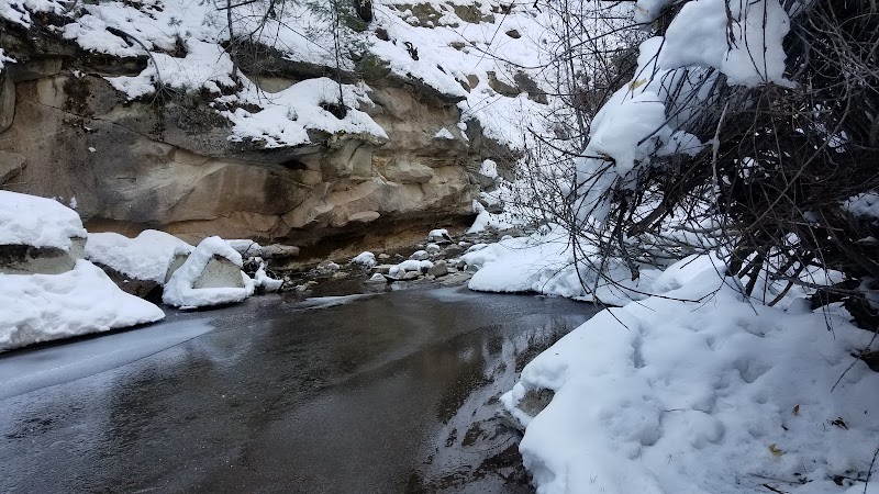
- "Quiet Creek Crossing Spot"
- "Old Logging Road Remnants"
Wildlife
- "Elk"
- "Mule Deer"
- "Black Bear"
- "Various Raptors"
History
"Westcreek region was historically logging terrain with old timber roads still visible. The area now serves as a recreational hub balanced with ongoing conservation efforts."