Mastering Marine Electronics: GPS and Depth Sounder on Cape Coral’s OBX II
Navigate Cape Coral’s waterways with confidence by mastering the GPS and depth sounder on the OBX II. This guide blends technology and hands-on advice to empower boaters with the skills needed to explore shallow channels and oyster bars safely and efficiently.
Calibrate Your Devices Before Launch
Ensure GPS satellite data is updated and calibrate your depth sounder against known depths to avoid misleading readings.
Plan Your Route with Tide Tables
High and low tides significantly affect water depth; always combine tide information with depth sounder data for safe navigation.
Maintain Clear Visibility of Screens
Position GPS and depth sounder displays where you can glance quickly without losing sight of your surroundings.
Regularly Update Electronic Charts
Electronic charts and GPS maps must be current to reflect changes in waterways caused by shifting sands and weather.
Mastering Marine Electronics: GPS and Depth Sounder on Cape Coral’s OBX II

27' Regal 26 OBX II
Three Day Minimum Rental • Up to 10 People • 300 HP Yamaha Outboard
Discover the beauty of Cape Coral's waters aboard the 27' Regal 26 OBX II with Amy Boat Rental. Perfect for a relaxing day on the water, this boat rental offers spectacular views and fun for all ages. Keep reading to plan your unforgettable boating adventure!
Navigating the waters around Cape Coral requires more than just a steady hand and a sense of direction—it demands a keen understanding of marine electronics, especially when piloting a vessel like the OBX II. Combining GPS technology with a reliable depth sounder transforms the boating experience from guesswork into precision navigation. Let’s unpack how to effectively use these tools in tandem to explore Cape Coral’s waterways safely and confidently.
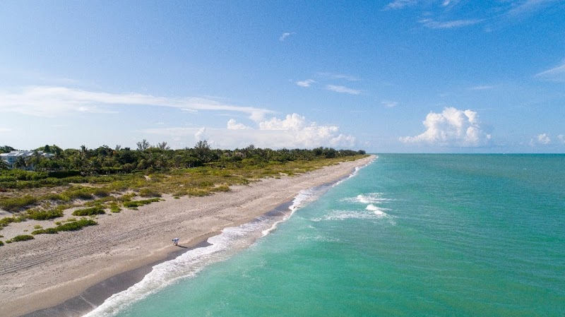
The OBX II, renowned for its agility in shallow waters typical of Cape Coral’s coastal zones, pairs perfectly with digital navigation aids. GPS offers exact positioning, often accurate to within meters, enabling you to chart a course through intricate canals, oyster bars, and mangrove-lined inlets that challenge the unprepared. Meanwhile, the depth sounder serves as your underwater sentinel, scanning what lies beneath the hull. It reads water depth in real time, alerting you to sandbars or sudden drops, a critical detail as currents and tides shift the seabed.
Set your GPS waypoint before you leave the dock—preferably multiple waypoints delineating safe passages and points of interest. The OBX II’s smaller draft brings you closer to shallower spots where snapping shrimp chirp and fish dart beneath the surface, but vigilance remains key. The GPS aids in tracking your movement even when visibility falls short due to fog or dusk. Meanwhile, the depth sounder’s sonar pulse bounces off the seafloor, outlining the underwater terrain as it truly is, not merely how it appears from above.
Mount your depth sounder screen where it’s visible without taking eyes off the helm, pairing it with the GPS display for constant cross-reference. Depth readings paired with GPS coordinates help identify areas to pause for sight fishing or avoid zones with excessive oyster growth that can snag propellers. Both devices need calibration: update satellite data regularly for GPS, and verify sounder calibration against known depths.
Practical advice: always factor tides, which can swing water levels a foot or more, affecting what your depth sounder will report in real time. Combine your electronic data with local charts and tide tables for optimal route planning. Don’t rely fully on technology—marine electronics are excellent aides, but the OBX II’s physical feel as it skims the water—sometimes scraping the bottom—remains an irreplaceable signal.
Embrace Cape Coral’s marine landscape—its currents push you forward, mangroves whisper warnings of shallow banks, and under your hull, the seafloor narrates its story in meter readings and sonar echoes. The harmony between GPS and depth sounder on the OBX II lets you communicate fluently with this vivid marine environment, turning each outing into a well-informed adventure.
Nearby Trips
All Adventures
Boat Charters
Water Activities
Adventures near Cape Coral
Discover the unique and memorable adventures that make Cape Coral special.
Frequently Asked Questions
How accurate is the GPS on the OBX II in Cape Coral’s canals?
The GPS unit on the OBX II typically offers accuracy within 3 to 5 meters, sufficient for navigating narrow canals and avoiding hazards with the complementary depth sounder’s real-time depth readings.
Can the depth sounder detect vegetation and soft bottom areas?
Yes, modern depth sounders differentiate between hard bottoms and softer plant-covered areas, alerting captains to zones where propellers might get entangled or grounding risk increases.
What should I do if my GPS signal drops in dense mangrove areas?
Signal loss can occur near thick mangroves due to satellite obstruction. In such cases, rely on dead reckoning, local charts, and depth sounder backups until GPS reception improves.
Are there specific local waterways around Cape Coral to watch for sudden depth changes?
Yes, oyster bars and shifting sandbanks near Matlacha Pass and Pine Island Sound are known for rapid depth shifts needing careful monitoring with depth sounders.
What’s the best way to set waypoints for a fishing trip?
Mark waypoints at known fishing hotspots, drop-offs, and sheltered bays from past trips or maps, then track your route for efficient return in low light or fog.
How do tides affect depth readings and route planning?
Cape Coral’s tides can vary one or more feet daily, impacting depth sounder readings; always cross-reference tides with sounder data to avoid shallow hazards or becoming stranded.
Recommended Gear
Marine GPS Unit
Provides accurate positioning essential for route planning and locating points of interest in Cape Coral’s waterways.
Depth Sounder/Fish Finder
Helps detect water depth and underwater obstacles, preventing groundings and guiding safe passage.
Waterproof VHF Radio
Crucial for communication in emergencies or coordinating with other boaters and marinas.
Sunglasses with Polarized Lenses
Reduces glare on water surfaces, making it easier to spot hazards and observe wildlife.
Local Insights
Hidden Gems
- "Exploration of backwater channels near Four Mile Cove Ecological Preserve"
- "Unmarked oyster bar edges visible only at low tide via depth sounder patterns"
Wildlife
- "Bottlenose dolphins often cruise deeper channels in spring and fall"
- "Blue herons and ospreys perch along mangrove edges, watching currents for fish"
History
"Cape Coral's canals were engineered extensively in the late 1950s, creating a unique urban waterway system. The OBX II’s shallow draft fits this human-made environment that ripples with ecological resilience."