Skip to main content
Ascending Mount Mansfield via the Long Trail: Walking the Spine of Vermont
Stowe
•9.8/10
•Hard
Ascending Mount Mansfield via the Long Trail: Walking the Spine of Vermont
Category
Natural Landmark
Typical Duration
45 minutes
Difficulty
Hard
Photo Gallery
Ascending Mount Mansfield via the Long Trail: Walking the Spine of Vermont - Stowe
Ascending Mount Mansfield via the Long Trail: Walking the Spine of Vermont - Stowe
Ascending Mount Mansfield via the Long Trail: Walking the Spine of Vermont - Stowe
About This Landmark
Ascending Mount Mansfield via the Long Trail: Walking the Spine of Vermont
Mount Mansfield, Vermont’s highest peak, isn’t just a destination—it’s a revelation. Rising to 4,395 feet, this ridge feels like the backbone of the Green Mountains, a wild thread weaving sky and earth. Ascending via the Long Trail, you’ll trace the steps of countless adventurers who sought this summit’s austere embrace.
The trail begins humbly, a gentle pathway threading through a cathedral of hardwoods. The leaves murmur overhead, a rustling hymn carried by the crisp mountain air. As you climb, the landscape shifts; roots twist into natural staircases, and boulders guard the path, ancient sentinels carved by time.
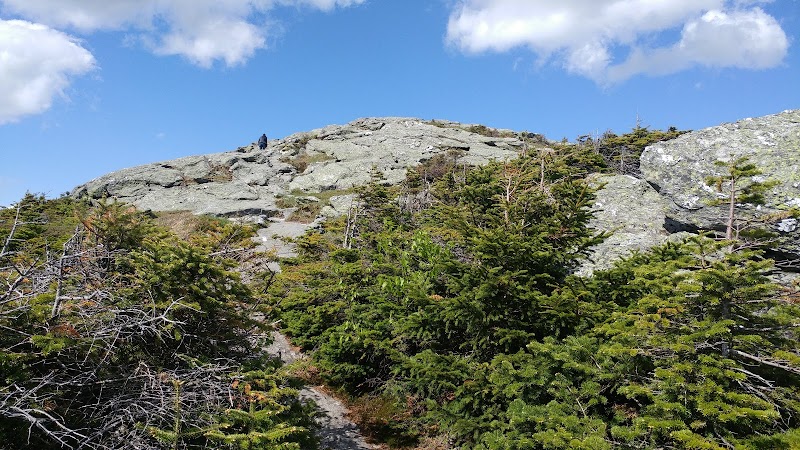
Then comes the alpine zone, where nature bares her soul. The trees bow out, replaced by hardy krummholz and lichens that cling defiantly to the windswept rock. The air sharpens, every breath like the first after a plunge into icy water. Each step feels like a negotiation with gravity, the trail demanding more of you as it carves across the mountain’s narrow spine.
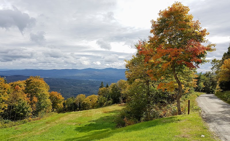
At the summit, the world explodes into view. To the west, Lake Champlain sprawls like liquid silver, cradled by the Adirondacks’ rugged silhouette. To the east, the White Mountains rise, their peaks shadowed and ancient. The ridge undulates before you, a natural amphitheater where the wind is the only applause.
This is no ordinary peak—it’s a place where you shed the trivial and touch the infinite. Mount Mansfield doesn’t ask for your conquest; it extends a quiet invitation to become part of something greater.
Adventure Guide Summary
About the Long Trail Route
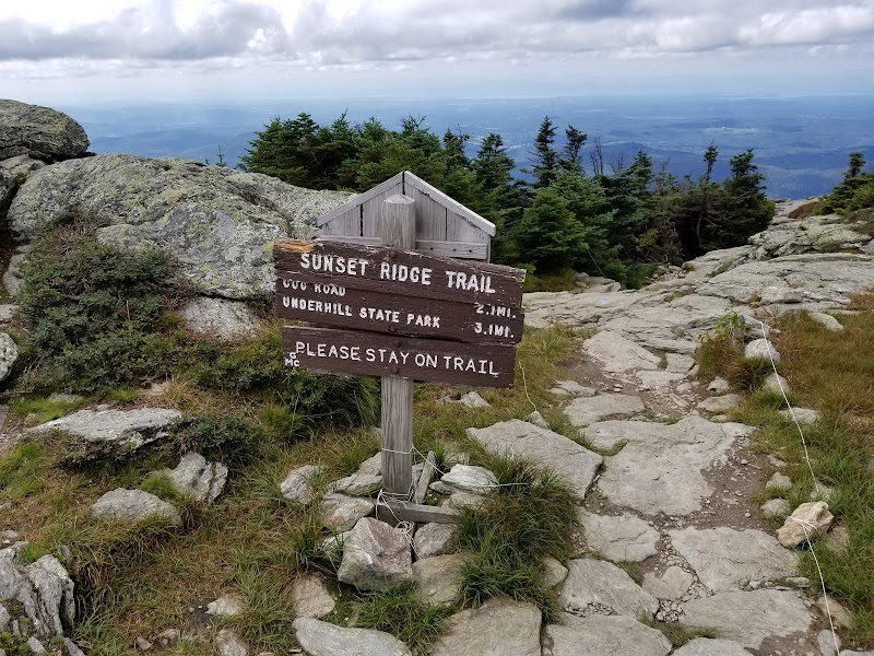
- Distance & Difficulty: The ascent via the Long Trail is approximately 6.8 miles round trip with an elevation gain of over 2,800 feet, rated strenuous.
- Unique Features: This route passes through Vermont’s only alpine tundra zone, home to rare plants like diapensia and alpine goldenrod.
Trailhead & Directions
- Start at the Underhill State Park trailhead on Mountain Road in Underhill, Vermont. The drive from Burlington takes about 45 minutes. Parking is available but requires a small fee.
What to Bring
- Sturdy boots, trekking poles, and layers for unpredictable weather.
- Snacks, plenty of water, and a camera for summit views.
Trail Highlights
- Chin to Nose Traverse: Mansfield’s ridgeline resembles a human profile; hikers pass features like "The Chin" and "The Nose."
- Wildlife: Look for peregrine falcons soaring overhead and marmots peeking out from rocky crevices.
Visitor Tips:
- Best Times: Spring and Fall for cooler temperatures and amazing lighting.
- What to Bring: Water, sunscreen, and a camera!
Ratings
Overall
9.8/10User rating
Experience Level
Hard
Experience Needed: This natural landmark is recommended for those with significant outdoor experience. Best for experienced adventurers.