THE ADVENTURE COLLECTIVE® · Independent discovery and booking for outdoor travel

Push from Interlaken Ost up a steep, spruce-lined route to Harder Kulm with a Swiss triathlete as your guide. This 9 km, ~750 m ascent hike pairs efficient coaching with panoramic rewards over Lakes Thun and Brienz.
Push from Interlaken Ost up a steep, spruce-lined route to Harder Kulm with a Swiss triathlete as your guide. This 9 km, ~750 m ascent hike pairs efficient coaching with panoramic rewards over Lakes Thun and Brienz.
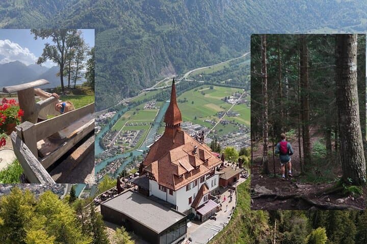
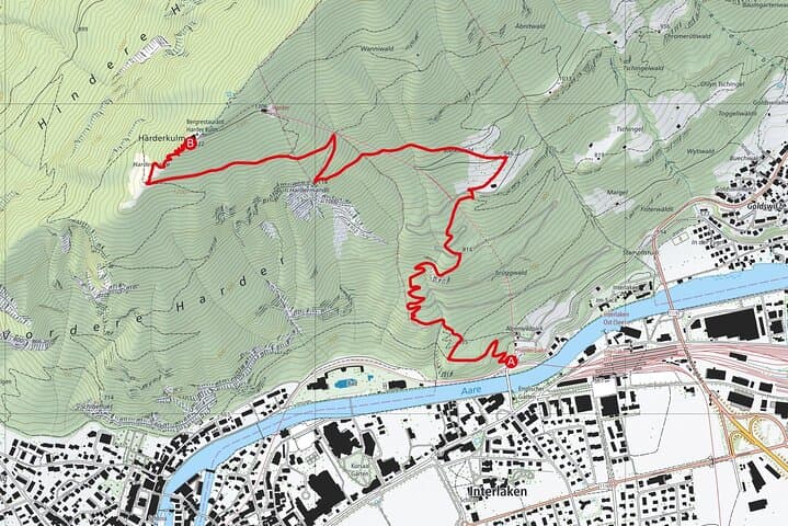
The day begins at Interlaken Ost, where the town’s orderly streets give way to a steep, green shoulder that rises toward Harder Kulm. Under a light alpine sun, a Swiss triathlete-turned-guide checks straps and offers a concise plan: a 9 km loop, roughly 750–800 m of ascent, and reward enough to make the lungs and legs forget the climb. You walk away from the train noise and into a fir-and-beech corridor; the trail pitches up in earnest, switchbacks cutting through moss and exposed roots.
Verified experiences and guided adventures in the surrounding area.
Operated by Nicolas Reinmann · Interlaken, Bern
The day begins at Interlaken Ost, where the town’s orderly streets give way to a steep, green shoulder that rises toward Harder Kulm. Under a light alpine sun, a Swiss triathlete-turned-guide checks straps and offers a concise plan: a 9 km loop, roughly 750–800 m of ascent, and reward enough to make the lungs and legs forget the climb. You walk away from the train noise and into a fir-and-beech corridor; the trail pitches up in earnest, switchbacks cutting through moss and exposed roots.
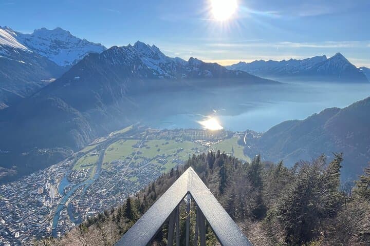
By mid-hike the valley opens. Lake Thun and Lake Brienz lie like glass plates separated by a strip of town, the Aare River daring you to follow its braided course. The geology here is straightforward and theatrical: steep, glacially carved troughs framed by the limestone shoulders of the Bernese Alps and the sharper silhouettes of the Eiger, Mönch and Jungfrau farther east. The guide points out old transhumance routes and explains how seasonal grazing shaped the meadows you pass.
Harder Kulm has a human history too. The Harderbahn funicular arrived in the early 20th century and turned this promontory into a panoramic stop for visitors; hikers have been walking the ridge for longer, testing themselves on weather and gradient. Today the lookout platform—an architectural cantilever made for photographs—feels like an invitation rather than a finale: you can linger, take in the vertical ice faces across the valley, and watch paragliders unspool from the ridge like flags in the wind.
Practical notes: the tour is private, led by an experienced guide who tailors pace and route. Expect steep sections where poles help, packed-earth trails that become rooty after rain, and moderate exposure near the summit viewpoints. The round-trip is roughly 9 km and designed for hikers with a moderate fitness baseline; allow 3–4 hours including stops.
Timing matters. Early starts cut the heat and the crowds; late afternoons bring softer light and a different cast on the peaks. Dress in layers—mountain weather changes fast—and bring 1–1.5 liters of water per person, plus an insulated layer for the summit.
Local respect goes a long way: stay on marked trails to protect alpine flora, give grazing cattle space, and carry out what you carry in. For a few demanding hours you’ll test steady breathing and leg strength, and in return the Alps will hand you a simple, expansive view that rewards the climb without ceremony.
moderate.
3–4 hours.
Suitable for hikers with a steady aerobic base and experience on sustained uphill trails; frequent hikers will be comfortable.
Meet in front of the Youth Hostel in Interlaken Ost; the guide will contact you beforehand—use WhatsApp or iMessage if needed.
Hikers should have a moderate fitness level; beginners who regularly walk uphill can join but should expect a sustained climb and steady pace.
Yes—the private format allows the guide to modify pace and rest stops to match participants’ abilities.
Service animals are permitted, but pets should be confirmed with the guide beforehand due to trail steepness and presence of cattle.
The tour does not automatically cancel for bad weather; check with the operator at least 24 hours prior for rescheduling and cancellation policies.
Yes—while the hike is designed as a loop, participants can opt to return via the Harderbahn funicular if available and desired.
Harder Kulm became a popular visitor destination after the Harderbahn funicular opened in the early 20th century; the plateau has served both tourism and local grazing for generations.
Stay on marked trails to protect thin alpine soils and seasonal meadows; pack out all waste and respect grazing animals.
Nicolas Reinmann operates guided outdoor trips and adventures with an emphasis on safety, stewardship, and memorable experiences.
The day begins at Interlaken Ost, where the town’s orderly streets give way to a steep, green shoulder that rises toward Harder Kulm. Under a light alpine sun, a Swiss triathlete-turned-guide checks straps and offers a concise plan: a 9 km loop, roughly 750–800 m of ascent, and reward enough to make the lungs and legs forget the climb. You walk away from the train noise and into a fir-and-beech corridor; the trail pitches up in earnest, switchbacks cutting through moss and exposed roots.
The day begins at Interlaken Ost, where the town’s orderly streets give way to a steep, green shoulder that rises toward Harder Kulm. Under a light alpine sun, a Swiss triathlete-turned-guide checks straps and offers a concise plan: a 9 km loop, roughly 750–800 m of ascent, and reward enough to make the lungs and legs forget the climb. You walk away from the train noise and into a fir-and-beech corridor; the trail pitches up in earnest, switchbacks cutting through moss and exposed roots.
By mid-hike the valley opens. Lake Thun and Lake Brienz lie like glass plates separated by a strip of town, the Aare River daring you to follow its braided course. The geology here is straightforward and theatrical: steep, glacially carved troughs framed by the limestone shoulders of the Bernese Alps and the sharper silhouettes of the Eiger, Mönch and Jungfrau farther east. The guide points out old transhumance routes and explains how seasonal grazing shaped the meadows you pass.
Harder Kulm has a human history too. The Harderbahn funicular arrived in the early 20th century and turned this promontory into a panoramic stop for visitors; hikers have been walking the ridge for longer, testing themselves on weather and gradient. Today the lookout platform—an architectural cantilever made for photographs—feels like an invitation rather than a finale: you can linger, take in the vertical ice faces across the valley, and watch paragliders unspool from the ridge like flags in the wind.
Practical notes: the tour is private, led by an experienced guide who tailors pace and route. Expect steep sections where poles help, packed-earth trails that become rooty after rain, and moderate exposure near the summit viewpoints. The round-trip is roughly 9 km and designed for hikers with a moderate fitness baseline; allow 3–4 hours including stops.
Timing matters. Early starts cut the heat and the crowds; late afternoons bring softer light and a different cast on the peaks. Dress in layers—mountain weather changes fast—and bring 1–1.5 liters of water per person, plus an insulated layer for the summit.
Local respect goes a long way: stay on marked trails to protect alpine flora, give grazing cattle space, and carry out what you carry in. For a few demanding hours you’ll test steady breathing and leg strength, and in return the Alps will hand you a simple, expansive view that rewards the climb without ceremony.