THE ADVENTURE COLLECTIVE® · Independent discovery and booking for outdoor travel

A 25-minute sunset flight that threads over Sedona’s red-rock icons and into Boynton and Long canyons to reveal Sinagua cliff ruins accessible only by extensive hiking. Perfect for travelers who want a concentrated, photographic view of geology and history without the multi-day trek.
A 25-minute sunset flight that threads over Sedona’s red-rock icons and into Boynton and Long canyons to reveal Sinagua cliff ruins accessible only by extensive hiking. Perfect for travelers who want a concentrated, photographic view of geology and history without the multi-day trek.
The helicopter lifts and the valley exhales beneath you—an orange band of sun sliding behind serrated red-rock ridgelines, while your headset picks up the pilot’s quiet narration and the wind’s steady pulse. For 25 minutes this tour stitches together Sedona’s most iconic landmarks—Cathedral Rock, Bell Rock, Courthouse Butte—and then pushes deeper, following Boynton and Long canyons until the canyon walls narrow and the rotor’s thrum becomes a private soundtrack to cliff-side ruins you can rarely reach on foot.
Verified experiences and guided adventures in the surrounding area.
Operated by Apex Air Tours · Sedona, Arizona
The helicopter lifts and the valley exhales beneath you—an orange band of sun sliding behind serrated red-rock ridgelines, while your headset picks up the pilot’s quiet narration and the wind’s steady pulse. For 25 minutes this tour stitches together Sedona’s most iconic landmarks—Cathedral Rock, Bell Rock, Courthouse Butte—and then pushes deeper, following Boynton and Long canyons until the canyon walls narrow and the rotor’s thrum becomes a private soundtrack to cliff-side ruins you can rarely reach on foot.
The ruins the pilot highlights belong to the Sinagua people, a farming and trading culture that occupied the Verde Valley and surrounding canyons from roughly AD 600–1400. Seen from above, their structures read like deliberate gestures into the landscape—clusters of masonry tucked beneath overhangs or perched on ledges that demanded knowledge of water, stone, and seasonal movement. Geologically, you’re flying over layers of the Schnebly Hill Formation and Coconino Sandstone—iron-stained, wind-sculpted slabs that glow as the sun falls. Oak Creek threads through the valley below, a narrow ribbon that once supported native agriculture and still draws wildlife to its riparian shade.
This is an aerial tour with practical muscle: the route covers more than 30 miles of canyon and mesa in a single sunset run, and the operator slows at key points so you can look down into Boynton and Long canyons where ancient footprints are invisible from the road. Seating is forward-facing and guests use noise-reducing headsets, so conversation, narration, and photography feel focused. The small group size—max six—keeps the cockpit intimate and the views uncluttered.
For planning: the meeting point is the red building opposite Mesa Grill; plan to arrive 30 minutes early for briefing and weight checks. Flights can be canceled for weather—book with a flexible evening and pack layers: Sedona’s temperature can drop sharply after sunset. If you’re prone to motion sickness take medication beforehand; the pilot will slow for photo windows but the ride still moves.
What you gain is perspective: a landscape that dares you to re-frame scale, an archaeological syllabus read from the air, and a sunset that paints sandstone like a slow flame. For anyone short on time but hungry for depth, the helicopter turns the long hike into a concentrated, unforgettable sweep of Sedona’s red-rock soul—efficient, elemental, and practical to plan.
easy.
25 minutes.
Minimal fitness required—participants must be able to sit for the flight and follow safety briefings; comfort with heights recommended.
The flight lasts approximately 25 minutes and covers over 30 miles of canyon and mesa, including passes over Boynton and Long canyons.
Infants are permitted but must sit on an adult’s lap for the duration of the flight per operator policy.
Flights canceled due to weather are refunded in full if canceled at least 24 hours before departure; last-minute cancellations for bad weather are standard and refundable per policy.
The operator conducts weight checks for balance and safety—bookings request passenger weight during reservation and at the check-in desk.
The helicopter slows to provide close aerial views of Sinagua ruins in Boynton and Long canyons, but does not land; these sites are otherwise accessible only by extensive hiking.
Yes—forward-facing seats and noise-reducing headsets make it easy to photograph; secure straps are recommended and the pilot will indicate best photo windows.
The Sinagua people occupied the Verde Valley from roughly AD 600–1400; many of their cliff dwellings and masonry sites are located in the canyon systems now flown over by this tour.
Sedona’s backcountry is sensitive; aerial tours concentrate visitors in the air rather than on fragile trails, but operators and flyers should avoid low-level downwash over archeological sites and respect land-management rules.
Apex Air Tours operates guided outdoor trips and adventures with an emphasis on safety, stewardship, and memorable experiences.
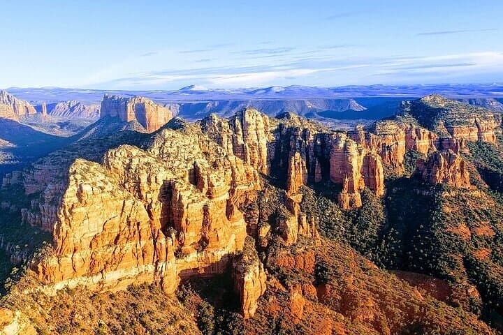
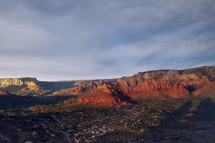
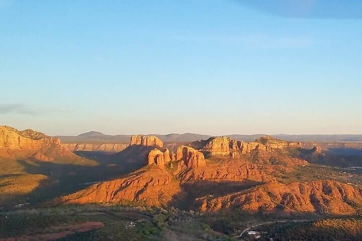
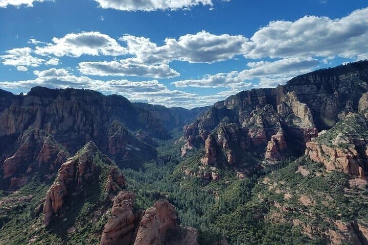
The helicopter lifts and the valley exhales beneath you—an orange band of sun sliding behind serrated red-rock ridgelines, while your headset picks up the pilot’s quiet narration and the wind’s steady pulse. For 25 minutes this tour stitches together Sedona’s most iconic landmarks—Cathedral Rock, Bell Rock, Courthouse Butte—and then pushes deeper, following Boynton and Long canyons until the canyon walls narrow and the rotor’s thrum becomes a private soundtrack to cliff-side ruins you can rarely reach on foot.
The helicopter lifts and the valley exhales beneath you—an orange band of sun sliding behind serrated red-rock ridgelines, while your headset picks up the pilot’s quiet narration and the wind’s steady pulse. For 25 minutes this tour stitches together Sedona’s most iconic landmarks—Cathedral Rock, Bell Rock, Courthouse Butte—and then pushes deeper, following Boynton and Long canyons until the canyon walls narrow and the rotor’s thrum becomes a private soundtrack to cliff-side ruins you can rarely reach on foot.
The ruins the pilot highlights belong to the Sinagua people, a farming and trading culture that occupied the Verde Valley and surrounding canyons from roughly AD 600–1400. Seen from above, their structures read like deliberate gestures into the landscape—clusters of masonry tucked beneath overhangs or perched on ledges that demanded knowledge of water, stone, and seasonal movement. Geologically, you’re flying over layers of the Schnebly Hill Formation and Coconino Sandstone—iron-stained, wind-sculpted slabs that glow as the sun falls. Oak Creek threads through the valley below, a narrow ribbon that once supported native agriculture and still draws wildlife to its riparian shade.
This is an aerial tour with practical muscle: the route covers more than 30 miles of canyon and mesa in a single sunset run, and the operator slows at key points so you can look down into Boynton and Long canyons where ancient footprints are invisible from the road. Seating is forward-facing and guests use noise-reducing headsets, so conversation, narration, and photography feel focused. The small group size—max six—keeps the cockpit intimate and the views uncluttered.
For planning: the meeting point is the red building opposite Mesa Grill; plan to arrive 30 minutes early for briefing and weight checks. Flights can be canceled for weather—book with a flexible evening and pack layers: Sedona’s temperature can drop sharply after sunset. If you’re prone to motion sickness take medication beforehand; the pilot will slow for photo windows but the ride still moves.
What you gain is perspective: a landscape that dares you to re-frame scale, an archaeological syllabus read from the air, and a sunset that paints sandstone like a slow flame. For anyone short on time but hungry for depth, the helicopter turns the long hike into a concentrated, unforgettable sweep of Sedona’s red-rock soul—efficient, elemental, and practical to plan.