
What the day feels like
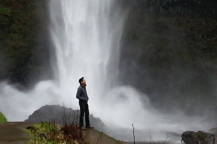
You arrive with wind in your cheeks and the Gorge already talking. From the passenger window the highway drops into light—basalt cliffs dark with moss, trees leaning toward the river as if eavesdropping on the current below. Then the first hint of spray: a white ribbon that unspools down rock, sudden and audible, the way waterfalls always are when you’re close enough to feel them. At Multnomah Falls the sound fills the valley. It’s immediate, tactile; it draws you off the roadside and onto a short paved path where tourists and day-trippers gather, necks craned, cameras up. The bridge—Benson Bridge—hovers like a stage between the lower and upper falls, and crossing it is the first small, unforgettable act of the afternoon.
This tour is compact by design: three and a half hours that move deliberately through the Gorge’s high drama. Guides—private and conversational—point to anchor points of time and geology. Under your feet is basalt, a thick shell left behind by Cascadian eruptions when lava spilled westward and built the bones of Western Oregon’s cliffs. You learn how those cliffs were carved not only by weather and rivers but by the Pleistocene flood events: the Lake Missoula Floods, which, some 15,000 years ago, scoured the Gorge with torrents of water and debris, leaving the steep-walled canyon you’re now threading. That mix of fire and flood is the script that makes these falls possible: basalt steps, fractures, and a river that still dares its edges.
There’s history here beyond geology. The Columbia River Gorge is ancestral land of Chinookan peoples—the river a corridor for trade, salmon runs, and stories. In more recent centuries, the Historic Columbia River Highway stitched access into the cliffs, and in 1925 the Multnomah Falls Lodge opened as a rustic waypoint for travelers, its stone-and-timber face still a popular place to warm up with coffee after the mist. Your guide will point out spots where early engineers carved switchbacks into basalt and where rail lines once hugged the river.
The tour makes smart use of geography. You’ll see both lower and upper tiers of Multnomah Falls—the full drop totals about 620 feet, sculpting a two-tiered fall that remains Oregon’s tallest single-drop fall when both tiers are linked. Along I‑84 the gorge unfolds: Horsetail Falls, Bridal Veil Falls, and quieter side cascades that demand less foot traffic but reward attention. In spring the whole thing is a study in volume—rivers high, ferns unfurled, basalt slick with moss. Later in summer the falls thin to a thread, but the views open wide and the light becomes photographer-friendly.
The practical side of that beauty matters. This particular outing is a private, 210-minute excursion that departs from Portland and moves east along the highway, stopping at key overlooks and trailheads. You can walk a quick, paved 0.2 mile from the Multnomah Falls parking lot to Benson Bridge for the classic perspective. If your legs want more, an upper-trail climb to the top viewpoint adds ~1.2 miles round-trip and about 600 feet of elevation gain—worth it if you want panorama rather than postcard. Terrain ranges from roadside viewpoints and short paved sections to steeper, rockier switchbacks if you push for upper viewpoints. Expect mixed footing and a wet spray zone near the falls; waterproof layers and grippy footwear matter.
Why book this instead of driving yourself? A guide threads context into the landscape: geology, indigenous and settler histories, and the little environmental stories tourists rarely see. They also know the parking patterns and timing—how to avoid the midafternoon crush or where to pause for the best light. For photographers, for families, or for people who want to compress a day of Gorge highlights into an easy afternoon, the private format is efficient and informative. The tour’s price point—starting from around $85 per person—covers local expertise, curated stops, and the convenience of a half-day window that still leaves the evening free for a Hood River brewery visit or a drive along the river.
Practical tips stitch the experience together. Morning or late-afternoon light softens the basalt and eases crowds; if you want the bridge to yourself, aim for a weekday and early start. Spring’s high flows are spectacular but mean more mist—bring quick-dry layers. Summer brings warmth, clearer skies, and better wireless if you need it, but also crowds and limited parking. Parking at Multnomah Falls can be tight on weekends; many guides time their approach to avoid the busiest windows. And for anyone who cares about the place: stick to trails, respect closures, and understand that this canyon is a living system—salmon runs, peregrine nesting sites, and fragile riparian habitat all coexist with the tourism.
If you want to make a day of it beyond the falls, your guide can point you toward quieter trails, nearby waterfalls like Wahkeena and Horsetail, or a scenic stop in Hood River for craft beer and views back into the Gorge. Or stay closer: the Lodge has a simple menu where you can warm up, refuel, and read interpretive panels that fold human history into the rock.
For people who like to plan, this tour is a tidy, elevated introduction to one of Oregon’s most photographed landscapes. It’s sensory—wet, loud, and immediate—yet grounded with explanation. Book it if you want the Gorge unpacked by someone who knows the angles, the stories, and the best places to pause. If you’re a photographer, a curious hiker wanting a short but satisfying climb, or a traveler who prefers interpretation to wandering, this afternoon in basalt and spray will feel efficient, generous, and, at moments, quietly wild. Learn more or reserve a guide for your afternoon by visiting the Afternoon Multnomah Falls and Gorge Waterfalls Tour and see how a few hours in the Gorge can reframe a whole region.
Trail wisdom
Small choices, better day.
Time your visit
Arrive early or late afternoon to avoid peak parking and get softer light for photos.
Bring a waterproof layer
Mist from the falls can soak clothing—pack a light rain shell to stay comfortable.
Respect closures and wildlife
Stay on marked trails to protect riparian areas and nesting birds.
Use a guide to beat logistics
Guides know the best pullouts and timing to maximize viewpoints and minimize walking if needed.
Local knowledge
Read the place, not just the route.
Watch for native species including Bald eagle, Black-tailed deer.
Keep an eye out for wildlife during the transition between areas and habitats. Respect distance guidelines.
The Gorge is protected as a National Scenic Area—stay on trails, pack out waste, and use established pullouts to reduce pressure on sensitive riverbanks.
Follow the guide's instructions on size limits, ethical handling, and leave-no-trace practices.
Wahkeena Falls trail for a quieter mossy route. Horsetail Falls and the short, scenic walk to its base
Locally recommended viewpoints and quiet spots known best to local operators.
The Columbia River Gorge was carved by the Missoula Floods and is traditional territory of Chinookan peoples; the Historic Columbia River Highway opened access for early 20th-century travelers.
Maritime roots and regional tradition shape the waterways and working coasts.
Seasonal guide
Four versions of the same landscape.
Spring
Best forHigh water flows · Wildflowers · Lush moss photography
ChallengesCold, wet conditions · Slippery trails
Spring brings the Gorge to life with the highest waterfall volume and vivid greenery—great for dramatic photos but expect spray and muddy sections.
Summer
Best forClear vistas · Extended daylight · Wildlife viewing
ChallengesLower waterfall flow · Crowds and parking shortages
Summer offers warm, clear conditions and easier upper-trail hiking, but plan for crowds and limited parking at popular pullouts.
Fall
Best forCrisp air and color · Milder crowds · Golden light
ChallengesUnpredictable rain · Shorter daylight hours
Fall balances cooler temperatures and autumn color with fewer tourists—rain can arrive quickly, so layer up.
Winter
Best forIcy, dramatic scenes · Solitude · Photographing frozen spray
ChallengesIcy trails and closures · Limited services
Winter can transform cliffs with ice and frosted trees; traction devices are advised and some roads or viewpoints may be closed.
Operator details
What the booking data adds.
Included
- ✓Transport by Mercedes-Benz Sprinter Van
- ✓Knowledgeable and Experienced Local Guide
- ✓Bottled water
- ✓Pick-up & Drop-off At Downtown Portland Hotels
- ✓Permit and parking fees for Multnomah Falls included during the permit season
Not included
- —Gratuities
Good to know
- ✓Service animals allowed
- ✓Specialized infant seats are available
- ✓Suitable for all physical fitness levels
Pack with intention
What to bring.
Good to know
Common questions.
The private tour lasts about 210 minutes and includes guided stops at Multnomah Falls and other Gorge viewpoints, interpretation on geology and history, and transportation from Portland.
Plan the edges
The details that make the day easier.
Multnomah Falls drops a total of approximately 620 feet, making it the tallest waterfall in Oregon.
After the hike, grab a warm meal at Multnomah Falls Lodge or drive to Hood River for craft breweries and views of the river; Cascade Locks offers waterfront cafés and an accessible marina for longer explorations.
- Closest airport
- Portland International Airport (PDX). Driving time: ~45–60 minutes east on I‑84 from Portland. Trailhead: Multnomah Falls Historic Lodge parking area. Cell service: patchy in parts of the Gorge. Permits: no permit required for day visits, but parking restrictions
The Gorge is a protected National Scenic Area—pack out all trash, stay on designated trails, and avoid disturbing riparian habitats to help preserve fragile ecosystems.
Explore by topic
Follow the threads.
Keep exploring
Make the story part of the trip.
In four hours you can move from shaded canyon ferns to wind-scoured coastal ridgelines, guided by someone who knows where the light—and the hidden views—live. This private half-day hike on the Monterey Peninsula or Big Sur is compact, curated, and perfect for travelers who want depth without a multiday commitment.
 Related story
Beneath a sky of shifting light, Skaftafell’s ice reads like a map of time. This three-hour guided glacier hike mixes technical instruction with geology and culture: compact, safe, and unforgettable.
 Related story
Lose the city for a few hours without leaving it: this 5-mile, 900-foot-gain Forest Park loop threads old-growth pockets, city viewpoints, and cultural landmarks for a compact taste of Portland’s wild side. Expect moss, roots, and stories.