
What the day feels like
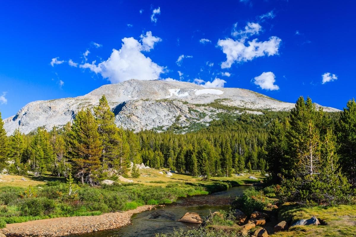
You crest a final ridge and the world opens: a scatter of glassy alpine lakes, a sweep of wind-polished granite, and a road that threads through a short, fierce summer above 9,000 feet. Tioga Pass doesn’t announce itself with a single grand gesture like Yosemite Valley’s plunging cliffs; it reveals in a succession of small, crystalline scenes—the sudden shimmer of Tenaya Lake, the bleached-gray talus fields under Mt. Dana, tufted meadows that look like spilled emeralds. The air is thin and bright; the sun cuts clean. For a few months each year, this high alpine corridor is Yosemite’s other face: raw, limit-testing, quietly glorious.
Tioga Pass sits at 9,943 feet on Highway 120, the highest paved pass in California and the eastern gateway to Yosemite’s High Country. The road—Tioga Road—threads east–west across the Sierra Nevada, connecting the Mono Lake/Lee Vining side with Tuolumne Meadows and the park’s subalpine heart. Drive it in the right season and you’ll feel like you’re crossing a spine of the continent: sweeping vistas that look small from the valley below reveal themselves to be entire ecosystems packed into a thin band of elevation.
This is mountain country shaped by ice. The same glaciers that carved the sheer walls of Yosemite Valley left behind rounded domes, glacial lakes, and the amphitheaters of the High Sierra. Granite is the grammar here—smooth, luminous, and relentlessly present. The result is a landscape that rewards motion: short walks turn into alpine classrooms for geology, hydrology, and the slow, stubborn life of the tundra.
Culture and history are woven through the pass too. The name Tioga—borrowed from the East by miners and settlers—marks a 19th-century ambition: to connect the eastern Sierra with the promise of California’s interior. Miners, loggers, and early road-builders shaped the first rough routes; later, the Civilian Conservation Corps and the National Park Service formalized Tioga Road into the paved scenic highway you drive today. Modern visitors arrive in rental SUVs and on guided tours, but the patterns of use echo those earlier movements—travel, transport, and the careful negotiation of place.
Why come here? For a different kind of Yosemite day. Many visitors make the valley the center of their trip; Tioga Pass is the antidote to crowds. It’s the place for alpine walks that can be as easy as a lakeshore stroll or as demanding as a summit push. If you’re time-limited, guided options like the Small-Group Day Trip to Yosemite from Lake Tahoe make Tioga Road accessible without the logistics headache. Adaptive versions of High Country tours let travelers with mobility considerations sample the pass’s vistas, from Olmsted Point’s cinematic view of Half Dome to the shorelines of Tuolumne and Tenaya.
On foot, you’ll find options to match almost every appetite. Tenaya Lake’s shoreline is forgiving—1–2 miles of easy, rounded terrain that’s perfect for stretching legs, picnicking, or a quick swim in warm afternoons. For a proper mountain day, the Mt. Dana trail from the Tioga Road parking area is the classic: roughly 6.2 miles round-trip with about 2,000 feet of gain to a summit that offers a panorama of Mono Lake and the High Sierra crest. The ground shifts from sparse forest to alpine talus; expect thin air, strong sun, and rock that seems to hold a memory of the glacier that dumped it there.
Prepare smart. Altitude changes everything—pace, appetite, and hydration. Footwear matters more than fashion: stiff-soled hiking shoes or lightweight boots handle the abrasive granite and loose scree better than trail runners. Weather turns fast in the High Sierra; a blue sky at dawn can be roped with clouds by noon. Timing your drive and hikes for morning to early afternoon reduces the likelihood of afternoon thunderstorms and gives you the best light for photos.
Logistics are refreshingly straightforward but seasonal. Tioga Road is typically open late May or June through October depending on snowfall; outside that window, the pass is closed and access from the east requires a long drive around. Services are sparse on the east side—Lee Vining and Mammoth Lakes are the nearest towns for food, fuel, and lodging—so stock up before you climb. If you’re driving from Lake Tahoe or San Francisco, guided multi-day itineraries that include Tioga Pass let you lean on local knowledge for timing and trails while concentrating on the view.
For the minimalist traveler: keep core layers, sun protection, and water handy. For the ambitious hiker: bring a map, a daypack with extra layers, and respect for fragile alpine meadows. And remember: in a place where summers are short and the ecosystem slow to recover, small actions—staying on durable surfaces, packing out trash, limiting group size—make a big difference.
Tioga Pass is an immediate, clarifying experience: the kind of place where an ordinary drive becomes an education in altitude and a short walk becomes a memory you carry long after the road drops back into forest. Whether you come with a guide from Lake Tahoe, join a multi-day Sierra circuit, or take one of the adaptive tours that open the High Country to more visitors, Tioga rewards planning, pacing, and a willingness to slow down. Here, the peaks don’t shout; they hold court. You show up, you listen, and you take the long view.
Trail wisdom
Small choices, better day.
Acclimatize before pushing hard
Spend a few hours at lower elevation or take it slow on your first hike—altitude at nearly 10,000 ft affects breathing and pace.
Start early to avoid storms
Afternoon thunderstorms are common—begin hikes at sunrise and aim to be off exposed ridgelines by early afternoon.
Pack a map and bear canister if overnighting
Cell service is unreliable; if camping near Tuolumne Meadows, use a bear canister and know backcountry regulations.
Protect alpine meadows
Stay on established trails and rock to avoid damaging slow-growing tundra vegetation.
Local knowledge
Read the place, not just the route.
Watch for native species including Marmot, Mule deer.
Keep an eye out for wildlife during the transition between areas and habitats. Respect distance guidelines.
High-country ecosystems recover slowly; stay on durable surfaces, pack out waste, and avoid trampling meadow vegetation to protect fragile alpine habitats.
Follow the guide's instructions on size limits, ethical handling, and leave-no-trace practices.
Gaylor Lakes—small alpine tarns just west of the summit with easy access and fewer visitors. Olmsted Point—an often-overlooked vantage with fractured views of Half Dome and Tenaya Canyon
Locally recommended viewpoints and quiet spots known best to local operators.
Tioga Road opened the high country to modern visitors after early trails and seasonal routes used by miners and ranchers; the pass has long been the eastern approach to Yosemite’s alpine basin.
Maritime roots and regional tradition shape the waterways and working coasts.
Seasonal guide
Four versions of the same landscape.
Spring
Best forWildflower blooms in lower elevations · Late-season snowshoe routes (early spring)
ChallengesSnowpack may keep Tioga Road closed · Variable temps and muddy trails
Spring is transitional—Tioga Road often remains closed into late May or June after heavy winters; when open, expect lingering patches of snow and early wildflowers.
Summer
Best forHigh-country hikes and lakes · Scenic drives and photography
ChallengesAfternoon thunderstorms · Crowds on weekends
Summer is peak access: roads are generally open, trails clear, and alpine lakes are warmest; start hikes early to beat storms and crowds.
Fall
Best forLone‑tree vistas and quiet trails · Crisp alpine air and clear light for photos
ChallengesShortening days and early snow · Services begin to shutter late season
Fall brings quieter trails and sharp light, but weather can flip quickly—be prepared for early season snowfall and limited services.
Winter
Best forSnowshoeing and backcountry skiing (advanced) · Photographing snow-clad granite from lower elevations
ChallengesTioga Road is usually closed · Very cold temperatures and avalanche risk
Winter closes Tioga Road; access requires backcountry skills and avalanche awareness—most visitors admire the snowy high country from lower-elevation viewpoints.
Pack with intention
What to bring.
Good to know
Common questions.
Tioga Road typically opens between late May and June and closes with the first heavy snowfall in October or November—dates vary yearly depending on snowpack.
Plan the edges
The details that make the day easier.
Tioga Pass is the highest paved pass in California at 9,943 feet (3,031 meters).
Stop in Lee Vining for homemade pies, visit Mono Lake’s tufa towers at sunrise, and sample mountain lodge fare in Mammoth Lakes—local businesses rely on seasonal tourism and value stewardship.
- Elevation
- 9,943 ft; Road open: typically June–Oct; Nearest towns: Lee Vining (east), Yosemite Valley
- south); Permits
- wilderness permits required for overnight backcountry.
Stick to designated trails and campsites, carry out all trash, and store food in approved containers—alpine meadows and slow-growing plants are easily damaged and take decades to recover.
Explore by topic
Follow the threads.
Keep exploring
Make the story part of the trip.
In four hours you can move from shaded canyon ferns to wind-scoured coastal ridgelines, guided by someone who knows where the light—and the hidden views—live. This private half-day hike on the Monterey Peninsula or Big Sur is compact, curated, and perfect for travelers who want depth without a multiday commitment.
 Related story
Beneath a sky of shifting light, Skaftafell’s ice reads like a map of time. This three-hour guided glacier hike mixes technical instruction with geology and culture: compact, safe, and unforgettable.
 Related story
Lose the city for a few hours without leaving it: this 5-mile, 900-foot-gain Forest Park loop threads old-growth pockets, city viewpoints, and cultural landmarks for a compact taste of Portland’s wild side. Expect moss, roots, and stories.