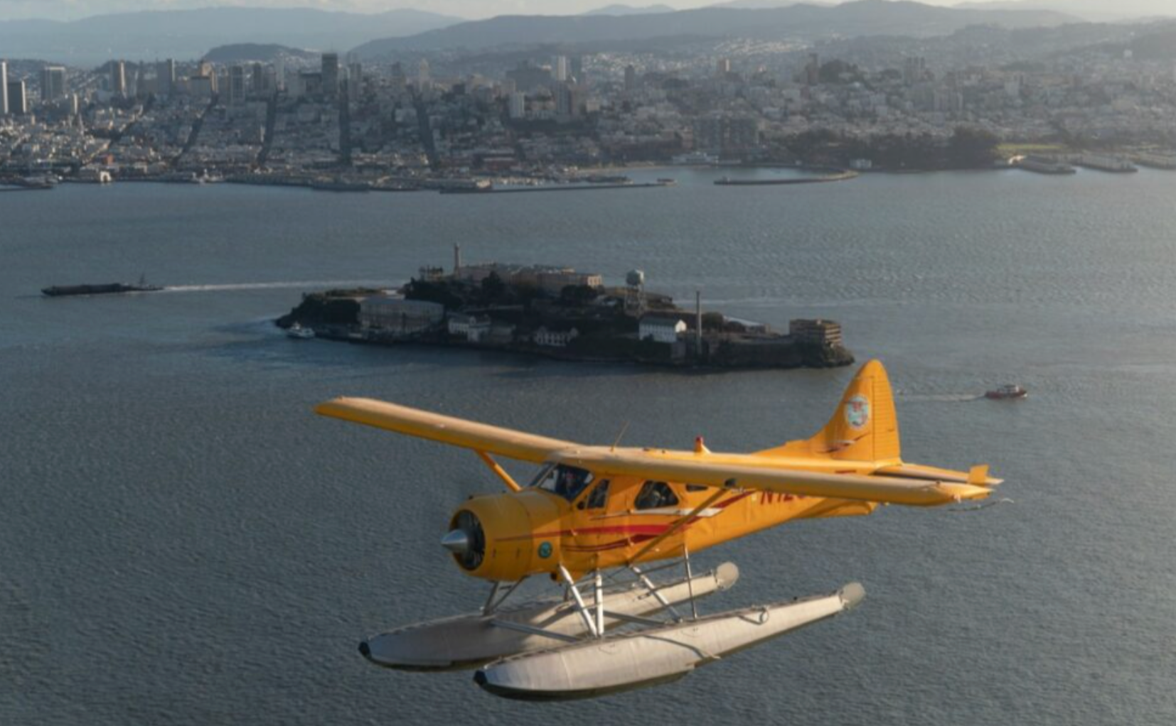
Top Airplane Adventures in San Pablo, California
Flying above San Pablo is a study in contrast: tidal marshes and wide salt flats meet industrial silhouettes and urban edges, while the East Bay hills and distant peaks sketch a shifting horizon. This guide focuses on airplane-based experiences—scenic flights, training sorties, vintage aircraft rides, and tailored charters—that turn a short flight into a layered introduction to the Bay Area’s landscape, history, and wildlife.
Top Airplane Trips in San Pablo
18 trips • Book with confidence • Instant confirmation
Why San Pablo Works for Airplane Adventures
San Pablo sits on the receiving edge of the Bay—where tidal flats, salt marshes, and industrial waterfronts form a textured, almost cinematic landscape when seen from above. An airplane tour here is less about a single postcard view and more about layered observation: the braided patterns of creeks feeding San Pablo Bay; the patchwork of wetlands that host migratory shorebirds; the industrial docks and refineries that narrate the region’s working history; and the soft, green sweep of the East Bay hills rising behind the shoreline. Taken together, these features make the airspace above San Pablo unusually instructive. From the right altitude a 20–40 minute flight can function as a compact primer on Bay ecology, regional industry, and the geography that channels weather and human settlement.
Aerial experiences in and around San Pablo are diverse. Short scenic sorties give photographers and first-time flyers an expansive window seat on the Bay and its tributaries; introductory flights and discovery lessons let aspiring pilots learn fundamentals without committing to long-form training; and occasional vintage or specialty flights provide a period-piece view of the region while connecting passengers to the living culture of general aviation. Because San Pablo is close to a network of general aviation fields and coastal approaches, flights can be configured to emphasize wildlife viewing, shorelines, or skyline panoramas. On clear days Mount Diablo and other East Bay summits create a dramatic backdrop; on hazy mornings the low sun imbues the marshes with metallic light and long shadows that are particularly beautiful from the air.
The experience is inherently tactile. You’ll notice how the bay’s thermal patterns influence ride smoothness, how sunlight changes the color of water and salt flats, and how urban edges look from a thousand feet—human geometry arranged against natural curves. That sensibility—the blend of technical flying and sensory reward—is what draws travelers to airplane adventures here. Pairing flights with ground activities amplifies the trip: birding at nearby wetlands becomes richer when you’ve seen the full extent of the habitat from above; a shoreline paddle or a ridge hike reads differently once you’ve traced those same lines from the sky. Practically, airplane outings are short, highly customizable, and a useful option when ground traffic or time constraints make exploring the Bay’s dispersed sites difficult.
Because airplane experiences intersect with weather, aviation regulations, and sensitive habitats, planning matters. Operators can adjust routing to minimize disturbance to wildlife areas or to focus on landmarks you most want to see. Bring a sense of curiosity and a clear plan for what you want from the flight—photography, learning to fly, or simply a dramatic view—and you’ll find San Pablo’s skies a productive, unexpectedly intimate way to know the Bay.
Airplane trips over San Pablo are efficient: short flights cover long visual ground, letting you sample wetlands, industrial waterfront, and ridge lines without a lot of driving.
Clear light in late spring through early fall often yields the best visibility for photography and long-distance views; mornings tend to be calmer for smoother rides.
Best Time to Visit
Best Months
Weather Notes
Late spring through early fall typically offers the most stable air and clearest visibility. Morning flights often have gentler winds and less bay fog; afternoons can build thermals and local turbulence. Winter brings more clouds and rain, which can limit scenic flying but sometimes produces dramatic low-light conditions.
Peak Season
Summer–early fall: best visibility and highest demand for scenic flights.
Off-Season Opportunities
Winter and early spring can be quieter and may coincide with migratory bird concentrations; however, expect more weather-related cancellations or limited routing.
Frequently Asked Questions
Do I need any permits to take a scenic flight?
Most scenic and charter flights operate under the operator’s air carrier authorization and do not require separate permits from passengers. Operators will inform you of identification requirements and safety briefings.
Are flights suitable for children and seniors?
Yes—many operators accommodate a wide range of ages, but check weight, mobility, and seating restrictions in advance. For very young children or older adults with mobility limitations, discuss boarding and seating arrangements before booking.
Can I bring professional camera gear or drones?
Handheld camera gear is generally permitted; large tripods or unsecured equipment may be restricted. Drones are regulated by the FAA and local protections—flying drones from an aircraft or near wildlife refuges is not allowed; coordinate with operators for photography plans.
Choose Your Experience Level
Beginner
Short scenic flights and introductory discovery flights require no prior experience—ideal for first-time flyers and photographers.
- 30–45 minute bay overview flight
- Introductory discovery flight with dual-control demo
- Short vintage aircraft experience (passenger seating only)
Intermediate
Passengers who want more engagement—longer scenic routes, focused photography missions, or an introduction to pilot controls—will find half-day options.
- Extended shoreline and wetlands survey flight
- Discovery lesson with hands-on time at controls
- Aerial photography session timed for golden hour
Advanced
Experienced fliers and pilots seeking deeper involvement—multi-leg charters, cross-country flight planning, or advanced instruction—can arrange custom flights or training blocks.
- Pilot-oriented cross-country sorties using local airspace
- Advanced instruction with instrument or complex-aircraft modules (operator-dependent)
- Custom charter routing for surveying or research work
Insider Tips & Local Knowledge
Confirm weather and routing with your operator; consider wildlife seasons and noise-sensitive areas when planning flights.
Book morning flights for calmer air and cleaner horizons; afternoons can produce thermals that make rides bumpier. If photography is your goal, request a window seat on the side that aligns with the routing—operators can often advise which side offers the best light for the landmarks you want. Tell the operator if you’re aiming to see wildlife so routing can minimize disturbance while maximizing views. Expect clear preflight briefings about baggage, ID, and safety—small aircraft have tighter payload and balance limits than commercial jets. If you’re taking an introductory pilot lesson, wear closed-toe shoes and comfortable layers; participants often have a short ground briefing followed by hands-on controls in the air. Finally, pair a flight with a ground activity—birdwatching at the bay’s marshes, a walk along the shoreline, or a visit to a local maritime or industrial heritage site—to round out the perspective you gained from above.
What to Bring
Essential
- Government-issued photo ID (required by operators)
- Layered clothing—temperatures can be noticeably cooler in the air
- Binoculars or telephoto lens for wildlife and shoreline detail
- Noise-cancelling ear protection or earplugs
- Phone or camera tether/strap to secure gear in turbulence
Recommended
- Sunglasses with neutral tint for glare over water
- Small daypack for personal items and paperwork
- Motion-sickness medication if you’re prone to airsickness
- Portable battery to keep devices charged for photos/navigation
Optional
- Compact windbreaker (open doors/low-wing planes can be breezy)
- Notebook for jotting aerial observations
- Reference map or downloaded satellite imagery to cross-check landmarks
Ready for Your Airplane Adventure?
Browse 18 verified trips in San Pablo with instant booking
Explore Top 15 San Pablo, California Adventures →