2

Top 18 Airplane Experiences in Martinez, California

Martinez, California

From low-level panoramas of the Carquinez Strait to longer bay-and-mountains circuits, airplane experiences around Martinez translate local geography into motion: salt marshes, shipping channels, and serrated ridgelines all read differently from a window seat. This guide focuses on the airplane-based ways to see, learn from, and interact with the region from the air—whether you want a calm scenic ride, a first flight lesson, or an adrenaline-charged aerobatic introduction.

18
Activities
Year-Round (weather dependent)
Best Months

Top Airplane Trips in Martinez

18 trips • Book with confidence • Instant confirmation

Why Airplane Experiences Around Martinez Are Unique

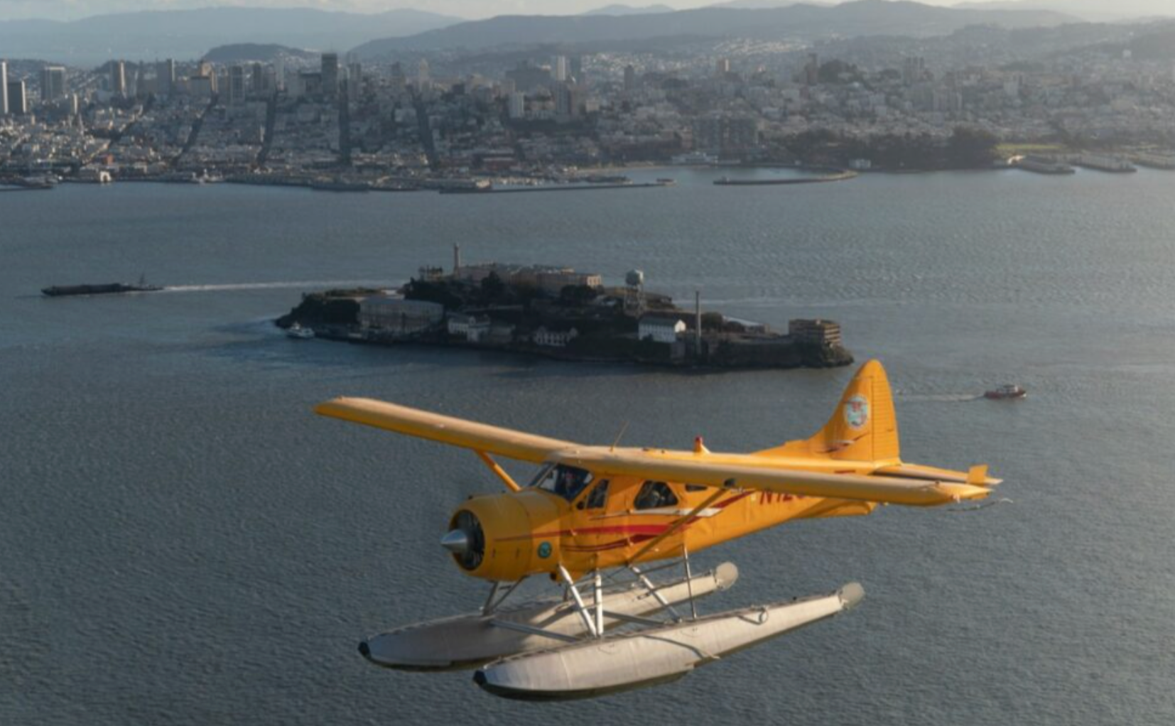
The sky above Martinez is a stitched map of industrial waterways, tidal marshes, and uplifted ridgelines. From a tourist’s perspective, the region’s signature features—Carquinez Strait’s tidal sweep, the laddered slopes of Mount Diablo to the south, and the marine layer that frequently rivers in off San Pablo Bay—combine to make short flights exceptionally dynamic. Unlike long-haul sightseeing that trades detail for breadth, airplane outings here emphasize shifting perspectives: a refinery line that reads like a geometric pattern from above, a winding rail corridor hugging the water’s edge, or the granular texture of salt marsh cordgrass that only reveals itself at low altitudes. These visually rich seams are what make airplane experiences in and around Martinez more than “a plane ride”; they become a mode of interpretation, a way to understand how water, industry, and hills converge.

There’s also a deeply human layer to flying near Martinez. The city sits at a crossroads of working landscapes—ports and refineries, commuter corridors, and protected wetlands—and pilots who operate local scenic flights and flight schools tend to be local storytellers as much as aviators. A good pilot will point out seasonal shifts—where migrating waterfowl concentrate, which dredged channels flush with boats in summer, or how thermal activity from inland valleys shapes cloud bases. This narrative element elevates short flights into micro-classes in regional geography and natural history, teaching riders to read the land as they glide.

Practically speaking, airplane activities here split into clear types: short scenic tours that last 20–60 minutes and focus on the Carquinez corridor and bay approaches; introductory flight lessons and discovery flights for people curious about piloting; and specialty offerings such as aerial photography charters or aerobatic introductions operated at nearby general aviation fields. The terrain makes each type of outing memorable—lower-elevation flights emphasize tidal textures and shipping lanes, while circuits that include Mount Diablo show a dramatic elevation contrast and expansive inland views. Weather is the organizing factor: marine layer and morning fog produce ethereal, low-contrast light that photographers sometimes prize and pilots must manage, while late spring and fall often offer the clearest flying conditions with more stable visibility.

For travelers, the appeal is both immediate and practical. Airplane experiences are accessible to a broad range of fitness and mobility levels—most scenic flights require little more than arriving, completing a short safety briefing, and settling in—but they also reward planning. Book windows, weight-and-balance considerations for small aircraft, and flexible timing around weather mean a little advance coordination pays off. And because Martinez sits within easy reach of complementary activities—kayaking the nearby rivers, winery tasting in the inland valleys, or hiking the lower slopes of Mount Diablo—an aerial flight can be paired with ground adventures to build a layered, full-day exploration of the region.

In short: flying around Martinez is a study in contrasts—salt and uplands, industry and wetlands, fog and sudden clarity—translated into motion. For anyone wanting an efficient, high-impact way to see how a patch of Northern California fits together, the airplane offers a perspective that’s both cinematic and instructive.

Short scenic flights provide a compact snapshot—ideal for travelers with limited time. In 20–45 minutes you can trace the strait, skirt San Pablo Bay, and loop inland for a Mount Diablo silhouette.

Introductory flight lessons and discovery flights are the best way to combine learning with sightseeing: expect a hands-on briefing, 20–40 minutes of dual flight time, and the option to log the experience toward pilot training if you choose to continue.

Activity focus: Scenic flights, discovery flights, flight lessons, aerial photography
Best vantage points include Carquinez Strait, Martinez shoreline, and Mount Diablo circuits
Flights are highly weather dependent—fog and low ceilings can cause cancellations
Most operators work out of nearby general aviation fields and require advance booking
Complementary activities: kayaking, cycling the waterfront, hiking and local wine tasting

Best Time to Visit

Best Months

MarchAprilMaySeptemberOctober

Weather Notes

Morning marine layer and fog are common from late spring through early summer and can reduce visibility; afternoons often clear. Late summer and early fall generally have the most stable flying weather and the best visibility windows.

Peak Season

Late spring through early fall, when clearer skies and calmer conditions increase flight availability.

Off-Season Opportunities

Winter and early spring can offer lower rates and quieter airfields; however, expect a higher chance of cancellations due to low clouds, rain, or gusty winds. Weekday morning windows occasionally provide the best combination of availability and price.

Frequently Asked Questions

Do scenic flights require prior flying experience or medical clearance?

No prior experience is required. Most scenic flights and discovery flights are open to the general public; however, operators may ask about mobility limitations. Medical clearance is typically not required for short tourist flights, but disclose any serious health issues when booking.

What happens if the flight is canceled for weather?

Operators usually offer a full refund or rescheduling. Because many flights operate from small general aviation fields, pilots will prioritize safety and may delay or cancel if ceilings are below safe operating minima.

Can I bring a camera and take photos from the plane?

Yes—photography is encouraged. Use a strap to secure your camera or phone. For window reflections, place the lens close to glass; polarized filters can help. Note that some special operations (e.g., aerobatics) may restrict loose equipment.

Choose Your Experience Level

Beginner

Short, guided scenic flights with a pilot- narrator—minimal commitment for maximum views.

  • 20–30 minute Carquinez Strait scenic circuit
  • Discovery flight (introductory lesson with dual controls)
  • Bay approach panoramic flights

Intermediate

Longer aerial tours and introductory hands-on flight lessons where passengers may take partial control under instructor supervision.

  • 45–60 minute bay-and-mount-diablo circuit
  • Introductory dual flight lesson (loggable toward pilot hours)
  • Aerial photography charter focusing on shoreline and marshes

Advanced

Specialized experiences for the adventurous or aspiring pilot: aerobatic introductions, tailwheel or complex-aircraft discovery flights, and multi-leg cross-country flights that include navigation practice.

  • Aerobatic introductory flight (subject to operator availability and health screening)
  • Tailwheel or complex-aircraft discovery lessons
  • Pilot-focused cross-country legs with navigation practice

Insider Tips & Local Knowledge

Confirm meeting points and arrival procedures with your operator—many flights depart from small ramps or FBOs with limited signage.

Book morning slots if you prefer calmer winds, but be prepared for early fog; late morning to early afternoon often offers the clearest windows. Check baggage and camera rules—operators of small aircraft sometimes limit hard-sided bags and require soft-sided camera cases. If you’re shooting photos, request a seat on the side of the aircraft that faces the coastline or Mount Diablo depending on your priority; pilots can usually accommodate seating preferences when informed in advance. Consider pairing a short scenic flight with a ground-based activity—launch a kayak from the Martinez waterfront before or after your flight for a layered perspective, or visit a local winery inland to round out the day. Finally, ask pilots about seasonal wildlife patterns: spring migration can concentrate shorebirds in certain marshes, and seals or dolphins occasionally appear near shipping channels, creating spectacular photo opportunities.

What to Bring

Essential

  • Valid photo ID (required by many operators)
  • Layered outerwear for wind and evaporative cooling at altitude
  • Sunglasses and sun protection
  • A charged camera or phone with a good lens and secure strap
  • Any required prescription medications (motion-sickness remedies if needed)

Recommended

  • Noise-cancelling headphones if provided by the operator, or earplugs
  • Binoculars for pre- and post-flight shoreline observing
  • Light daypack for ground activities before/after your flight
  • Small handheld GPS or offline map app for coordinating meeting points

Optional

  • Compact folding stool or cushion for waiting at small airfields
  • Polarizing filter for photography to reduce glare over water
  • Notebook or voice recorder for noting pilot tips and route names

Ready for Your Airplane Adventure?

Browse 18 verified trips in Martinez with instant booking

Explore Top 15 Martinez, California Adventures →