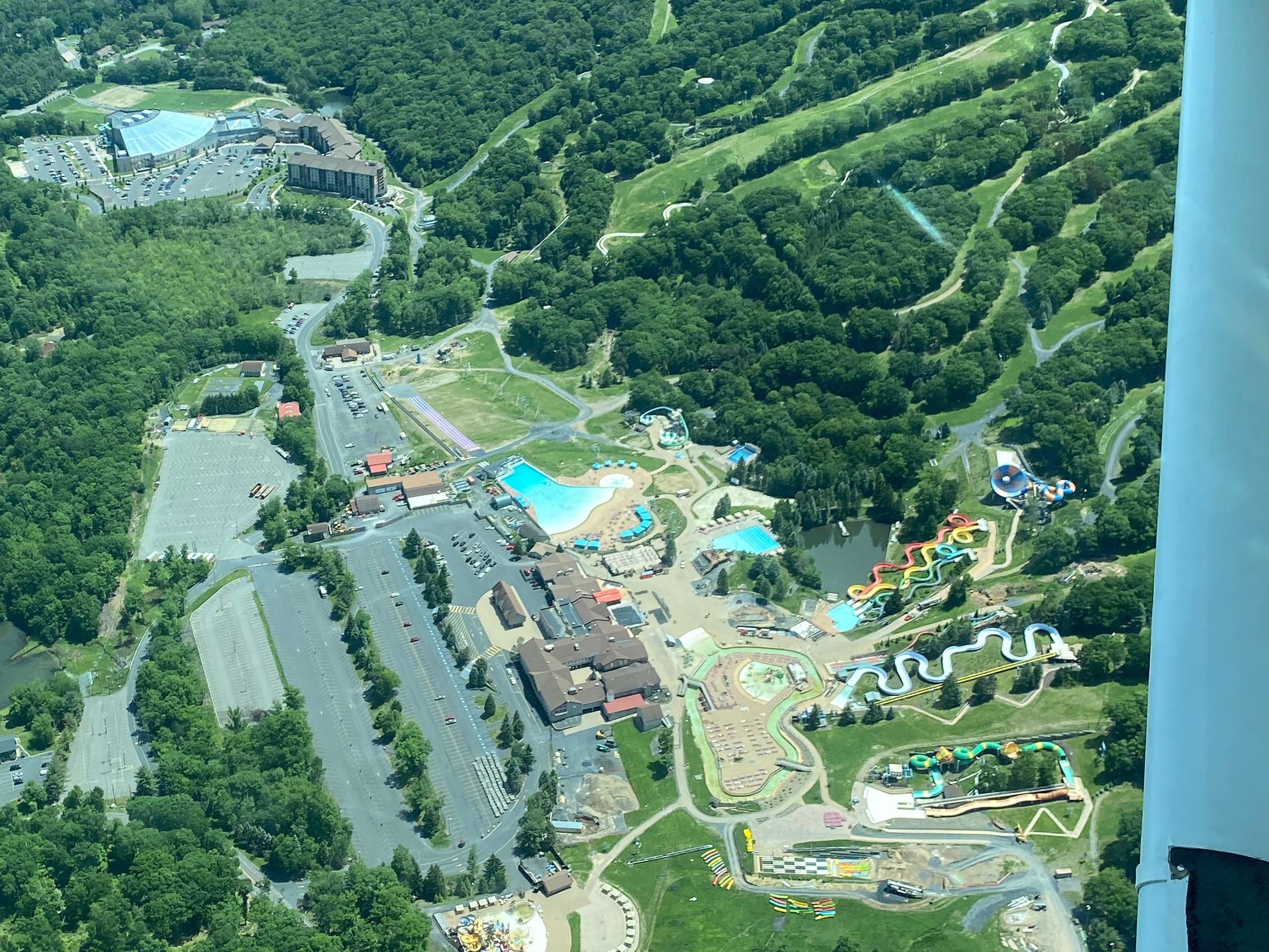
Air Tours in Hope, New Jersey

Hope, New Jersey

From the slow curve above pastoral farmland to a low sweep parallel to the Kittatinny ridgeline, air tours around Hope compress a week of landscape change into forty-five minutes. These small-plane and helicopter flights turn the familiar lines of roads, rivers, and patchwork fields into a stitched map of ridgelines, seasonal color, and water-sheened valleys. The Delaware River cleaves the scene, the Appalachian Trail threads the ridgeline, and on clear days the long arc of the Kittatinny forms a blue-gray spine that feels vast from an altitude that still smells faintly of oil and warm metal. For travelers who want to see the Skylands from above — whether to photograph fall foliage, understand the scale of the river corridor, or pair a gentle thrill with a day of hiking and river paddling — an aerial tour is the most direct way to rewrite perspective.

4
Activities
Spring–Fall (weather dependent)
Best Months

Top Air Tour Trips in Hope

4 trips • Book with confidence • Instant confirmation

Why Air Tours Near Hope Offer a Distinct View

There is a particular kind of clarity that comes from lifting a short distance off the land. Around Hope, New Jersey, the view is not about vertigo; it’s about scale and storytelling — seeing how waterways shape settlement, how ridges funnel storms, and how forests and farms trade territory in seasonal panels. From low-altitude circuits that skim over wheat fields and old stone walls to higher passes that let the Delaware Water Gap unfold like a curetted wound in the landscape, air tours translate geology and human history into an immediate visual language.

Pilots operating in and around Hope work to translate local knowledge into the flight itself: they’ll aim a camera window at a seldom-seen notch in the ridge, linger where a river bend exposes hidden islands, and time climbs for the best light angles. The region’s mix of agricultural valley, folded metamorphic ridges, and linear parkland along the Delaware creates a varied flightline — agricultural mosaics that are most legible in early summer, and ridgelines that erupt into color during autumn. Beyond the scenic spectacle, aerial outings are practical reconnaissance for other outdoor plans. A short flight can show the fluvial pattern that will guide a paddling route or reveal the topography of a multi-day hike on the Appalachian approach trails. That cross-disciplinary value is what makes air tours around Hope appealing: they’re both spectacle and useful orientation for anyone planning to move through the landscape more slowly.

Weather and seasonality are central to the experience. Morning flights on calm, clear days offer the best visibility and the cleanest light for photography; afternoons are more likely to bring thermals and cloud build-up on warm months. Winter flights, when available, strip the map to line and contrast, but cancellations rise with low ceilings and gusty winds. Ultimately, an air tour around Hope is a concentrated lesson in landscape: travel by air and you see both the bedrock story written in ridges and the human footnotes of roads, rail lines, and islands of conserved land.

Air tours provide orientation for other activities — hikers, paddlers, and photographers often book a flight before committing to a river route or a long ridge hike.

Operators usually offer a mix of small-group scenic flights and private charters; choose based on how much control you want over route and timing.

Seasonal color (late September through October) draws the most demand, while spring and early summer showcase the patchwork of farm fields and river islands.

Activity focus: Scenic air tours (small planes, helicopters, sometimes microlight/glider options depending on operator availability)
Number of local listed experiences: 4
Vantage highlights: Delaware River corridor, Kittatinny Ridge, patchwork farmland
Best views on clear, low-humidity mornings; visibility and cloud ceiling matter more than raw temperature
Flights are weather-dependent; expect last-minute changes or cancellations during unsettled conditions

Best Time to Visit

Best Months

AprilMaySeptemberOctober

Weather Notes

Calm mornings with clear skies deliver the best visibility. Spring and autumn offer the most photogenic light; summer brings better lift conditions but also more convective clouds and afternoon gusts. Low ceilings, fog, and high winds commonly force reschedules.

Peak Season

Autumn leaf season (typically late September–October) draws the most demand for scenic flights.

Off-Season Opportunities

Winter can offer stark, high-contrast views and quieter booking windows, but expect a higher likelihood of cancellations and limited daylight hours.

Frequently Asked Questions

Do I need any special permits to take an air tour?

No personal permits are usually required for scenic air tours, but operators manage flight plans and permissions. If a tour includes a private landing or special access, that will be handled by the operator.

How long does a typical scenic flight last?

Lengths vary by operator and itinerary. Scenic options commonly range from short circuits that showcase local highlights to extended hops that pass over the Delaware Water Gap — confirm duration with the operator before booking.

What happens if weather cancels my flight?

Operators typically offer rescheduling or refunds for weather cancellations. Because flights are highly weather-dependent, flexible travel plans are recommended.

Choose Your Experience Level

Beginner

First-time aerial passengers and sightseers. Tours are curated to minimize motion discomfort and maximize scenic viewpoints.

  • Short scenic circuit over local farmland and river bends
  • Introductory helicopter hop with narrated highlights
  • Group small-plane sightseeing flight

Intermediate

Travelers with some aerial experience who want focused photography or specific-route reconnaissance before a hike or paddle.

  • Targeted photographic flight along the Kittatinny ridgeline
  • Flyovers timed for golden hour or leaf color
  • Custom routing to preview river access points

Advanced

Enthusiasts and professionals seeking extended survey flights, private charters, or aerial support for research and mapping.

  • Private charter with flexible routing
  • Survey or mapping-oriented flights coordinated with guides
  • Combined air-and-ground itinerary for multi-day planning

Insider Tips & Local Knowledge

Weather and visibility are the governing factors — flexibility and early booking help.

Book morning flights for the clearest light and calmest air; late-afternoon bookings can deliver dramatic shadows but more turbulence. Ask pilots about seat recommendation: sitting over the wing often reduces motion and vibration, while seats slightly aft of the wing can offer better downward visibility. Bring camera gear in a soft bag for easier handling in confined cockpits, and secure loose straps. If you’re prone to motion sickness, take medication ahead of time and avoid heavy meals immediately before the flight. Coordinate aerial tours with ground activities — a morning flight followed by a riverside paddle or a ridge hike gives a layered perspective of the same landscape. Finally, communicate expectations with the operator about photography priorities, desired landmarks, and tolerance for low-altitude passes so the pilot can tailor the route when conditions permit.

What to Bring

Essential

  • Valid photo ID (carry-on requirement varies by operator)
  • Camera with a fast lens or wide-angle; bring spare memory/cards
  • Warm windbreaker — small planes and helicopters can feel colder aloft
  • Sunglasses and sunscreen for open-cabin reflections
  • Any required medical or motion-sickness medication

Recommended

  • Noise-reducing headphones or ear protection if not provided
  • Binoculars for pre- and post-flight shoreline scanning
  • Light daypack for camera gear and an extra layer
  • Phone with offline maps and the operator’s contact saved

Optional

  • Polarizing filter for photographing water and fall foliage
  • Compact tripod or stabilizer for longer lenses
  • Notebook for jotting pilot notes and landmark names

Ready for Your Air Tour Adventure?

Browse 4 verified trips in Hope with instant booking

Explore Top 15 Hope, New Jersey Adventures →