Skip to main content
Walking the Poudre River Trail in Cache la Poudre River Corridor
Explore the Poudre River Trail in Fort Collins, CO, spanning 21 miles of easy paths along the river. Ideal for walking, biking, and birding, the trail offers serene views and wildlife sightings. Best visited in spring and fall for mild weather and fewer crowds.
Fort Collins
•7.5/10
•Easy
Walking the Poudre River Trail in Cache la Poudre River Corridor
Category
Walking
Typical Duration
10-20 minute
Difficulty
Easy
Photo Gallery
Walking the Poudre River Trail in Cache la Poudre River Corridor - Fort Collins
Walking the Poudre River Trail in Cache la Poudre River Corridor - Fort Collins
Walking the Poudre River Trail in Cache la Poudre River Corridor - Fort Collins
About This Landmark
Walking the Poudre River Trail in Cache la Poudre River Corridor
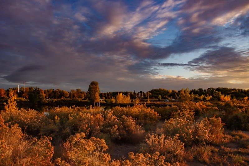
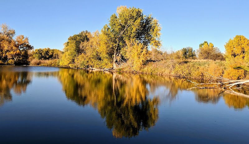
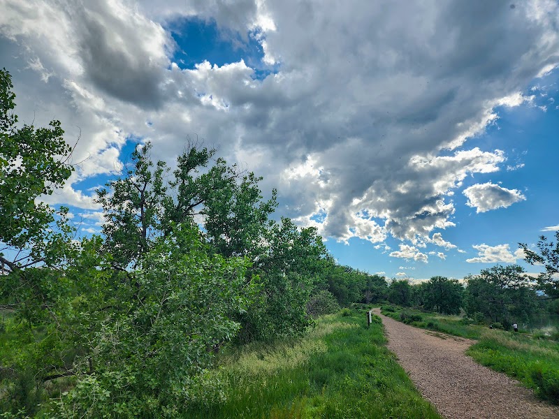
The Poudre River Trail is a premier destination for walking enthusiasts seeking scenic tranquility and an immersive outdoor experience near Fort Collins, Colorado. Stretching over 21 miles, the trail weaves through diverse landscapes, including riparian ecosystems, cottonwood groves, and sweeping plains, offering pristine views of the Cache la Poudre River. This trail stands out for its accessibility, smooth paths, and proximity to wildlife, making it a must-visit for locals and travelers alike.
Adventure Guide to Walking the Poudre River Trail
-
Start at Riverbend Ponds Natural Area
Located near Prospect Road, this segment features serene ponds surrounded by birdlife, including herons and waterfowl. The connecting trails here are ideal for shorter walks, with seating areas to enjoy views of wetlands. For photographers, this spot shines during sunrise with vivid reflections off the water. -
Sights Around Legacy Park
This centrally located stretch in Fort Collins includes well-maintained paths that are both stroller- and wheelchair-friendly. The trail here offers a mix of shaded and open areas, with views of the river’s dynamic flow. Picnic areas and a charming pedestrian bridge make it a great mid-point stop. -
Western End at Lions Open Space
Located near Laporte, the western reach of the trail offers a more rugged experience, with grassy landscapes transitioning into foothills. This area provides glimpses of history, including remnants of the Overland Trail, a historic stagecoach route. Be on the lookout for mule deer grazing along the path.
Local Insights
The trail is a Certified National Recreation Trail and is named after the Cache la Poudre River, which was designated as Colorado’s first National Wild and Scenic River. The name stems from French trappers who hid gunpowder ("poudre") in the area during the 1820s. The trail also plays a role in connecting communities, linking natural areas, parks, and cultural heritage sites.
Visitor Tips
- Best Times: Visit early mornings in spring or fall for cooler weather and fewer crowds.
- What to Bring: Water, sunscreen, sturdy shoes, and binoculars for birdwatching.
- Directions: From Fort Collins, head northwest along Highway 287. Most entry points to the trail are a 10-20 minute drive.
Visitor Tips:
- Best Times: Spring and Fall for cooler temperatures and amazing lighting.
- What to Bring: Water, sunscreen, and a camera!
Ratings
Overall
7.5/10User rating
Photography
7.0/10Scenic value
Featured Activities
Primary Activity
Walking
Also Great For
Biking
Birding
Wildlife Viewing
Essential Information
Nearby City
Fort Collins, Colorado
Protected Areas
Cache la Poudre National Heritage Area, Poudre River Trail Corridor
Experience Level
Easy
Experience Needed: This natural landmark is recommended for those with minimal outdoor experience. Perfect for families and beginners.