Skip to main content

Trekking Through Bishop Pass
Explore the challenging trails of Bishop Pass Trailhead, near Bishop, CA. Renowned for its alpine beauty, this high-altitude trail offers hiking and backpacking opportunities from June to September, with panoramic views and access to fishing. Suitable for adventure seekers.
Bishop Pass Trailhead
•8.8/10
•Hard
Trekking Through Bishop Pass
Category
Hiking
Typical Duration
2-4 hours
Difficulty
Hard
Photo Gallery
Trekking Through Bishop Pass - Bishop Pass Trailhead
Trekking Through Bishop Pass - Bishop Pass Trailhead
Trekking Through Bishop Pass - Bishop Pass Trailhead
About This Landmark
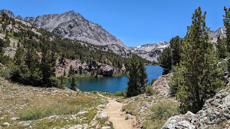
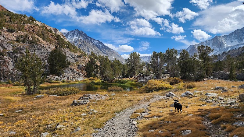
Bishop Pass Trailhead in the Inyo National Forest of California is a spectacular gateway to the Eastern Sierra’s alpine beauty. Located near Bishop, California, this renowned trailhead offers breathtaking views of rugged peaks, shimmering lakes, and diverse flora. It's a key access point to the John Muir Wilderness and Kings Canyon National Park, making it an unmissable experience for nature enthusiasts. The trail provides a unique combination of geological formations and lush meadows, with pine forests framing the crystal-clear waters of the alpine lakes. This trailhead is celebrated for its high-altitude trails that challenge and reward hikers with panoramic views seldom found elsewhere. An interesting cultural nuance: these lands have been revered by the native Paiute people for centuries, adding a layer of historical intrigue to your adventure.
Adventure Guide To Bishop Pass Trailhead
1. Hiking the Bishop Pass Trail
- Location: Bishop Pass Trailhead
- Special Features: Stunning high-altitude trails linked to the legendary John Muir Trail.
- Key Features/Amenities: Multiple alpine lakes and rugged mountain scenery.
- Local Insights: Known for its challenging climbs and serene beauty, this trail is a favorite among seasoned hikers.
- Visitor Tips:
- Best Times to Visit: Late June to September for optimal weather.
- What to Bring: Sturdy hiking boots, layers for changing weather, water, and a trail map.
- Driving Directions: From Bishop, drive west on Highway 168 for about 16 miles, then turn onto South Lake Road. Travel time is approximately 45 minutes.
2. Backpacking Alongside Lakes
- Location: Various alpine lakes accessible from Bishop Pass Trail.
- Special Features: Camping beside pristine lakes like Saddlerock or Long Lake.
- Key Features/Amenities: Spectacular sunsets and ample photography opportunities.
- Local Insights: These lakes are treasure troves for nature lovers and offer peaceful solitude.
- Visitor Tips:
- Best Times to Visit: Mid-summer is ideal for warmer nights.
- What to Bring: Camping gear, fishing rod.
3. Fishing in the High Sierra Lakes
- Location: High Sierra Lakes surrounding the trailhead.
- Special Features: Abundant trout fishing in remote, picturesque lakes.
- Key Features/Amenities: Quiet fishing spots.
- Local Insights: Consider an overnight trip to maximize your experience.
- Visitor Tips:
- Best Times to Visit: Early morning for the best catch.
- What to Bring: Fishing permit, tackle box, sun protection.
Ratings
Overall
8.8/10User rating
Photography
9.0/10Scenic value
Featured Activities
Primary Activity
Hiking
Also Great For
Backpacking
Fishing
Essential Information
Nearby City
Bishop, California
Protected Areas
John Muir Wilderness, Inyo National Forest, Kings Canyon National Park
Experience Level
Hard
Experience Needed: This natural landmark is recommended for those with significant outdoor experience. Best for experienced adventurers.