Skip to main content
Hiking Brins Mesa Trail in Sedona
Explore the 5.0-mile Brins Mesa Trail near Sedona, AZ. Considered a moderate route, it offers stunning red rock views and is popular for hiking and photography, especially during spring and fall.
Brins Mesa Trail
•8.0/10
•Moderate
Hiking Brins Mesa Trail in Sedona
Category
Hiking
Typical Duration
10 minutes
Difficulty
Moderate
Photo Gallery
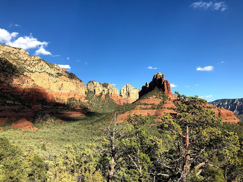
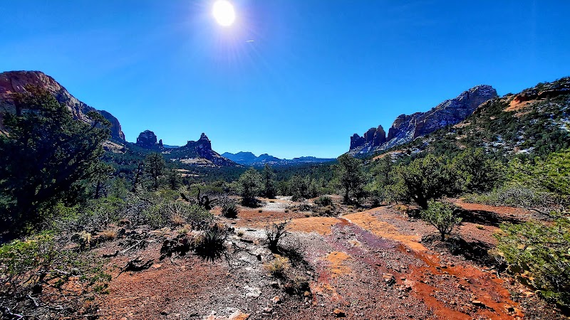
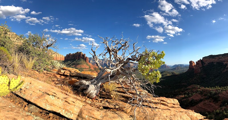
Hiking Brins Mesa Trail in Sedona - Brins Mesa Trail
Hiking Brins Mesa Trail in Sedona - Brins Mesa Trail
Hiking Brins Mesa Trail in Sedona - Brins Mesa Trail
About This Landmark
Hiking Brins Mesa Trail in Sedona
Hiking the Brins Mesa Trail in Sedona offers a unique way to experience the region's striking red rock formations, sweeping vistas, and diverse desert landscape. This trail is popular among outdoor enthusiasts for its moderate difficulty, scenic appeal, and proximity to Sedona’s vibrant downtown. Brins Mesa Trail stands out as an essential hike in the area, offering visitors a glimpse into Sedona’s rich geological history and stunning natural beauty.
Adventure Guide to Hiking Brins Mesa Trail
1. Trail Details and Route:
The Brins Mesa Trail is approximately 5.0 miles round trip if hikers go out and back. Starting at the Jordan Road Trailhead, it climbs steadily toward the mesa, offering panoramic views of Sedona’s iconic red rock landmarks such as Wilson Mountain, Capitol Butte, and the Cockscomb formation. The trail’s gradual ascent makes it accessible for hikers of varying skill levels, though sturdy footwear is advised due to rocky terrain.
2. What Makes It Special:
The trail’s defining feature is the stunning view from the top of Brins Mesa. Once you reach the mesa, the landscape opens up to vast, unobstructed views ideal for photography or quiet reflection. Wildflowers are abundant in spring, while fall brings a kaleidoscope of colors from surrounding oak and juniper trees. The hike also provides potential connections to other trails like the Soldier Pass Trail or Cibola Pass, making it a perfect gateway for extended adventures.
3. Key Features and Wildlife:
Brins Mesa Trail also reveals scars from the historic Brins Fire of 2006, offering a fascinating look at how the landscape has regenerated. Keep an eye out for local wildlife, including mule deer, jackrabbits, and various bird species like red-tailed hawks.
Local Insights
The Brins Fire significantly shaped the area, and remnants are still visible along the trail. Locals often hike this trail at sunrise or sunset to enjoy cooler temperatures and golden light that accentuates the red rocks.
Visitor Tips
- Best Times to Visit: Early morning or late afternoon avoids midday heat.
- What to Bring: At least 1 liter of water, sunscreen, comfortable hiking shoes, and snacks.
- Driving Directions: From Sedona’s downtown, take Jordan Road north to the Jordan Road Trailhead (about 10 minutes’ drive). Limited parking is available, so arriving early is recommended.
Visitor Tips:
- Best Times: Spring and Fall for cooler temperatures and amazing lighting.
- What to Bring: Water, sunscreen, and a camera!
Ratings
Overall
8.0/10User rating
Photography
8.0/10Scenic value
Featured Activities
Primary Activity
Hiking
Also Great For
Photography
Wildlife Viewing
Essential Information
Nearby City
Sedona, Arizona
Protected Areas
Coconino National Forest
Experience Level
Moderate
Experience Needed: This natural landmark is recommended for those with some outdoor experience. Good for regular hikers.