About this landmark
At Milepost 240 on the Blue Ridge Parkway
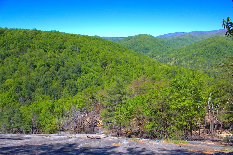
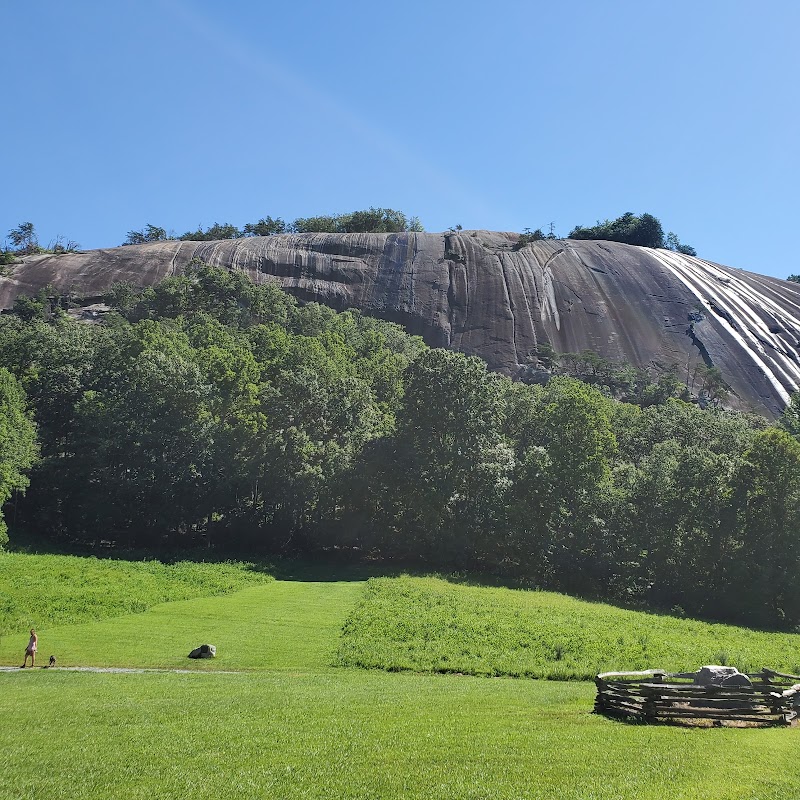
Doughton Recreation Area sits along the Blue Ridge Parkway near Traphill and is organized around a long ridgeline route and a handful of named descents. The Bluff Mountain Trail runs roughly 7.5 miles across a mix of high mountain meadows and hemlock forest, and the primary source describes a sharp escarpment adjacent to the ridge with a drop of nearly 2,000 feet; from the ridge several trails run down the escarpment at varying grades and lengths.
That network—Bluff Mountain Trail as the spine, Grassy Gap Fire Road and three other descent trails as the spokes—creates a modular system of outings. Hikers and trail runners can prioritize steady ridgeline mileage, select a long old roadbed descent, or choose a short, steep primitive cut that trades time for intensity. The Basin Creek corridor and the small Caudill Cabin lie below the ridge and invite extensions that change the trip’s character from ridge-focused to creekside exploration.
This feature explains how the named pieces fit together on the ground, what each descent feels like, how Basin Creek alters route choices, and which travelers should plan which combination of trail legs.
How the ridge and the road meet
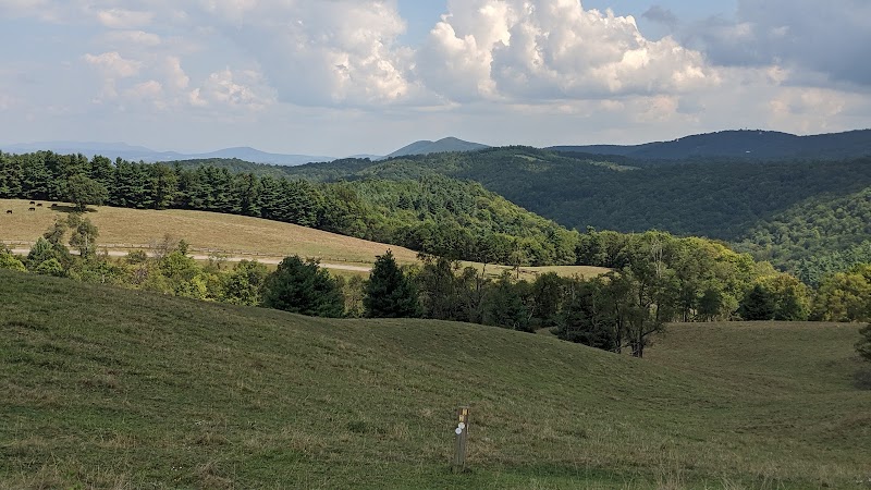
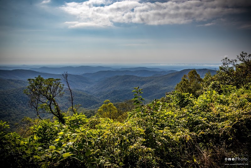
Doughton is inseparable from the Blue Ridge Parkway setting described in the source: the Bluff Mountain Trail follows a high ridgeline that crosses open balds and forested stretches while offering repeated exposure toward the parkway escarpment. The source locates the primary access at Milepost 240, which organizes where hikers start and where several parking areas and trailheads are sited along the parkway.
For planning, that means the outing often begins with a deliberate highway stop rather than a remote trailhead drive. The ridge functions as both the scenic stage and the logistical backbone—the ridgeline walk gives options to string together shorter segments or to commit to a longer passage that ends via one of the descents.
Bluff Mountain Trail: long, open, repeatable
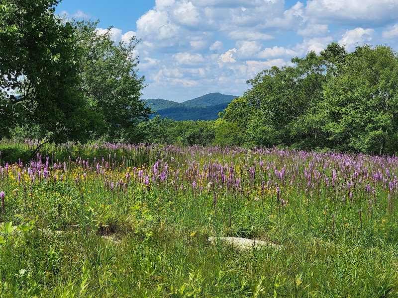
Bluff Mountain Trail is the organizing feature at 7.5 miles. The trail traverses exposed mountain meadows and sections of hemlock forest; the source emphasizes the sequence of landscapes rather than a single vantage point, which makes repeated short out-and-backs or longer through-runs equally viable.
Because the ridge can be run as a continuous traverse or used to access multiple descent options, travelers should think of the Bluff Mountain route as a durable piece of mileage that can be tuned for pace and effort. Recent visitor reports describing wide-ranging views and plentiful wildflowers align with the source’s depiction of open meadow sections along the ridge.
Choosing a way down the escarpment
Four named trails descend from the ridge to the lower valley and change the outing’s grade dramatically. The source lists Grassy Gap Fire Road (6.5 miles) as the gentlest, following an old roadbed; Flat Rock Ridge (5 miles) and Cedar Ridge (4.4 miles) offer intermediate options; and Bluff Ridge Primitive Trail (2.8 miles) is the steep, fast connector that demands careful foot placement on the way up.
These options let visitors dial the effort and technical exposure. A common short circuit described in the source begins at the Bluff Mountain parking area, runs about 2.5 miles south on the ridge, connects to Grassy Gap and drops roughly five miles to the primitive campsite, then climbs 2.8 miles back—an example of how the descent choice defines both distance and difficulty for the loop.
Basin Creek and the Caudill Cabin
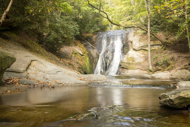
Below the ridge the Basin Creek corridor offers a different texture: creekside walking, remnants of former community structures and a small cabin identified in the source as the Caudill Cabin. The source describes a roughly 3.3-mile approach up Basin Creek to the cabin from the lower network, which turns a ridge-focused day into a valley approach with waterfalls and cultural remains.
Including Basin Creek in a route changes the outing’s narrative—what begins as a ridge run becomes a return through historical landscape fragments. One supplied visitor review recounts reaching relic features such as an old mill stone along Basin Creek, and another notes a visitor center presence that can add interpretive context before or after creekside travel.
Who this network rewards—and who should plan elsewhere
The configuration rewards people who want modular mileage and who can manage either steady ridge mileage or steep elevation change on the descents. Trail runners chasing long, sustained ridge running will find the Bluff Mountain spine especially useful; hikers who prefer creekside walking and historical context will prefer routing through Basin Creek to the Caudill Cabin.
Travelers who require substantial infrastructure or who prefer short, flat loops with frequent facilities should note that the feature set is a trail system rather than a developed day-use complex. Recent visitor feedback highlights picnic areas and scattered restrooms, but the fundamental offering remains a network of trails that require the usual backcountry preparation for remote or lengthy legs.
A system of routes more than a single trail
Doughton Recreation Area’s value comes from the way its ridge and descent trails combine: Bluff Mountain Trail gives a long, repeatable backbone while the named descents and the Basin Creek approach allow hikers and runners to scale effort, distance and scenery. That modular structure suits those who want to construct their own outing rather than follow a single marquee viewpoint.
Plan around the spine—choose your descent to match fitness and objective—and you will leave understanding what the source means by Doughton’s character: a compact, configurable mountain landscape that rewards route thinking as much as individual vistas.
Adventure Guide
Which route at Doughton Recreation Area is best for you?
Pick the option that matches your fitness, interest in historical creekside features, and appetite for steep descents.
| Option | Best For | Emphasis |
|---|---|---|
| Short ridge-and-descent loop (Bluff Mountain + Grassy Gap) | Trail runners and seasoned hikers wanting a contained loop with steady grades | Sustained ridgeline mileage followed by a long old-road descent and a demanding climb back |
| Basin Creek extension to Caudill Cabin | Hikers interested in creekside features and cultural remnants | Include a roughly 3.3-mile valley approach to visit the Caudill Cabin and see mills and waterfalls along Basin Creek |
| Fast up-and-down (Bluff Ridge Primitive) | Strong, technical runners or hikers who prefer short, steep ascents and descents | Short connector that trades time for intensity—expect steep, primitive trail conditions |
Planning essentials
- Access & trailheads: Primary access is on the Blue Ridge Parkway at or near Milepost 240; parking areas provide entry to Bluff Mountain Trail and adjacent connectors.
- Trail selection & difficulty: Bluff Mountain Trail (7.5 mi) is the long ridge spine; Grassy Gap Fire Road is the gentlest descent (6.5 mi), while Bluff Ridge Primitive Trail is the steepest (2.8 mi). Choose descents to match your endurance and footing skills.
- Camping & overnight: The source identifies a primitive campsite reached from the lower network below the ridge; treat this as minimally developed and plan accordingly.
- Visitor services & contemporary reports: Recent visitors report a staffed visitor presence and interpretive displays, a passport stamp at the visitor center, and that park staff or volunteers had cleared fallen trees on trails after storms in observations shared by visitors.
Directions & Logistics: Access from the Blue Ridge Parkway at Milepost 240; start on Bluff Mountain Trail for ridge mileage and choose one of the named descents to descend into the lower network or Basin Creek.
Frequently Asked Questions
Q: How long is the Bluff Mountain Trail?
The primary source lists Bluff Mountain Trail at 7.5 miles across the ridge.
Q: What descent options lead off the ridge and how do they differ?
The source names four descents: Grassy Gap Fire Road (6.5 miles; follows an old roadbed and is the most moderate), Flat Rock Ridge (5 miles), Cedar Ridge (4.4 miles), and Bluff Ridge Primitive Trail (2.8 miles; the steepest). Choose based on desired distance and grade.
Q: Can I visit the Caudill Cabin from the trail network?
Yes; the source describes an approach up Basin Creek of about 3.3 miles to the Caudill Cabin from the lower trails, turning a ridge outing into a creekside excursion.
Q: Are trail conditions maintained after storms?
One recent visitor reported that park staff or volunteers had cleared fallen trees and that the trails they used had zero blockages; condition can vary, so check recent reports before visiting.
Adventure Guide
Which route at Doughton Recreation Area is best for you?
Pick the option that matches your fitness, interest in historical creekside features, and appetite for steep descents.
| Option | Best For | Emphasis |
|---|---|---|
| Short ridge-and-descent loop (Bluff Mountain + Grassy Gap) | Trail runners and seasoned hikers wanting a contained loop with steady grades | Sustained ridgeline mileage followed by a long old-road descent and a demanding climb back |
| Basin Creek extension to Caudill Cabin | Hikers interested in creekside features and cultural remnants | Include a roughly 3.3-mile valley approach to visit the Caudill Cabin and see mills and waterfalls along Basin Creek |
| Fast up-and-down (Bluff Ridge Primitive) | Strong, technical runners or hikers who prefer short, steep ascents and descents | Short connector that trades time for intensity—expect steep, primitive trail conditions |
Planning essentials
- Access & trailheads: Primary access is on the Blue Ridge Parkway at or near Milepost 240; parking areas provide entry to Bluff Mountain Trail and adjacent connectors.
- Trail selection & difficulty: Bluff Mountain Trail (7.5 mi) is the long ridge spine; Grassy Gap Fire Road is the gentlest descent (6.5 mi), while Bluff Ridge Primitive Trail is the steepest (2.8 mi). Choose descents to match your endurance and footing skills.
- Camping & overnight: The source identifies a primitive campsite reached from the lower network below the ridge; treat this as minimally developed and plan accordingly.
- Visitor services & contemporary reports: Recent visitors report a staffed visitor presence and interpretive displays, a passport stamp at the visitor center, and that park staff or volunteers had cleared fallen trees on trails after storms in observations shared by visitors.
Directions & Logistics: Access from the Blue Ridge Parkway at Milepost 240; start on Bluff Mountain Trail for ridge mileage and choose one of the named descents to descend into the lower network or Basin Creek.
Frequently Asked Questions
Q: How long is the Bluff Mountain Trail?
The primary source lists Bluff Mountain Trail at 7.5 miles across the ridge.
Q: What descent options lead off the ridge and how do they differ?
The source names four descents: Grassy Gap Fire Road (6.5 miles; follows an old roadbed and is the most moderate), Flat Rock Ridge (5 miles), Cedar Ridge (4.4 miles), and Bluff Ridge Primitive Trail (2.8 miles; the steepest). Choose based on desired distance and grade.
Q: Can I visit the Caudill Cabin from the trail network?
Yes; the source describes an approach up Basin Creek of about 3.3 miles to the Caudill Cabin from the lower trails, turning a ridge outing into a creekside excursion.
Q: Are trail conditions maintained after storms?
One recent visitor reported that park staff or volunteers had cleared fallen trees and that the trails they used had zero blockages; condition can vary, so check recent reports before visiting.
Visitor Tips
- Best Times:Spring and Fall for favorable conditions and optimal lighting.
- What to Bring:Plenty of water, sun protection, a camera, and respectful Leave-No-Trace mindset.