
What the day feels like
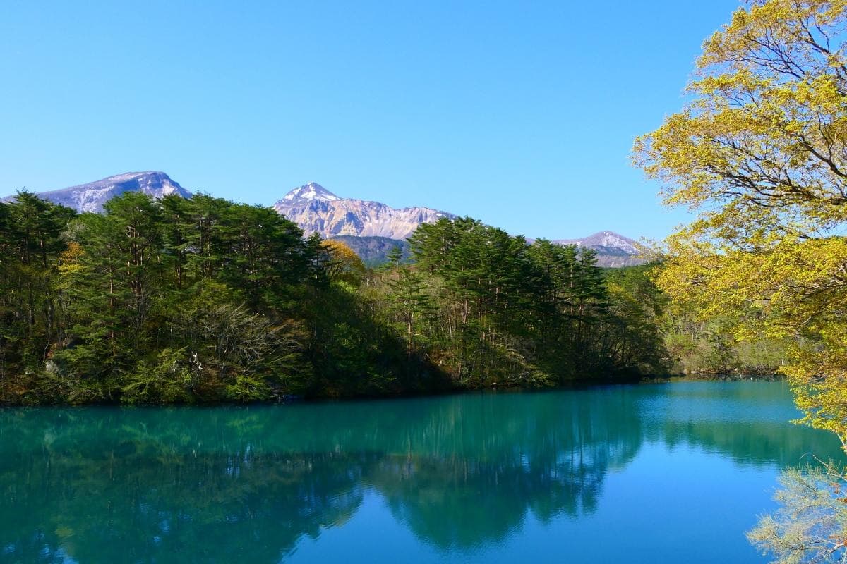
You step out of the low clouds into a rim of blue-green water and a silence that feels deliberate. The world here—pocked with crater lakes, serrated ridgelines and mushrooming stands of beech—remembers an eruption. Bandai-Asahi National Park in Japan is a place where geology reads like a recent memory: rocks still arranging themselves, ponds still catching the light of a shifting sky. On a damp morning the Goshikinuma—the 'five-colored ponds'—flash from turquoise to indigo as if some painter is still choosing pigments. In the distance, the shoulders of Mount Bandai rise, a dark cone where steam and the weather tussle.
There’s no mistaking why hikers and nature lovers are drawn here. The park is an exercise in contrasts. Lowland wetlands give way to alpine fields; crater rims open onto mirror-flat lakes. Vegetation ranges from moist alder and bamboo in stream valleys to wind-battered dwarf pines near the summit. Animals move through the seams: sika deer appear like bronze ghosts at dusk, macaques raid berry bushes, and the occasional eagle rides the thermals above the ridgelines.
Mount Bandai’s eruption in 1888 is the defining event. The blast rearranged topography, damming rivers and creating the lakes that now sit like gemstones across the Urabandai area. The human story folded into that geology: nearby towns rebuilt, farmers redirected irrigation, and new trails followed the lines of lava and landslide. Today, small onsen towns and farmsteads cling to the park’s edges, offering hot baths and hearty bowls of soba to warm wet hikers.
The park is not a single outing but a multi-textured set of experiences. Short walks to observation decks and the easy circuits around the Goshikinuma ponds give quick payoffs—ideal when weather is changeable. For a fuller immersion, the full-day ascent to Mount Bandai’s summit (1,819 meters) is straightforward but sustained: expect steep sections, loose volcanic scree, and rewards in ridge views that look across Lake Inawashiro to distant ranges. In winter, the park flips character; deep snow covers the meadows and backcountry ski and snowshoe routes open where months earlier flowers carpet the plateaus.
What makes a trip here elegant is the balance between wildness and accessibility. Trails are generally well-marked, lodgings—often modest ryokan or pension-style inns—are a short drive from trailheads, and public transport plugs into towns like Inawashiro. Still, the landscape can feel primary: unpredictable weather, fragile bogs and steep volcanic scree require respect.
Practical notes lean on preparation. There are routes for every fitness level, but cell coverage can be patchy and weather moves fast—carry waterproof layers, start hikes early, and bring navigation aids. In summer, the ponds are brilliant cleansed blues; in autumn, the mountain’s slopes go from green to raw orange in a span of weeks. Conservation is visible; boardwalks protect bogs and signage asks walkers to stay on trails to preserve delicate post-eruption soils.
For photographers and slow walkers the park is a masterclass. Morning low-light lifts color in the ponds; cloud inversions top ridges; and reflections on still waters give a compositional clarity that’s rare. Eat locally: the area’s sake and mountain vegetables are honest and restorative after a long day of trail. And end any day with an onsen soak—an old ritual of warmth and repair that suits the volcanic birthplace of the place.
Bandai-Asahi rewards patience: a pond that looked ordinary on first pass will reveal a ring of new-growth moss at second glance; a tolerable slope may deliver a clearing with a postcard of a lake you didn’t know existed. For travelers who want hiking with geological narrative—and the kind of scenes that keep you walking until light runs out—this park delivers a compact but deep taste of Japan’s mountain soul.
Trail wisdom
Small choices, better day.
Start early for calm ponds and clearer views
Morning air reduces wind chop on the lakes and cuts the chance of cloud obscuring ridge vistas—aim to be on trail by sunrise for the best light.
Bring layered rain protection
Weather changes quickly at altitude; a waterproof shell and insulating mid-layer keep you comfortable across warm valleys and cool summits.
Respect boardwalks and fragile bogs
Many ponds and wetlands were formed by the 1888 eruption—staying on marked paths preserves rare vegetation and prevents erosion.
Carry bear-aware noise makers in summer
Japanese black bears inhabit parts of Tohoku—make noise on thicker trails and store food securely at campsites.
Local knowledge
Read the place, not just the route.
Watch for native species including Sika deer, Japanese macaque.
Keep an eye out for wildlife during the transition between areas and habitats. Respect distance guidelines.
The park balances public access with fragile post-eruption ecosystems—stick to boardwalks, follow campsite rules and use refillable containers to reduce waste.
Follow the guide's instructions on size limits, ethical handling, and leave-no-trace practices.
Azuma-Kofuji crater rim - a perfect conical volcano walk with broad views. Early-morning Goshikinuma ponds before buses arrive
Locally recommended viewpoints and quiet spots known best to local operators.
Mount Bandai’s 1888 eruption reshaped the landscape, creating many of the ponds and lakes that define the Urabandai area today.
Maritime roots and regional tradition shape the waterways and working coasts.
Seasonal guide
Four versions of the same landscape.
Spring
Best forWildflowers and fresh green foliage · Quieter trails before peak season
ChallengesPatchy snow at higher elevations · Mud and soggy boardwalks from melt
Late spring brings alpine blossoms and thawing ponds; expect muddy approaches and lingering snow above treeline.
Summer
Best forFull access to trails and ponds · Cool mountain respite from lowland heat
ChallengesAfternoon storms · Crowds on popular short circuits
Warm valley days can flip to rain by afternoon—plan hikes for the morning and expect vivid pond colors.
Fall
Best forPeak autumn foliage · Crisp visibility and long golden hours
ChallengesShorter daylight hours · Weekend crowds during peak color
Autumn is the standout season—brilliant leaves and clear vistas make this the optimal time for summit and ridge hikes.
Winter
Best forSnowshoeing and backcountry skiing · Quiet, ethereal snowscapes
ChallengesDeep snow and avalanche risk · Limited access to some trailheads
Winter turns the park into a silent white landscape; technical skills and avalanche awareness are essential for venturing off groomed corridors.
Pack with intention
What to bring.
Good to know
Common questions.
Take the Tohoku Shinkansen to Fukushima or Koriyama, then regional trains or buses toward Inawashiro; local buses or rental cars connect to Urabandai trailheads.
Plan the edges
The details that make the day easier.
Mount Bandai’s 1888 eruption created Lake Hibara and many of the Goshikinuma ponds, permanently changing local drainage and creating the vivid crater lakes seen today.
Pair hikes with local sake and mountain vegetable dishes at family-run inns; finish days with a hot onsen soak—a regional ritual tied to the park’s volcanic roots.
- Nearest hub
- Inawashiro; main activities: pond circuits, summit hikes, winter snow travel; permit: generally none for day hikes; cell coverage: patchy; languages: limited English—basic Japanese phrases help.
Stick to trails and boardwalks, pack out all trash, use refillable bottles, and choose established campsites to protect fragile post-eruption soils and rare bog flora.
Explore by topic
Follow the threads.
Keep exploring
Make the story part of the trip.
Set out from Bass Harbor for a private, customizable day on Blue Hill Bay — lighthouses, puffins, seals, and the chance to feel Acadia from the water. Small groups, local captains, unforgettable views.
In four hours you can move from shaded canyon ferns to wind-scoured coastal ridgelines, guided by someone who knows where the light—and the hidden views—live. This private half-day hike on the Monterey Peninsula or Big Sur is compact, curated, and perfect for travelers who want depth without a multiday commitment.
 Related story
Beneath a sky of shifting light, Skaftafell’s ice reads like a map of time. This three-hour guided glacier hike mixes technical instruction with geology and culture: compact, safe, and unforgettable.