
What the day feels like
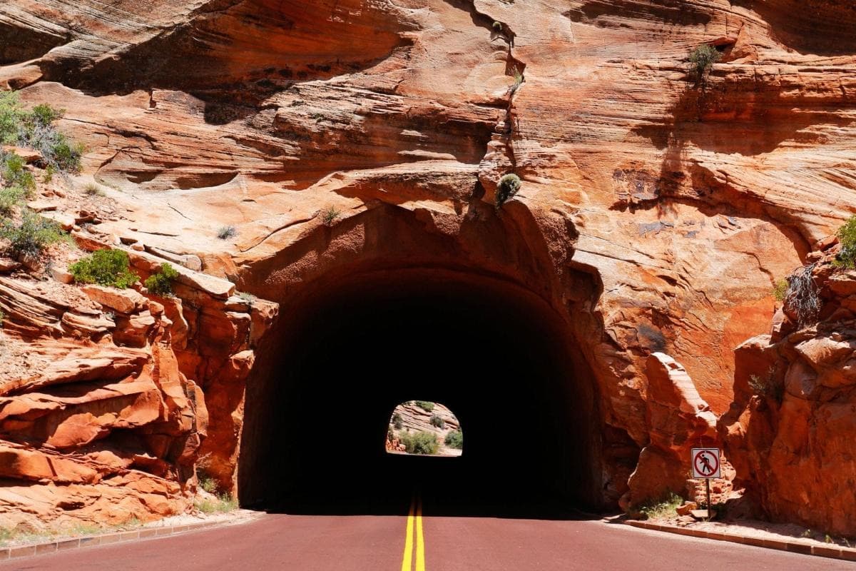
You arrive at dawn when the desert is still cool and the sandstone seems to inhale the first light. The road that climbs out of Zion Canyon becomes a ribbon of asphalt cut into ochre cliffs; then, without fanfare, it disappears into a mouth of dark rock. For a minute you stand with your hand on the hood, listening to the cars behind you—a string of tires and engine notes that will become a metronome in the tunnel’s belly. When you drive in, the world narrows to a cone of headlight and masonry. The Zion–Mt. Carmel Tunnel is a passage not only through the mountain but through time: carved at the edge of the 20th century, it still conducts visitors from one kind of southern Utah landscape to another—slot canyons and sheer cliffs giving way to undulating, juniper-scattered plateaus.
The tunnel is, by measure, straightforward—roughly 1.1 miles long—but its impression is large. Light pockets punched into the rock along the way were intentionally left to reveal views and to ventilate; in places, the interior is ringed with the same banded Navajo sandstone that defines Zion. Outside, Checkerboard Mesa sits to the east like a geological record, its square-checked weathering a clear example of cross-bedded sandstone. Together, these features tell the story of an ancient desert of dunes turned to stone and later sculpted by wind and water.
The tunnel’s human story is as compelling as the rock. Constructed between 1927 and 1930 as part of a push to open remote parts of Zion National Park, the tunnel was an engineering feat for its era—hand-drilled, dynamited and dressed by crews who worked in precarious ledges and shifting stone. Its completion helped transform access to the park, enabling the motor age to bring visitors to viewpoints once reached only by mule or foot.
But the tunnel is not merely a conduit. It’s a gateway. When you emerge at the east portal you’re on Zion–Mount Carmel Highway, a scenic drive that trades the narrow clefts of the main canyon for wide vistas and pinyon-dotted benches. Stop at the pullouts to photograph Checkerboard Mesa or hike the short, exposed Canyon Overlook Trail—just a mile round trip with roughly 150–200 feet of gain—for one of the most immediate, panoramic views of Zion Canyon. The contrast is part of the experience: one moment you are hemmed in by vertical walls, the next you’re surveying the canyon like a cartographer.
Travelers come for different reasons. Photographers arrive at golden hour to silhouette the tunnel mouth against sunrise; drivers relish the engineered intimacy of a car threading a 1.1-mile rock tube; families use the route to reach quieter trailheads on the park’s east side. For hikers, the tunnel is a smart piece of logistics. It will shave time off access to trails that loop onto the East Rim and to the less-visited alcoves and ridgelines that reward those looking for solitude and sky.
Practicality matters here. The tunnel operates within rules set by the National Park Service: there are size restrictions, and vehicles that exceed the posted dimensions must be escorted through the tunnel—an often overlooked detail that’s essential if you’re renting an RV, towing a trailer, or driving a large van. Unlike Zion Canyon’s shuttle-dependent main canyon, the Mount Carmel Road is open to private vehicles year-round (weather permitting), but conditions can change quickly: freeze–thaw cycles can wind up snow on the east side in winter, while summer storms can bring brief but intense showers.
What to prepare for, practically: keep your tank at least half full—there are no fuel stations inside the park; bring a basic first-aid kit and layers for temperature swings between canyon floor and plateau; secure any loose items before driving through the tunnel so the car’s echo doesn’t become a distraction. For photographers, a polarizer will deepen the blue of the sky and cut glare on sandstone; for hikers, a pair of trail shoes with good traction and sun protection will go further than you expect.
If you want to build a day around the tunnel: pair it with an early walk in Zion Canyon (Angels Landing or the Riverside Walk, depending on permitting and comfort), then drive the Mount Carmel Highway through the tunnel and hike Canyon Overlook for a new perspective. Alternatively, use the tunnel as a transition on a multi-day circuit that takes you to the remote East Rim trails where the crowds thin and the views stretch farther.
The tunnel’s appeal is pragmatic and elemental; it asks little more than curiosity and respect. Drive slowly, pause at the overlooks, and remember that this engineered cut through stone sits within a broader cultural landscape—traditional Southern Paiute lands and a modern national park grappling with visitation pressures. Leave no trace, follow posted guidelines, and you'll find the tunnel to be more than a route: it’s a corridor that compresses Utah’s layered geology and human history into a few minutes of motion—and then, just as quickly, opens you into a new sky.
Trail wisdom
Small choices, better day.
Check vehicle restrictions
Oversized vehicles require an escort through the tunnel—confirm dimensions and scheduling with the park before you go.
Time it for light
Drive the tunnel at golden hour for the best exterior light and fewer mid-day crowds at overlooks.
Short hike add-on
Pair the drive with the Canyon Overlook Trail (≈1 mile round trip, ~150–200 ft gain) for immediate panoramic views.
Secure gear before entry
Stow loose items and close windows—the tunnel amplifies noise and wind that can unsettle unsecured gear.
Local knowledge
Read the place, not just the route.
Watch for native species including Desert bighorn sheep, Mule deer.
Keep an eye out for wildlife during the transition between areas and habitats. Respect distance guidelines.
High visitation has prompted management measures—increase in shuttle use, parking limits, and educational outreach—so practice Leave No Trace and follow park guidance.
Follow the guide's instructions on size limits, ethical handling, and leave-no-trace practices.
Canyon Overlook Trail—short, dramatic viewpoint just east of the tunnel portal. Checkerboard Mesa pullouts—excellent for late-afternoon light and geological study
Locally recommended viewpoints and quiet spots known best to local operators.
The tunnel was constructed between 1927 and 1930 to connect Zion Canyon with the eastern plateaus, opening new access for motorists and visitors.
Maritime roots and regional tradition shape the waterways and working coasts.
Seasonal guide
Four versions of the same landscape.
Spring
Best forwildflower contrasts on the plateau · comfortable daytime driving · photography of thawing crevices
Challengesvariable spring storms · possible late snow at higher elevations
Spring brings milder temperatures and blooming shrubs on the east side, but be prepared for sudden weather swings that can make roads slick.
Summer
Best forlong daylight for exploration · pairing with cooler morning hikes · stargazing after sunset
Challengesheat on exposed overlooks · monsoon-driven afternoon storms
Summer offers full access and long days; travel early to avoid heat and afternoon thunderstorms that can roll in quickly.
Fall
Best forcrisp air and clear vistas · fewer crowds · photography with warm tones
Challengescooler nights · shorter daylight hours
Fall is optimal for visibility and color contrasts—expect cooler mornings and pleasant daytime temperatures for hikes and drives.
Winter
Best forsnow-dusted sandstone scenes · solitude on trails · dramatic low-angle light
Challengesicy patches on roads and overlooks · possible temporary closures after storms
Winter delivers striking contrasts but requires caution—check road conditions and pack traction for icy pullouts.
Pack with intention
What to bring.
Good to know
Common questions.
The tunnel is approximately 1.1 miles (about 1.8 kilometers) long from portal to portal.
Plan the edges
The details that make the day easier.
The Zion–Mt. Carmel Tunnel was completed in 1930 and is approximately 1.1 miles long—an engineering milestone that significantly improved access to Zion's eastern plateaus.
Springdale, the gateway town, blends canyon-side cafés and Southwestern flavors—local eateries and galleries reflect the area’s outdoor culture; recognize the park sits on traditional Southern Paiute lands.
- Length
- ~1.1 miles; Access: Zion–Mt. Carmel Highway; Fees: Zion NP entrance fee applies; Vehicle rules: size
- escort requirements for oversized vehicles; Best time
- early morning or late afternoon; Facilities: limited on-road services—plan ahead.
Stick to pullouts and designated viewpoints, pack out all trash, avoid disturbing native vegetation, and use established parking to minimize erosion and habitat impact.
Explore by topic
Follow the threads.
Keep exploring
Make the story part of the trip.
Set out from Bass Harbor for a private, customizable day on Blue Hill Bay — lighthouses, puffins, seals, and the chance to feel Acadia from the water. Small groups, local captains, unforgettable views.
In four hours you can move from shaded canyon ferns to wind-scoured coastal ridgelines, guided by someone who knows where the light—and the hidden views—live. This private half-day hike on the Monterey Peninsula or Big Sur is compact, curated, and perfect for travelers who want depth without a multiday commitment.
 Related story
Beneath a sky of shifting light, Skaftafell’s ice reads like a map of time. This three-hour guided glacier hike mixes technical instruction with geology and culture: compact, safe, and unforgettable.