
What the day feels like
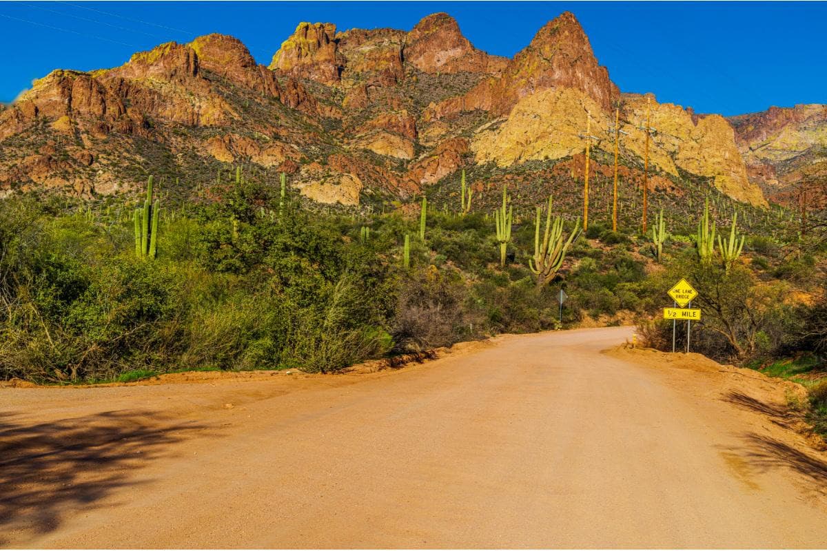
You start before dawn, the city’s orange glow shrinking in the rearview as the freeway peels away and the air thins into a bigger, brighter sky. For the next hour the landscape is patient and spare: saguaro arms lift like sentinels, creosote smells faintly of rain, and distant cliffs begin to stitch themselves into volcanic profiles. The Apache Trail is not a single summit or a single trail — it is a corridor of stories carved through the Sonoran Desert, a road that composes its own kind of wilderness and rewards the traveler who slows down.
By midmorning you are threading the narrow ribbon of State Route 88, the original access road to the Roosevelt Dam. The switchbacks hug faces of rhyolite and basalt; the cliffs here look like stacked lithographs — reds, browns, charcoal — their layered angles hinting at a violent volcanic past. Where the road narrows to one lane, the canyon seems to breathe, its walls leaning in. There's a reason this road was built in the first place: to haul men, tools and dynamite to the great engineering project that tamed the Salt River in the early 20th century.
The human history overlays the geology. Superstition Mountain looms to the south, a jagged fortress of volcanic rock and lore. Apache scouts and stagecoaches used these corridors long before crews arrived to carve the trail to Roosevelt Dam. Then there are the legends: the Lost Dutchman's Mine, whispered prospectors, and the tiny, stubborn community at Tortilla Flat — a former stage stop that still has a population measured in the single digits and a collection of photos pinned to the walls of its cafe like a living museum.
This stretch of Arizona is also a living habitat. Watch for desert bighorn sheep balancing on ledges; bald eagles that stoop and ride thermals over Canyon Lake; coyotes that call at dusk; and the low, fossilized shapes of ocotillo that prick the skyline. The Apache Trail toggles between hard, wide-open desert and intimate canyon — and it’s precisely the contrast that makes the day trip feel like several trips in one.
The most convenient way to see it without fretting about the gravel and switchbacks is to join a guided tour. Small-group options keep the experience efficient — a comfortable van that threads the road while a guide unfurls the history and the geology, and stops where you want to stretch your legs. Across the options, a core sequence emerges: leave Phoenix, wind past the Superstition Mountains, pause at Goldfield Ghost Town for a slice of staged Wild West, meander into Tortilla Flat for a cup of strong coffee and local kitsch, then descend to Canyon Lake.
Canyon Lake is where the road’s desert mood softens. Here the Dolly Steamboat cuts a deliberate line across the water on a narrated 90-minute cruise. The boat threads a slot canyon, allowing passengers to see sheer cliffs tumble to the water and to scan gullies for nesting raptors. The combination of canyon geology, cool water, and the crackle of guide narration gives the place an almost theatrical change of scene — an essential contrast to the parched miles you’ve just traveled.
For those who want to push from a scenic drive into a proper hike, the Superstition Mountains offer routes for a range of abilities. A guided hike can translate local lore into safe steps: where to look for rare desert plants, how the rock tells of ash flows and intrusions, and where Lost Dutchman tales once intersected with human ambition. Photography-focused tours also run here: desert light at sunrise and late afternoon refracts differently on volcanic faces than it does in alpine ranges, and your guide will point you toward the best exposures and compositions.
Practicalities matter on the Apache Trail. Parts of the road are unpaved, narrow, and uncompromising; high-clearance vehicles are recommended for self-drivers, and cell service is spotty. Water is not optional — carry at least a liter per person for short outings and more if you plan to hike. Temperatures swing wildly: summer can scorch, and desert nights grow cold outside the tourist-season months. Touring with a licensed guide removes a lot of the logistical angst: they handle the driving, offer local knowledge, and time visits to avoid crowds and heat.
The Apache Trail is not a show staged only for visitors — it’s a lived landscape. Local guides are often long-term residents who understand the seasons: where to find wildflowers in spring, how monsoon clouds change the desert’s palette in summer, and which canyons might collect water and life after a storm. Respect for the land here is practical and necessary: stay on roads and trails, pack out trash, and be mindful of wildlife. The Sonoran Desert may appear resilient, but its soils and plants recover slowly.
When you return to the city the late light tends to linger in your phone photos and memory: a canyon cliff rimmed with gold, a steamboat ringing its bell through a slot canyon, the small absurdity of Tortilla Flat’s little post office and signboard. The Apache Trail is an easy day trip from Phoenix on paper — but it will give you more than a day’s worth of sensations: geological time, human tales, and the deliberate, steady pace of desert travel. Go prepared, and let the road re-tune your sense of scale.
Trail wisdom
Small choices, better day.
Choose the right vehicle
If you’re self-driving, use a high-clearance vehicle and avoid low-slung cars — sections of AZ-88 are narrow and unpaved.
Book the Dolly Steamboat in advance
The 90-minute Canyon Lake cruise fills quickly on weekends — reserve a spot to guarantee the best departure time.
Hydrate and sun-protect
Carry at least 1 L of water per person for short visits, sunscreen, and a hat — desert sun is deceptively strong.
Respect wildlife and heritage sites
Observe animals from a distance and avoid trampling desert plants or collecting artifacts in ghost towns.
Local knowledge
Read the place, not just the route.
Watch for native species including Desert bighorn sheep, Bald eagle.
Keep an eye out for wildlife during the transition between areas and habitats. Respect distance guidelines.
Traffic and off-road use can damage fragile soils and desert plants; support local guides who practice leave-no-trace and avoid disturbing wildlife.
Follow the guide's instructions on size limits, ethical handling, and leave-no-trace practices.
Shortly east of Tortilla Flat, look for a quiet pullout above the Salt River with panoramic views over Roosevelt Lake.. The lesser-known La Barge Canyon viewpoint (on some tour routes) frames volcanic spires and is quieter than main overlooks.
Locally recommended viewpoints and quiet spots known best to local operators.
The Apache Trail was built in the early 1900s to support construction of Roosevelt Dam and to connect remote mining and stagecoach settlements.
Maritime roots and regional tradition shape the waterways and working coasts.
Seasonal guide
Four versions of the same landscape.
Spring
Best forWildflowers · Photography · Mild hiking
ChallengesVariable desert rains · Occasional crowds
Spring brings wildflower bursts and comfortable temperatures — prime time for photography and short hikes.
Summer
Best forMonsoon cloudscapes · Fewer tourists in mid-day · Dramatic storms
ChallengesExtreme heat · Flash floods in canyons
Monsoon season creates dramatic skies and fewer road crowds, but mid-day heat and sudden storms make timing and caution essential.
Fall
Best forCooler driving conditions · Longer daylight for exploration · Birdwatching
ChallengesUnpredictable weather swings · Cooler nights
Fall balances warm days with cool evenings — excellent for longer outings and wildlife viewing as animals become more active.
Winter
Best forClear light · Quiet roads · Cool-weather hikes
ChallengesCold mornings · Some services reduced
Winter offers crisp skies and quiet stretches of road; dress in layers for chilly mornings and evenings.
Pack with intention
What to bring.
Good to know
Common questions.
Most day trips run 40–50 miles round-trip depending on start and end points; tours typically last 6–8 hours including stops.
Plan the edges
The details that make the day easier.
The Apache Trail was originally constructed in the early 1900s to provide access for building Roosevelt Dam on the Salt River.
The corridor blends Sonoran culinary notes — tamales, green-chili stews and mesquite-smoked meats — with a long mining and stagecoach culture; stop at local cafes in Tortilla Flat or Goldfield for postcards, old-time saloons and miner’s lore.
- Nearest city
- Phoenix (approx. 40–60 minutes). Road: AZ-88 (Apache Trail), watch for unpaved sections. Boat: Dolly Steamboat 90-minute cruises at Canyon Lake. Best to book tours or bring a high-clearance vehicle; limited cell reception.
Stick to designated roads and trails, pack out all trash, avoid off-road driving, and choose local guides who contribute to regional conservation efforts; the Sonoran Desert recovers slowly from disturbance.
Explore by topic
Follow the threads.
Keep exploring
Make the story part of the trip.
Set out from Bass Harbor for a private, customizable day on Blue Hill Bay — lighthouses, puffins, seals, and the chance to feel Acadia from the water. Small groups, local captains, unforgettable views.
In four hours you can move from shaded canyon ferns to wind-scoured coastal ridgelines, guided by someone who knows where the light—and the hidden views—live. This private half-day hike on the Monterey Peninsula or Big Sur is compact, curated, and perfect for travelers who want depth without a multiday commitment.
 Related story
Beneath a sky of shifting light, Skaftafell’s ice reads like a map of time. This three-hour guided glacier hike mixes technical instruction with geology and culture: compact, safe, and unforgettable.