
What the day feels like
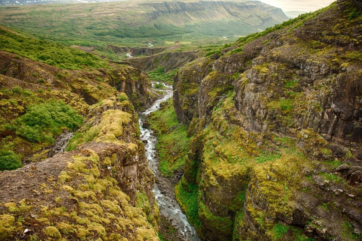
The trail begins in a field of peat and moss that seems to inhale the sky. You shoulder your pack, tighten the gaiters, and follow a narrow worn line toward a brim of basalt where the land drops away into a green wound: a canyon braided with river and mist. From the first bend you can hear it—low at first, then gathering—Glymur. The name means "the rumble," and on a good day the fall lives up to it: water throwing itself nearly 200 meters into a narrow gorge, sending spray and a palpable sense of motion up the valley like a challenge.
Glymur sits in Hvalfjörður, the Whale Fjord, a tidal inlet that curls north of Reykjavík. For decades Glymur was celebrated as Iceland’s tallest waterfall—its 198 meters of drop made it an icon of raw Icelandic scenery—until the discovery of Morsárfoss revised the ranking. The change didn’t soften Glymur’s character. Its drama is less about scale and more about intimacy: the canyon, the river crossings, and the approach that turns a simple viewpoint into a small, earned expedition.
Geology here reads like a brief history of Iceland’s violent youth. Basalt cliffs and folded lava flows frame the canyon, and the river—Botnsá—has carved a channel edged in moss and loose rock. In spring the melt feeds the falls with urgent force; by late summer the flow thins, but the canyon’s faceted rock and the steepness of the descent remain. Hvalfjörður itself carries a cultural layer: named for whales once common in the fjord, the area later hosted wartime activity when Allied naval infrastructure used the sheltered harbor. Today, the road that skirts the fjord and the tunnel under it make Glymur an accessible day trip from Reykjavík, but the hike still feels removed enough to be an escape.
Why come? Glymur is a perfect compromise for travelers who want more than a postcard view without committing to a full alpine route. The hike is compact—three to four hours round-trip for fit walkers—yet it delivers varied terrain: muddy peat, rocky ledges, a narrow cliffside path with a short, exposed scramble, and a boulder-and-log river crossing that, depending on water level, tests balance and nerve. Guided private hikes from Reykjavík compress logistics (transport, local knowledge) into a comfortable package, while helicopter tours fold Glymur into a larger aerial narrative over volcanoes, glaciers, and Þingvellir. For those building an Iceland road trip, a custom jeep tour or self-drive itinerary can combine Glymur with hot springs, lava fields, and coastal highlights.
The practical edge: plan for changeable weather and for sections that demand focus. Trail markers are present but not constant; in fog or low light, the canyon edge can feel like a seam you don’t want to misstep from. Waterproof boots with good ankle support are non-negotiable. Trekking poles keep knees happy on the descent and steady your stance on the river crossing. In winter the route becomes technical—ice and wind make crampons and experience mandatory.
Start early in summer to have the trail to yourself and to catch the light low on the canyon. Photographers will prize the vantage points that compress depth—the waterfall hanging above a narrow pool—and long exposures give Glymur a silkiness that belies the power of the drop. Guides will point out local flora regrouping on the cliff faces and, if you’re lucky, seals bobbing in the fjord below.
Leave no trace matters here. The moss that carpets Iceland’s highlands is deceptively fragile; follow the trail, avoid trampling new growth, and pack out everything. The river crossings are part of the adventure—don’t make them dangerous by improvising paths that widen the trail and erode banks.
For timing and logistics: the hike typically takes 3–4 hours round trip and covers roughly 6–8 kilometers with about 300–400 meters of elevation gain—sufficient to raise the heart rate but not so long that you need a full day. A private guided hike from Reykjavík will handle the 45–60 minute transfer and include an experienced leader who knows where seasonal variations change the safest crossing points. Helicopter options are pricier but unique: the aerial route places Glymur in context alongside Reykjanes’ lava fields and the great ice expanses of Iceland—an efficient way to see the country’s geological contrasts if weather allows.
Who is this for? Hikers who are comfortable with uneven footing and a short exposed scramble, travelers wanting a scenic half-day adventure outside Reykjavík, and photographers seeking a dramatic waterfall without the busier tourist crowds of southern Iceland. Families with older children or teenagers will find the route a satisfying challenge; small children and those uncomfortable with heights should skip the cliffside sections.
A final note: Glymur rewards attention. The roar is an invitation to listen to how water reshapes stone, how weather sculpts a place daily, and how Iceland’s rugged personality is more intimate here than on the highways of tourists. The rumble reminds you that travel is not just about arriving at a viewpoint, but about earning a perspective. With the right gear, respect for the trail, and eyes open, Glymur becomes one of those places that doesn’t merely photograph well—it changes the way you think of a walk.
Trail wisdom
Small choices, better day.
Expect river crossings
The trail includes a boulder-and-log crossing; waterproof boots and poles increase safety and comfort.
Start early
Morning light and fewer hikers make for clearer photos and steadier footing on narrow sections.
Wear good traction
On wet rock and summer mud, aggressive tread prevents slips; in winter bring crampons.
Follow the marked trail
Stick to established paths to protect fragile moss and avoid eroded shortcuts.
Local knowledge
Read the place, not just the route.
Watch for native species including Harbor seals in the fjord, Various seabirds and waders on the shoreline.
Keep an eye out for wildlife during the transition between areas and habitats. Respect distance guidelines.
Stay on established trails to protect delicate moss and prevent erosion; pack out all waste and avoid altering river crossings or banks.
Follow the guide's instructions on size limits, ethical handling, and leave-no-trace practices.
A lesser-used viewpoint further along the canyon rim with sweeping fjord vistas. Small roadside hot springs and pools tucked into Hvalfjörður's coves for a post-hike soak
Locally recommended viewpoints and quiet spots known best to local operators.
Hvalfjörður—"Whale Fjord"—was once a center for whaling and later a sheltered Allied naval base during WWII; the area retains quiet coastal settlements.
Maritime roots and regional tradition shape the waterways and working coasts.
Seasonal guide
Four versions of the same landscape.
Spring
Best forPowerful water flow · Wildflower displays
ChallengesHigh water levels · Mud and slippery rocks
Snowmelt swells the falls and river, creating dramatic flow—expect wet, muddy approaches and stronger currents at crossings.
Summer
Best forStable trail conditions · Long daylight · Birdwatching
ChallengesMidges on calm days · Bigger crowds on sunny weekends
Warmest and most reliable season for hiking; aim for early starts to avoid crowds and soft midday light for photos.
Fall
Best forAutumn color accents · Fewer visitors
ChallengesUnpredictable weather · Shortening daylight
Crisp air and quieter trails make fall appealing, but be ready for wind and rapid temperature shifts.
Winter
Best forSnowy canyon scenes · Northern lights if timing aligns
ChallengesIce, high winds, and avalanche risk in places; requires crampons/axe
Winter makes the route technical—only attempt with proper gear and experience or a qualified guide.
Pack with intention
What to bring.
Good to know
Common questions.
Expect about 3–4 hours round-trip covering roughly 6–8 km with 300–400 meters of elevation gain, depending on detours and pace.
Plan the edges
The details that make the day easier.
Glymur was long considered Iceland’s tallest waterfall at roughly 198 meters until the discovery of Morsárfoss in 2007, but its dramatic canyon setting keeps it a standout destination.
After the hike, sample local Icelandic lamb and skyr at cafés in small coastal settlements or head back to Reykjavík for a geothermal pool soak—a communal way locals unwind and swap road-trip tips.
- Trail length
- ~6–8 km RT • Elevation gain: ~300–400 m • Time: 3–4 hours • Difficulty: moderate • Nearest city: Reykjavík (45–60 min drive) • Seasonal hazards: high spring flows, winter ice.
Protect Iceland’s fragile moss and soils by staying on paths, avoid building new crossing points, and carry out all waste; consider guided tours that practice low-impact travel.
Explore by topic
Follow the threads.
Keep exploring
Make the story part of the trip.
Set out from Bass Harbor for a private, customizable day on Blue Hill Bay — lighthouses, puffins, seals, and the chance to feel Acadia from the water. Small groups, local captains, unforgettable views.
In four hours you can move from shaded canyon ferns to wind-scoured coastal ridgelines, guided by someone who knows where the light—and the hidden views—live. This private half-day hike on the Monterey Peninsula or Big Sur is compact, curated, and perfect for travelers who want depth without a multiday commitment.
 Related story
Beneath a sky of shifting light, Skaftafell’s ice reads like a map of time. This three-hour guided glacier hike mixes technical instruction with geology and culture: compact, safe, and unforgettable.