
What the day feels like
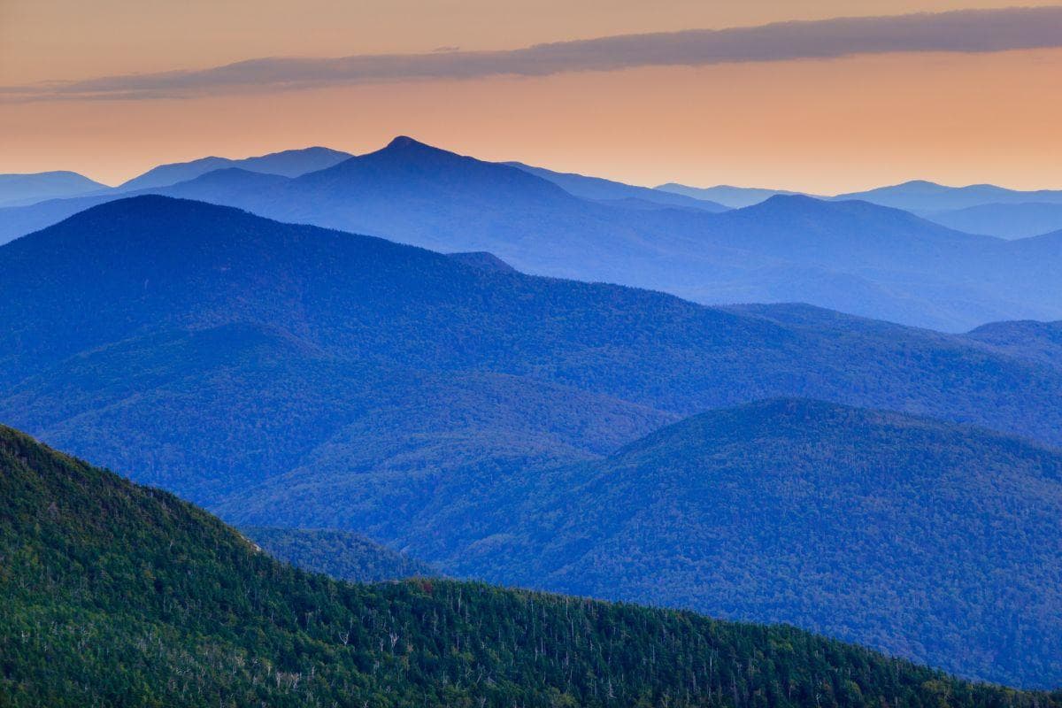
There’s a moment just below the treeline on Mt. Mansfield where the trees thin, the wind learns your name, and Vermont pulls its colors tight around you. Hikers who reach this alpine spine often stop not because they’re out of breath but because the mountain asks them to: look. From the lip of rock called the Chin you can see the green thrum of Stowe’s valley narrowing into the Winooski River basin, and if you time it right—early autumn or a crystalline winter morning—the ridgeline glows like someone pressed a hot palm to the map of New England.
Mt. Mansfield, Vermont’s highest peak at 4,393 feet, is a mountain of personalities. From a distance it’s popularly known as the “Sleeping Man”: shoulders, forehead, chin and all carved into a skyline that generations of Vermonters recognize like a family portrait. Up close it’s a study in contrasts: ancient schist and marble giving way to stunted krummholz, bog-lined paths that swallow your boots, and alpine heath that flares with fireweed and blueberry in late summer. This is not a passive summit; the mountain pushes back with weather, ridge exposure and a weatherboard of microclimates that make preparation less optional and more part of the pleasure.
Geologically, Mt. Mansfield is a fold in the Green Mountains, a ridge born from millions of years of pressure and thaw. Its rock is older than the country that claims it: complex metamorphic beds laid down and folded during the Taconic and Acadian orogenies. Those who know the mountain will point out the cliff bands and the way the summit ridge follows a knife-edge of resistant rock—features that produce both dramatic views and fragile alpine habitat. The tiny, stunted firs and heaths near the top aren’t scenic afterthoughts; they’re survivors in a precarious ecosystem that takes centuries to rebuild when trampled.
The human history here is layered too. Prior to European settlement the area was part of the homeland used by Abenaki peoples for hunting and seasonal movement. More recently, the mountain became an icon of New England outdoor culture: guides, sleds, logging roads that turned into trails, and a town—Stowe—that learned to fold skiing, hiking and small-scale agriculture into a year-round identity. Today the town’s maple syrup stands, brewpubs and farm-to-table restaurants meet head-on with outdoor outfitters; you can finish a long ridge walk and find both a local IPA and a plate of braised greens within a short drive.
If you’re planning to climb Mt. Mansfield, the practical skeleton of the trip is straightforward but honest. The most common approach follows portions of the Long Trail, which traverses the summit ridge and connects with a series of well-marked side trails from Route 108 (Smugglers’ Notch) and Stowe. Expect roughly 5–8 miles round-trip depending on the chosen trailhead, and plan for elevation gain in the neighborhood of 2,200–3,000 feet if you start from valley trailheads—numbers that translate into sustained uphill work and the need for real pacing. Terrain shifts from soft, loamy woods to wet bog boardwalks and finally to rock and exposed ridge; trail shoes or light boots for scrambling sections are a good call.
Timing matters. Early morning starts cut through mosquitoes in summer and reward you with lower winds on the upper ridge; in fall, aim for the calendar sweet spot—late September into early October—when foliage competes with the sky. Winter transforms Mansfield into a different animal: crampons or microspikes, an ice axe for steeper approaches, and avalanche awareness if you wander off managed trails or into gullies. No matter the season, weather can change fast. A sunny, warm parking lot can give way to a wind-harried summit with sub-freezing wind-chill in a couple of hours.
Water and layers are simple currency here. Bring a liter or two, more if it’s hot or if you plan to linger on the ridge; the scrubby alpine plants don’t provide shade. Think lightweight insulating layers, a shell, and trekking poles if you want to save knees on the down. Footwear with good traction is non-negotiable once you move onto the rocky headlands near the Chin and the Forehead, where exposure is real and a misstep feels consequential. Lastly, keep to the boardwalks and hardened trails in the alpine zone—those plants are fragile and slow-growing.
For many, Mt. Mansfield is not just the summit but the approach: Sterling Pond below the summit ridge is a short detour that rewards tired legs with a mirror of the mountain, especially dramatic at dawn. In winter, the mountain’s slopes feed the Stowe ski area and backcountry routes that challenge skiers with steeps and collect powder in sheltered bowls. Wildlife is shy but present—black bears, peregrine falcons, and a host of passerines and small mammals—so carry bear-aware practices and binoculars, not snacks that you’re going to hold onto during the climb.
Practical logistics: Stowe is the gateway community—lodging ranges from inns and B&Bs to full-service hotels. Drive times: Burlington and its airport are roughly 40–60 minutes away, depending on season and traffic; the drive to trailheads along Route 108 can be narrow and winding, and winter maintenance sometimes closes the road temporarily. Cell service is spotty on the ridgeline; bring a map and know your exit points. Parking lots at popular trailheads fill early on weekends during peak season, so consider weekday starts or pre-dawn departures.
Why go? Mt. Mansfield is a mountain that rewards honest effort with a lens on Vermont’s diverse landscapes—valleys, ridgelines, and that unmistakeable “man in the mountain” profile. It’s approachable for motivated day-hikers, and it steps up into technical winter terrain for those who want to push skills. The mountain isn’t meant to be conquered; it’s meant to be engaged with—respectfully, patiently, and with the basic gear and judgment that keep you on the right side of the weather. When you crest the shoulder and the valley opens beneath you, the payoff is immediate: a sense of being both small and fully present in an old, living landscape. That’s the best reason to come to Mt. Mansfield—and to come back.
Trail wisdom
Small choices, better day.
Start early
Parking along Route 108 fills fast and weather is milder in the morning—aim to be on the trailhead before 8 a.m.
Protect alpine plants
Stay on boardwalks and marked trails near the summit—alpine vegetation takes decades to recover from trampling.
Pack layers and wind protection
Upper ridges can be dramatically colder and windier than the valley—carry a shell and insulating mid-layer.
Footwear and traction
Use sturdy trail shoes or light boots; in winter carry microspikes or crampons when ice is expected.
Local knowledge
Read the place, not just the route.
Watch for native species including Black bear, Peregrine falcon.
Keep an eye out for wildlife during the transition between areas and habitats. Respect distance guidelines.
The alpine zones on Mansfield are fragile and slow to recover—stay on boardwalks and consider joining local trail maintenance or Leave No Trace programs to help protect the habitat.
Follow the guide's instructions on size limits, ethical handling, and leave-no-trace practices.
Sterling Pond—an easy detour for mirrored mountain reflections. The Chin and Forehead viewpoints—dramatic rock features with sweeping valley views
Locally recommended viewpoints and quiet spots known best to local operators.
Locals long referred to the mountain as the “Sleeping Man” because its profile resembles a reclining figure; the mountain has been a landmark and seasonal use area for Abenaki people and New England settlers alike.
Maritime roots and regional tradition shape the waterways and working coasts.
Seasonal guide
Four versions of the same landscape.
Spring
Best formud-season hiking · early wildflowers · lower crowds
Challengesmuddy trails · thaw-related trail damage · cool, variable weather
Spring brings melting snow and boggy conditions—expect muddy approaches and lingering wet sections; waterproof footwear is helpful.
Summer
Best foralpine flora · longer daylight · backcountry camping nearby
Challengesmosquitoes/black flies · afternoon storms · higher temperatures in the valley
Summer offers full trail access and green ridgelines but remember insect repellent and an early start to avoid afternoon thunderstorms.
Fall
Best forpeak foliage · crisp clear days · photography
Challengescrowds on weekends · rapid weather shifts · early sunset
Fall is prime time for color and visibility—book accommodations early and plan daylight routes to enjoy the foliage and avoid late descents.
Winter
Best forsnowshoeing · backcountry skiing · crisp alpine views
Challengesice on exposed ridges · short daylight · avalanche risk in gullies
Winter transforms Mansfield into a technical environment—bring traction, layered insulation and avalanche awareness for ungroomed areas.
Pack with intention
What to bring.
Good to know
Common questions.
Expect 4–8 hours round-trip depending on your trailhead and pace; steeper valley starts increase both distance and elevation gain.
Plan the edges
The details that make the day easier.
Mt. Mansfield is Vermont’s highest peak at 4,393 feet (1,339 meters), and its summit ridge forms the state’s highest point.
Stowe pairs backcountry and resort culture—after a summit day, sample local maple syrup at a roadside stand, grab a hearty meal at a farm-to-table restaurant, and relax with a Vermont craft beer while scanning the ridgeline you just climbed.
Protect alpine tundra by staying on designated trails and boardwalks; avoid picking plants and pack out all trash—consider volunteering with local trail organizations to offset trail erosion.
Explore by topic
Follow the threads.
Keep exploring
Make the story part of the trip.
Set out from Bass Harbor for a private, customizable day on Blue Hill Bay — lighthouses, puffins, seals, and the chance to feel Acadia from the water. Small groups, local captains, unforgettable views.
In four hours you can move from shaded canyon ferns to wind-scoured coastal ridgelines, guided by someone who knows where the light—and the hidden views—live. This private half-day hike on the Monterey Peninsula or Big Sur is compact, curated, and perfect for travelers who want depth without a multiday commitment.
 Related story
Beneath a sky of shifting light, Skaftafell’s ice reads like a map of time. This three-hour guided glacier hike mixes technical instruction with geology and culture: compact, safe, and unforgettable.