
What the day feels like
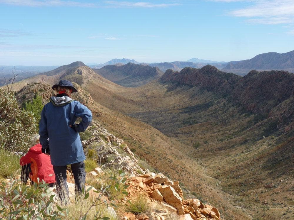
The first footfall on red dust is always the same — a tiny, private acknowledgment that places like the West MacDonnell Ranges register on your body differently. On the Larapinta Trail that dust rubs into boots and socks and memory, a fine sediment of ochre that colors everything from the ridgelines of quartzite to the sky at dusk. Start a day on the trail and you’ll feel the landscape awake beneath you: spinifex sighs as you pass, a wedge-tailed eagle wheels and claims the thermals, and narrow gorges cut shadows like notches in an otherwise relentless sun.
There’s a clarity to the Larapinta that rewires expectations of “outback.” The route runs roughly 223 kilometers along the backbone of the West MacDonnell (Tjoritja) ranges, radiating west from Alice Springs across land that is Arrernte country. It’s not a single continuous wilderness; instead the trail stitches together ridgelines, waterholes and camps, offering a sequence of geological and human stories. Walk a morning and you’ll see banded quartzite fluting into clefts a hundred million years in the making; stop at a waterhole and you’ll be standing where ancient pathways gathered life and lore.
Geology here is blunt and honest. The ranges are old — parts are several hundred million years in age — and their bones show as folded metamorphic rock and sandstone escarpments. Mount Sonder, the western terminus for many, rises to about 1,380 meters and gives one of the most reliable alpine-like sunrises in Australia when conditions are clear. Between these high points are secretive waterholes: Ellery Creek Big Hole, Ormiston Gorge and Redbank Gorge persist as permanent or semi-permanent reservoirs that have sustained people and wildlife through long dry seasons.
Arrernte people have a living connection to this country that predates the walking trail by millennia. You’ll see traces of that in cultural markers along the route, in the rhythm of place names and in art and storytelling back in Alice Springs. The Larapinta was mapped into a formal trail in recent decades, but the land itself holds stories far older than the trail’s waymarkers.
For travelers, the Larapinta is shapeshifter: it can be a multi-day thru-hike of endurance and solitude, or a patchwork of day-hikes and short sections that deliver concentrated rewards. Sections vary in character — rocky ridgewalks that demand attention to footing, creekside meanders that flirt with shade, long, exposed approaches that require disciplined sun strategy. Expect sections from single-digit kilometers up to longer 20–25 km stretches; the full trail commonly takes 12–14 days for through-hikers and is physically demanding because of the terrain and desert conditions rather than technical difficulty.
If you’re not planning a self-supported thru-hike, guided options provide a compelling alternative. A 7-Day Guided Tour of Alice Springs with Accommodation Included, for example, pairs base stays with day excursions into the West MacDonnells, and broadens the experience to include Uluru, Kata Tjuta and Palm Valley. Guided trips often take care of transport, some meals and interpretive context, which is useful if you want deep insight into geology and Anangu and Arrernte histories without the logistics of long-distance packing.
Practical edges: water logistics are the single biggest determinant of experience here. Design your days around known water points and carry ample reserves — summer heat can make even short sections unforgiving. There are official campsites and some basic facilities, but much of the route remains remote; plan resupplies in Alice Springs, and consider a well-planned guide or support vehicle if you’re attempting longer stretches. Footwear needs to be robust: ridgeline quartzite is unforgiving on ankles, and sections of loose scree require stable boots with aggressive soles.
Seasons matter. The best hiking weather is through the cooler months (April–October) when daytime temperatures are comfortable and nights cold, sometimes freezing at higher camps. Summer in the Red Centre is hot and storm-prone; flash floods can make gorges dangerous and water unreliable.
For photographers, the Larapinta is a study in contrasts: the hard light of midday sculpts rock faces, while golden hours bring texture and long shadows across the ranges. Early starts reward you with luminous skies and the best vantage points for sunrise on Mount Sonder.
There’s an ethical cadence to hiking here. This is living country — move with respect. Stay on established tracks, carry out everything you bring in, and be mindful at culturally sensitive sites.
You’ll come away changed in a practical way: more patient with weather, more respectful of water, and more attuned to how the landscape keeps its own time. The Larapinta offers both a physical challenge and a concentrated cultural and geological lesson; if you let it, the trail will teach you how to move slowly enough to notice both swift whipbirds and slow geological time.
Trail wisdom
Small choices, better day.
Respect water — plan resupplies
Design each day around known water points and carry at least 2–3 liters extra; water is scarce between official camp areas.
Footwear for sharp rock
Wear sturdy boots with good ankle support and aggressive tread for quartzite ridgelines and scree.
Sun strategy
Start early, carry a wide-brim hat and SPF 30+ sunscreen, and plan midday shade stops near waterholes.
Navigation and backup
Follow marked sections but carry a map, GPS and spare batteries — some parts are remote with limited phone coverage.
Local knowledge
Read the place, not just the route.
Watch for native species including Black-footed rock wallaby, Wedge-tailed eagle.
Keep an eye out for wildlife during the transition between areas and habitats. Respect distance guidelines.
Water is scarce and fragile here — use established campsites, pack out waste, and avoid disturbing culturally sensitive sites to minimize impact.
Follow the guide's instructions on size limits, ethical handling, and leave-no-trace practices.
Redbank Gorge — a quieter waterhole and dramatic gorge walls ideal for late afternoon swims. Serpentine Gorge and Serpentine Chalet Dam for secluded birding and rock formations
Locally recommended viewpoints and quiet spots known best to local operators.
The trail runs through Arrernte country; Indigenous people have used these ranges for thousands of years, and cultural sites remain significant throughout the corridor.
Maritime roots and regional tradition shape the waterways and working coasts.
Seasonal guide
Four versions of the same landscape.
Spring
Best forWildflower displays · Moderate temps for day-hikes · Birdwatching in waterholes
ChallengesVariable temperatures · Windy days mid-season
Spring offers warming days and wildflowers, but mornings can be cool and wind increases on exposed ridges.
Summer
Best forShort early-morning outings · Flash-flood drama in gorges (from a safe distance)
ChallengesExtreme heat · Unreliable water and flash floods
Summer is hot and storm-prone; avoid long hikes and monitor weather closely due to flood risks.
Fall
Best forClear skies and stable weather · Long-distance sections
ChallengesCool nights · Higher demand for guided trips
Autumn brings stable conditions and comfortable hiking days; nights cool quickly, so warm sleeping gear is needed.
Winter
Best forSummit sunrises from Mount Sonder · Extended hiking with low daytime heat
ChallengesFreezing nights · Possible frost on tents and gear
Australian winter (June–Aug) is the optimal season for thru-hiking — cool days and cold nights make for excellent walking if you pack for nighttime cold.
Pack with intention
What to bring.
Good to know
Common questions.
The trail is roughly 223 kilometers and is commonly broken into 12 sections; through-hikers typically take 12–14 days to complete it.
Plan the edges
The details that make the day easier.
At roughly 223 km, the Larapinta Trail is one of Australia’s most famous long-distance walking routes and traverses the ancient West MacDonnell Ranges (Tjoritja).
Alice Springs is both the logistical hub and cultural gateway — visit local Arrernte art galleries, try camel or kangaroo dishes in town, and seek out evening talks to learn about Indigenous connection to country.
- Length
- ~223 km; Access: Alice Springs start
- finish; Water
- limited — plan refills; Accommodation: backcountry campsites or guided tour accommodation; Safety: carry adequate water and emergency comms.
Stick to marked trails, use designated campsites, pack out all waste and respect Indigenous cultural sites — minimal impact preserves both ecology and heritage.
Explore by topic
Follow the threads.
Keep exploring
Make the story part of the trip.
Set out from Bass Harbor for a private, customizable day on Blue Hill Bay — lighthouses, puffins, seals, and the chance to feel Acadia from the water. Small groups, local captains, unforgettable views.
In four hours you can move from shaded canyon ferns to wind-scoured coastal ridgelines, guided by someone who knows where the light—and the hidden views—live. This private half-day hike on the Monterey Peninsula or Big Sur is compact, curated, and perfect for travelers who want depth without a multiday commitment.
 Related story
Beneath a sky of shifting light, Skaftafell’s ice reads like a map of time. This three-hour guided glacier hike mixes technical instruction with geology and culture: compact, safe, and unforgettable.