
What the day feels like
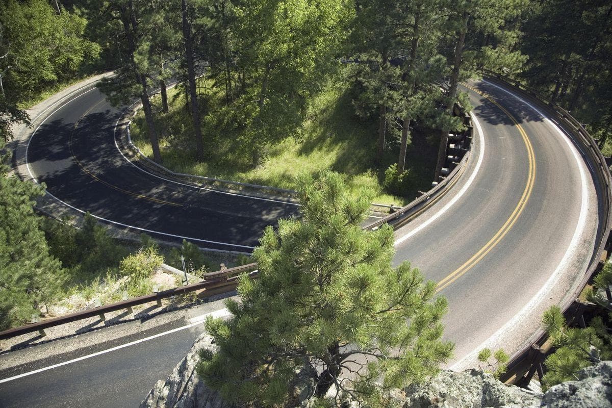
The road curls like a question mark through granite ribs, looping back under itself on wooden pigtail bridges while tunnels carve dark mouths through black hillsides that, for a moment, swallow engines and song. When you emerge you are rewarded not with a single reveal but with a sequence: a switchback panorama here, a granite spire there, and then—through a tunnel just wide enough to feel intimate—Mount Rushmore’s presidents fill the exit like a staged curtain call. Iron Mountain Road is engineered theater: a compact, intentionally framed, slow-motion approach to one of America’s most famous monuments.
Less a commute than a choreography, Iron Mountain Road (signed as SD-16A) threads the southern Black Hills between Custer and Keystone. Built in the 1930s under the vision of South Dakota politician Peter Norbeck, the byway was designed to keep grades gentle while letting the landscape do the guiding. That’s why you’ll find pigtail bridges—timber ramps that twist vehicles back onto themselves—and tunnels purposefully cut to frame distant peaks and the carved faces of Mount Rushmore. The effect is both practical and cinematic: it tucks the driver into the land and keeps the destination feeling like discovery.
Geologically the Black Hills are an island of ancient rock rising from the prairie—upturned, eroded, and pocked with granite spires. Iron Mountain Road gives you a compact geology lesson: look for exfoliated granite faces, rounded domes, and tight columns where ice wedging and slow erosion have been at work for millions of years. The road skirts the margins of Custer State Park, a working landscape of pine and open prairie where bison, pronghorn, and mule deer still move through the foothills. On any summer morning you can expect a herd-shadowed skyline if you’re patient at pullouts along Wildlife Loop Road and the lesser-known side tracks that knit the park together.
Culturally, the drive sits at a crossroads. Nearby Crazy Horse Memorial and the Indian Museum of North America speak to ongoing conversations about the Lakota people and regional identity. Small towns like Custer and Keystone act as hospitable bases: rustic main streets, locally crafted art, and menus that riff on bison, elk, and prairie produce offer a down-to-earth complement to the engineered spectacle of the road and memorials.
For travelers the appeal is immediate and flexible. You can drive Iron Mountain Road in under an hour if you’re intent on covering ground, but the road rewards slow travel. Stop at designed overlooks to watch light move across granite; step out at Sylvan Lake for a short walk among needles and mirrored water; plan the approach to Mount Rushmore so the monument appears through a tunnel at the low angle of afternoon light. If you time it right in summer, finish at the Mount Rushmore Lighting Ceremony—an evening rite that casts the faces into glow and pairs history with a hum of patriotism.
Practicalities: the whole scenic loop from Keystone to Custer and back is roughly a half-day outing if you pepper it with short hikes and photo stops. Elevations here sit around 5,700–6,000 feet, so expect slightly thinner air than the plains and cooler nights through much of the year. The road is paved and well maintained but narrow in places; RV drivers should watch for low-clearance or long-vehicle restrictions on the tunnels and pigtails. There are no tolls to use Iron Mountain Road itself, though national- and state-park fees apply at some pullouts and at the Mount Rushmore visitor area.
How to plan it: start early to avoid midday tour traffic and the RV surge. If you’re after wildlife, dawn and the hour before sunset are best. Bring layers; granite radiates heat in the sun and sheds it fast in shade, so a lightweight shell will keep you comfortable whether you’re on a short scramble or leaning on the hood for photos. For a richer experience, lock in a guided tour that uses the road as a narrative spine—the guides carry local stories about mining, conservation, and Norbeck’s deliberate design choices that you won’t pick up just from a map.
Safety and etiquette are simple: stay in designated pullouts, respect speed limits on switchbacks, and never feed wildlife—especially bison. A respectful distance protects you and the animals and preserves the fragile behavior patterns of the park’s inhabitants.
Why go now? Iron Mountain Road compresses the Black Hills into an easily digestible sequence of engineered reveals and natural monuments. It’s a drive that favors curiosity over speed; the bridges and tunnels were intentionally placed so you would see the land in frames and sequences, and that design still rewards the traveler who is willing to pull over, walk a short loop, and listen to the place.
For photographers, the road is a masterclass in composition. For families, it’s a series of short, dramatic stops that feel like a curated museum without walls. For anyone with a moderate sense of wonder—and a willingness to leave the interstate behind—Iron Mountain Road delivers a compact, readable, and surprisingly intimate Black Hills experience.
Trail wisdom
Small choices, better day.
Use designated pullouts
Don’t stop in traffic lanes—park only in the marked viewpoints to keep traffic flowing and protect wildlife.
Watch tunnels and vehicle length
Tunnels and pigtail bridges are scenic but narrow—RV and trailer drivers should confirm clearance before entering.
Bring binoculars
Wildlife often graze below ridgelines; binoculars make it easy to observe bison and deer without disturbing them.
Time your approach
Late afternoon light frames the presidents best through Iron Mountain Road’s tunnels; aim to arrive before sunset for optimal views.
Local knowledge
Read the place, not just the route.
Watch for native species including American bison, Mule deer.
Keep an eye out for wildlife during the transition between areas and habitats. Respect distance guidelines.
Respect wildlife distance, use designated pullouts, and pack out all trash—these simple actions reduce roadkill and protect fragile habitats.
Follow the guide's instructions on size limits, ethical handling, and leave-no-trace practices.
Small pullouts overlooking Needles Highway for intimate granite spire views. Sylvan Lake shoreline for a short, low-effort hike and reflection
Locally recommended viewpoints and quiet spots known best to local operators.
Peter Norbeck, a South Dakota governor and senator in the 1920s–30s, championed the byway system and designed roads like Iron Mountain Road to create scenic, low-grade approaches through the Black Hills.
Maritime roots and regional tradition shape the waterways and working coasts.
Seasonal guide
Four versions of the same landscape.
Spring
Best forWildflower blooms · Quieter drives · Budding wildlife sightings
ChallengesUnpredictable weather · Possible late snow at higher elevations
Spring brings green renewal and fewer crowds, but mornings can be chilly and some higher pullouts may still have snow.
Summer
Best forEvening lighting ceremony · Full access to pullouts · Picnics and short hikes
ChallengesPeak visitor traffic · Hot afternoons and limited parking at popular stops
Summer is prime tourism season—expect crowds but also the full suite of services and the Mount Rushmore evening ceremony.
Fall
Best forAutumn color · Crisp air for photography · Fewer crowds
ChallengesShorter daylight hours · Occasional early snow or icy mornings
Fall’s golden light and cooling temps make for excellent drives and photography; dress in layers for brisk mornings.
Winter
Best forSnow-dusted panoramas · Quiet solitude · Stargazing on clear nights
ChallengesCold, icy roads · Limited services and possible closures
Winter transforms the Black Hills into a quiet, snowy landscape—beautiful but more remote; check road conditions and closures before heading out.
Pack with intention
What to bring.
Good to know
Common questions.
The scenic byway (SD-16A) is a short, driveable route that takes roughly 30–60 minutes without stops; with photo stops and short hikes, plan for a half day.
Plan the edges
The details that make the day easier.
Iron Mountain Road was constructed in the 1930s under the influence of Peter Norbeck, who designed its pigtail bridges and tunnels to create framed views of the Black Hills and Mount Rushmore.
Custer’s downtown offers hearty bison burgers, locally made crafts, and galleries showcasing Plains Indian artists; nearby Crazy Horse Memorial presents a living cultural project and museum focused on Native American perspectives.
- Drive time
- 30–60 minutes (1
- 2 day with stops). Elevation
- ~5,700–6,000 ft. Vehicle: paved road but narrow in places—RV warnings apply. Fees: no road tolls; park
Do not feed wildlife, stay on paved pullouts, and pack out all trash; choose guided tours that support local conservation efforts.
Explore by topic
Follow the threads.
Keep exploring
Make the story part of the trip.
Set out from Bass Harbor for a private, customizable day on Blue Hill Bay — lighthouses, puffins, seals, and the chance to feel Acadia from the water. Small groups, local captains, unforgettable views.
In four hours you can move from shaded canyon ferns to wind-scoured coastal ridgelines, guided by someone who knows where the light—and the hidden views—live. This private half-day hike on the Monterey Peninsula or Big Sur is compact, curated, and perfect for travelers who want depth without a multiday commitment.
 Related story
Beneath a sky of shifting light, Skaftafell’s ice reads like a map of time. This three-hour guided glacier hike mixes technical instruction with geology and culture: compact, safe, and unforgettable.