
What the day feels like
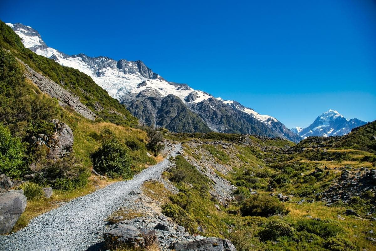
On a grey-morning walk the Tasman River does the thing rivers do at the toe of a great mountain: it dares you to keep watching. Braided channels glitter between dark moraine, pulling your eye toward a jagged horizon where Aoraki / Mount Cook pins clouds like flags. The Kea Point Track begins with that dare—an easy, purposeful trail through tussock and alpine scrub that finishes where the range grows impossibly close, a vista so immediate you can feel the mountain’s gravity.
Kea Point is not a long hike. It’s an offering: a clean, compact taste of Aoraki Mount Cook National Park that gets you close to glacial landforms, turquoise moraine ponds and, if you’re lucky, an inquisitive kea. Walk slowly and you’ll hear the park’s personalities—stones shifted by centuries of ice, wind that seems to have learned the language of cirques, and the sharp, clever cries of the kea, the world’s only alpine parrot and a native that defines the place.
Geology is the backbone of this trail. Aoraki’s peaks are young in geological terms, towered by schist and greywacke sculpted by repeated ice advances and retreats. From the endpoint of Kea Point you’ll see the lower reaches of the Mueller Glacier’s pale, glacial sediment and the sculpted moraines left as the ice retreated in the last century. The braided Tasman River—its color a powder-blue from suspended glacial flour—carves a plain of constantly shifting channels below the viewpoint. In the short sweep of the Kea Point walk you’re watching a slow-motion glacier story unfold.
There’s also human history here. The mountain Aoraki holds deep spiritual significance for Ngāi Tahu iwi; Aoraki appears in oral histories as an ancestral figure whose transformation into the mountain is central to local whakapapa (genealogy). European mountaineering brought another chapter: The Hermitage hotel and the little settlement that became Mount Cook Village grew up to serve climbers and visitors drawn by the peak’s challenge. The national park is part of Te Wahipounamu World Heritage Area, a recognition of both the place’s wild landscapes and its ecological value.
The Kea Point Track suits the park’s short-window visitor: it’s compact, dramatic and informative. The path is a well-formed gravel trail with gentle rises, boardwalks over sensitive vegetation and a couple of stream crossings bridged for convenience. The return distance is about 3 km (roughly 1–1.5 hours depending on stops). It’s accessible to families and casual walkers but provides enough alpine context to satisfy someone doing a longer trek the next day.
Beyond scenery, the trail is an invitation to observe. Kea are not only cheeky—they’re integral to the alpine ecosystem and unforgettable companions to any trip to Aoraki. They’ll test your pack straps but please resist feeding them; their diet and survival depend on being wild. At the viewpoint, look for the pale stain of glacial milk in meltwater ponds, the crisp outline of hanging valleys on the distant flanks, and the scatter of subalpine plants clinging to the moraines. If conditions are calm, you may hear the faint, distant cracking of ice calving off a nearby glacier—that sound-of-ice that suddenly makes you appreciate the living scale of the landscape.
Practicality is part of the Kea Point charm. There’s no permit or fee for the track; it’s a day walk off the main village access road. Pack layers—weather in the Southern Alps can flip from calm to squall—and bring a windproof shell, sturdy footwear, water and snacks. Timing matters: aim for morning or late afternoon for softer light and fewer people; midday can be bright and harsh, and the sun off the glacial river can be deceptive.
Kea Point is also a gateway. It pairs neatly with longer park walks: the nearby Hooker Valley Track extends the glacial story with river crossings and a different close-up of the mountain, while the Mueller Hut Route rewards those with the fitness and experience to climb higher. For photographers the composition options are generous: foreground moraine, a thread of braided river and a mountain that doesn’t just loom— it engages.
Finally, come with respect. Trails like Kea Point succeed because visitors keep them that way: stay on formed paths, take all rubbish out, don’t feed wildlife, and leave stone and plant features undisturbed. The park is a living classroom—if you pay attention, the trail will teach you both the slow work of ice and the fragile balance that keeps an alpine world intact.
If your trip to Aoraki / Mount Cook is short on days but long on ambition, Kea Point offers a concentrated summit of experience: geology, birds, river systems and a mountain that commands your attention. It’s the place where a short walk becomes a meaningful chapter in a larger alpine trip, one you’ll remember when you hear the kea’s cry in some other ridge, or see the milky blue of glacial melt reflecting a huge, patient sky.
Trail wisdom
Small choices, better day.
Early light is best
Start at dawn or early morning to catch softer light on the mountains and to avoid mid-day winds that can pick up on the plain.
Respect the kea
Kea are curious and persistent—do not feed them, secure loose straps and stow food in sealed containers.
Layer for wind
Bring a windproof shell even on mild days: the trail crosses exposed moraines where wind and chill spike quickly.
Short but stop often
Though the distance is brief (about 3 km return), allow extra time for viewpoint stops and photography.
Local knowledge
Read the place, not just the route.
Watch for native species including Kea (Nestor notabilis), New Zealand pipit and alpine-tussock birds.
Keep an eye out for wildlife during the transition between areas and habitats. Respect distance guidelines.
The park is actively managed to protect fragile alpine habitats—stick to formed tracks, avoid disturbing nesting birds, and never feed wildlife, especially kea.
Follow the guide's instructions on size limits, ethical handling, and leave-no-trace practices.
The small glacial ponds off the main viewpoint that mirror the mountain on calm days. A quiet kea-watching perch near the carpark at dawn when the birds are most active
Locally recommended viewpoints and quiet spots known best to local operators.
Aoraki / Mount Cook is central to Ngāi Tahu tradition; the mountain’s name and stories form part of iwi whakapapa, and the park sits within the Te Wahipounamu World Heritage Area.
Maritime roots and regional tradition shape the waterways and working coasts.
Seasonal guide
Four versions of the same landscape.
Spring
Best forwildflower displays · fewer tourists · photography of seasonal light
Challengesunpredictable weather · remaining snow patches
Spring brings melting snow and wildflowers, but be prepared for sudden cold snaps and muddy sections early in the season.
Summer
Best forstable weather · clear mountain views · family-friendly walks
Challengesstrong sun and UV · crowds at peak times
Summer offers the warmest, most stable conditions and long daylight hours—ideal for pairing Kea Point with longer hikes.
Fall
Best forcrisp air and clarity · fewer visitors · rich late-season light
Challengescooler nights · variable weather patterns
Autumn provides striking light and thinner crowds; expect colder mornings and the first real alpine chills after sunset.
Winter
Best fordramatic snowscapes · photography of frosted peaks
Challengesicy or snow-covered tracks · short daylight hours
Winter makes the landscape austere and beautiful but increases hazards—check conditions and carry appropriate winter gear.
Pack with intention
What to bring.
Good to know
Common questions.
The track is roughly 3 km return and typically takes 1–2 hours depending on pace and the time spent at viewpoints.
Plan the edges
The details that make the day easier.
Aoraki / Mount Cook National Park is part of the Te Wahipounamu World Heritage Area, recognized for its outstanding glacial landscapes and biodiversity.
Mount Cook Village is centered around The Hermitage hotel and a small cluster of visitor services; local food leans toward hearty, high-country fare—lamb, game and locally smoked trout—paired with cafés serving supplies for day walks.
- Distance
- ~3 km return • Time: 1–2 hours • Difficulty: Easy • Cost: Free • Trailhead: near Mount Cook Village carpark • Facilities: toilets in village, no services on trail • Permits: none
Protect kea and fragile alpine plants by keeping to formed tracks, storing food securely, and packing out all waste; support local conservation by following DOC guidelines and choosing responsible operators.
Explore by topic
Follow the threads.
Keep exploring
Make the story part of the trip.
Set out from Bass Harbor for a private, customizable day on Blue Hill Bay — lighthouses, puffins, seals, and the chance to feel Acadia from the water. Small groups, local captains, unforgettable views.
In four hours you can move from shaded canyon ferns to wind-scoured coastal ridgelines, guided by someone who knows where the light—and the hidden views—live. This private half-day hike on the Monterey Peninsula or Big Sur is compact, curated, and perfect for travelers who want depth without a multiday commitment.
 Related story
Beneath a sky of shifting light, Skaftafell’s ice reads like a map of time. This three-hour guided glacier hike mixes technical instruction with geology and culture: compact, safe, and unforgettable.