
What the day feels like
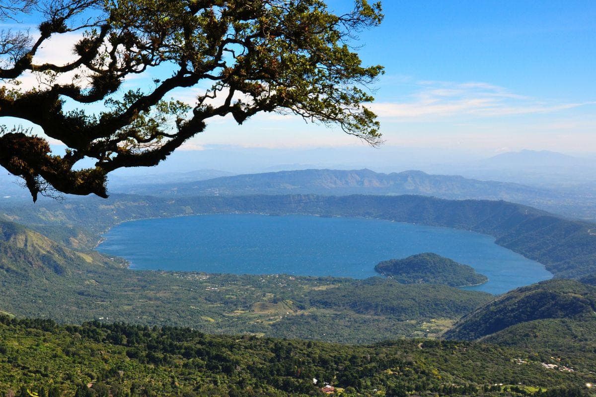
By mid-morning the lake is a sheet of glass—turquoise light folded into the rim of an old volcano. You step onto a narrow spit of volcanic sand and the water nudges your toes like it’s testing whether you belong. Around you the caldera walls rise in gradients of green: coffee terraces, secondary forest, and the abrupt, ash-streaked flank of Santa Ana—El Salvador’s highest active volcano—keeping a patient watch. That hush, the close geometry of water and mountain, is the first of many persuasive arguments to come to Lake Coatepeque.
Coatepeque is not a postcard contrived by an advertising agency. It’s a living caldera lake—one of the country’s most photogenic natural features—shaped by fire and then softened by centuries of human life. The lake fills a volcanic caldera and, on clear days, offers a nested view: your reflection, the bowl of the lake, and beyond it the jagged silhouette of the Ilamatepec massif. Locals call it Lago de Coatepeque; many visitors arrive after a morning on Santa Ana Volcano, trailing dust from the hike but keen to trade sweat for cool water and a lakeside lunch.
Geology here is literal and theatrical. Coatepeque formed when a massive eruption collapsed a magma chamber into a bowl—an event that rewrote local topography and created the conditions for the lake’s famously clear water. From a cultural angle, the caldera has been worked for generations: coffee plantations and small shore-side villages maintain a slow rhythm of fishing, rowing, and afternoon siestas. The historical thread ties into larger Salvadoran life—colonial haciendas, a mosaic of indigenous names, and a people who have learned to live with the occasional reminder that the earth beneath them is restless.
For travelers who like movement, the lake performs well as a bookend to a volcano hike. Several tours combine the Santa Ana (Ilamatepec) ascent—roughly a 7 km round-trip with about 700–900 m of elevation gain and 3–5 hours of on-trail time—with a post-hike cooldown on Coatepeque’s shores. The contrast is sharply satisfying: you climb through a misty cloud forest where the trees lean over the trail like old sentries, scrub past sulphurous knobs near the summit, and then descend to a lunch table facing placid water. Small-group operators sell the combo for a reason—this is one of those places where the landscape’s drama needs a slower palate: sweat and silence up top, and then the convivial clink of plates and the lift of cold beer by the water.
If you’re after solitude rather than a packaged day, choose a late-afternoon shoreline stroll. The western coves hold quieter water and, at sunset, the light on the caldera walls is incandescent. Boat rentals are available from informal piers; a short motor or paddle across opens different vantage points for photography or a secluded swim. For birders, the lake margin and riparian scrub host herons and kingfishers, and in the dry season migratory waterfowl join the resident species.
Practical planning matters here. Summer and late wet-season afternoons can bring sudden thunderstorms; early starts are the rule for the volcano hike—both to avoid heat and to get the clearest crater views. Trails climb from cloud forest to volcanic scoria, so footwear that handles both mud and loose ash is essential. Water and sun protection become non-negotiable the moment you leave the tree line. Many guides include transport from San Salvador or Tunco, making the logistics of an early departure painless, and a lakeside lunch is almost always part of the package—expect fresh fish, hearty Salvadoran sides, and coffee from nearby mountains.
Sensible respect for local practice elevates the experience. The lakeside communities welcome business but not trash: bring reusable containers and leave nothing on the shore. Swim in designated areas, and if you rent a boat, pair up with a local operator who understands the lake’s seasonal rhythms. For photographers, dawn and dusk are peak windows; midday offers brutal contrast but luminous water color.
Why plan a trip here? Lake Coatepeque is a compact ambient theater of geology and human scale. It pairs with one of Central America’s most accessible volcano climbs, it offers straightforward water activities, and it rewards modest effort with striking visual payoffs. Whether you’re an experienced hiker seeking a volcanic summit or a traveler who prefers to linger over lunch and watch the shoreline village life unfold, Coatepeque is a place where the elements feel purposeful—water that beckons, wind that rearranges clouds, and a mountain that quietly measures time. In short: it’s one of those rare spots where you can calibrate the day to your appetite for movement or stillness, and either choice will feel well spent.
Trail wisdom
Small choices, better day.
Start early for the volcano
Leave before dawn for Santa Ana to beat heat and clouds—morning climbs increase your chance of clear crater and Coatepeque views.
Wear mixed-terrain shoes
Bring sturdy trail shoes that grip in mud and loose volcanic ash; sandals are fine lakeside but not on the summit trail.
Hydrate and fuel
Carry at least 2 liters of water, electrolytes, and high-energy snacks for the 3–5 hour hike segments.
Support local guides
Book a certified local guide or small-group tour to get the best viewpoints and learn the geology and history of the area.
Local knowledge
Read the place, not just the route.
Watch for native species including great egret, green iguana.
Keep an eye out for wildlife during the transition between areas and habitats. Respect distance guidelines.
Tour operators increasingly emphasize no-plastic policies and sensible boating practices; sticking to marked trails reduces erosion and protects shoreline habitat.
Follow the guide's instructions on size limits, ethical handling, and leave-no-trace practices.
A quiet western cove for sunset swims and reflections. Small family-run lakeside restaurants that source local tilapia and brew mountain coffee
Locally recommended viewpoints and quiet spots known best to local operators.
Coatepeque fills a volcanic caldera and has been a focal point for local agriculture and lakeside settlements since colonial times.
Maritime roots and regional tradition shape the waterways and working coasts.
Seasonal guide
Four versions of the same landscape.
Spring
Best forclear crater views · birdwatching · lakeside dining
Challengesvariable showers · muddy trails in early spring
Spring (March–May) offers warm days and improving visibility—ideal for combining a Santa Ana summit with an afternoon swim at Coatepeque.
Summer
Best forlush foliage · fewer crowds · wildlife listening
Challengesafternoon storms · higher humidity
Summer brings dense greenery and active birdlife; plan hikes in the morning and afternoons for lake activities between showers.
Fall
Best fordry trails · crisp mornings · photography
Challengesvariable tourist services as season shifts
Fall gives some of the best light for photos and generally stable weather—perfect for summit attempts and sunset lakeside sessions.
Winter
Best forcool climbs · clear skies · migration birdwatching
Challengescooler nights · limited water-borne activity on chillier days
Winter (dry season) brings cooler temperatures and the clearest vistas—opt for mid-morning starts to enjoy both summit views and a warm lakeside lunch.
Pack with intention
What to bring.
Good to know
Common questions.
Yes—there are designated swimming areas and operators who rent boats; water quality is generally good, but always follow local guidance and swim in supervised spots.
Plan the edges
The details that make the day easier.
Lake Coatepeque occupies a volcanic caldera created by past eruptions; its name comes from the Nahuatl words meaning 'place of snakes'—a reminder of the region's deep indigenous history.
Lakeside cuisine centers on fresh fish (often tilapia), hearty soups and pupusas; nearby coffee farms supply the espresso that ends many lakeside lunches—ask for locally roasted beans.
- Nearest city
- Santa Ana (30–45 minutes); common combo: Santa Ana Volcano hike + Coatepeque lunch; typical day trip: 8–10 hours including transport from San Salvador; book certified guides for summit access.
Choose small local operators, avoid single-use plastics, respect no-boat zones and shorelines, and consider offsetting transport emissions when possible.
Explore by topic
Follow the threads.
Keep exploring
Make the story part of the trip.
Set out from Bass Harbor for a private, customizable day on Blue Hill Bay — lighthouses, puffins, seals, and the chance to feel Acadia from the water. Small groups, local captains, unforgettable views.
In four hours you can move from shaded canyon ferns to wind-scoured coastal ridgelines, guided by someone who knows where the light—and the hidden views—live. This private half-day hike on the Monterey Peninsula or Big Sur is compact, curated, and perfect for travelers who want depth without a multiday commitment.
 Related story
Beneath a sky of shifting light, Skaftafell’s ice reads like a map of time. This three-hour guided glacier hike mixes technical instruction with geology and culture: compact, safe, and unforgettable.