
What the day feels like
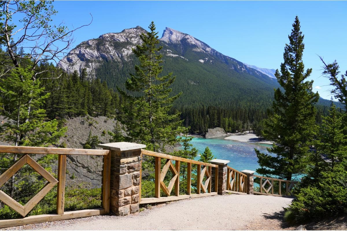
The first breath at Bow Summit is thin and clear, like someone has turned the world’s contrast knob up a notch. You step out of the car onto the crest of the Icefields Parkway and the valley drops away into a bowl of turquoise so saturated it looks staged: Peyto Lake, a wolf-shaped smear of glacier-fed color, sits miles below and refuses to be ignored. Winds push across the ridge with composure; the scent of spruce and cold stone slips into your lungs. Here, on one of the road’s highest viewpoints, the Rockies present themselves in tidy, cinematic slices—knife-edged ridgelines, glaciers flecked with crevasses, and the broad shoulders of the Bow River’s headwaters.
Getting to Bow Summit is half the story. The Icefields Parkway (Highway 93) threads 232 kilometers between Lake Louise and Jasper, and Bow Summit is its near-immediate reminder that this isn’t a drive for the inattentive. For travelers who prefer to keep their eyes outside the windshield, private sightseeing tours—like the Icefields Pkwy private tour that links Lake Louise, Bow Summit/Peyto, and the Columbia Icefield—turn an otherwise long day into a string of decisive stops. A knowledgeable driver-guide will time light, suggest short hikes, and talk geology and local lore as the highway unspools.
Geology here reads like a brief history of Earth in hard rock. Forty million years of tectonic collisions have shoved older sedimentary beds westward and uplifted them into the jagged skyline above you. Peyto Lake’s unreal color is a direct product of that history: meltwater from the Peyto Glacier carries rock flour—ultra-fine silt ground from ancient bedrock—that scatters blue-green light and produces that signature hue. From Bow Summit you can see that water is both builder and artist: cirques carved from glacial ice, moraines knuckling out into valleys, and rivers that insist on finding the most dramatic route downhill.
The cultural history binds Indigenous presence with early mountaineer tales. The lake itself takes its name from Bill Peyto, an early Banff guide and Park warden who patrolled these ranges in the late 19th and early 20th centuries. Indigenous peoples have long known this landscape in stories and seasonal routes; nowadays, protected status under Parks Canada seeks to balance access and stewardship.
What to do when you arrive? The classic move is a short walk from the Bow Summit parking lot to the Peyto Lake viewpoint: the trail is short—about 1 to 1.4 kilometers round trip depending on which path you take—and rises gently on a combination of packed dirt, boardwalk and a few stairs. It’s accessible for most hikers and rewards anyone with a camera or an appetite for alpine panoramas. For those who want to stretch legs longer, the trail network around the summit offers variations along ridgelines and into subalpine meadows carpeted with wildflowers in mid-summer.
Timing matters. Light just after dawn and late afternoon delivers the richest color: morning often paints low clouds in soft pastels, while evening light slices the ridgeline and makes the lake glow. Crowds peak mid-day in summer; if you want the view to yourself, schedule the stop first thing or join a private tour that stages the route to avoid busloads. Winter turns the place austere—access is possible but road and parking conditions change rapidly; snowshoes and careful planning are mandatory.
Practicalities that will save a trip: carry a Parks Canada pass, check road conditions on the Icefields Parkway (weather and wildlife closures are common), and bring layers—alpine conditions can shift from sunny and warm to windy and sub-zero in hours. Footwear that grips is recommended even on the short viewpoint trail since sections can be muddy or icy depending on season. Keep a safe distance from wildlife; elk, bighorn sheep, and occasional bears frequent the lower valleys.
If you use a private tour to visit Bow Summit, the benefits go beyond parking validation. A good guide will point out minor pullouts you’d otherwise speed past—frozen waterfalls, obscure viewpoints, and the geology that explains why the lake looks the way it does. These tours can be customized for photographers, families, or serious hikers and let you fold in other Icefields Parkway highlights without worrying about driving or navigation.
Why go? Bow Summit and the Peyto viewpoint condense the appeal of the Canadian Rockies into a tidy, walkable experience: awe without commitment. It’s a place to feel the scale of ice and mountain, to watch water doing its slow, stubborn work, and to remember how quickly a change in light can alter the mood of an entire range. For anyone planning a Rockies road trip, it’s a reliable, high-return stop—a taste of glacier-born color and alpine clarity that stays with you.
Practical closing: respect the rules, plan around light and crowds, and consider a guided stop if you want context delivered without the fatigue of a long drive. Bow Summit is a simple, exacting reminder that some of the best views don’t demand long hikes—only a moment’s attention and the willingness to step out and look down.
Trail wisdom
Small choices, better day.
Go at dawn or dusk
Light is richest in the early morning and late afternoon; fewer visitors at these times mean better photos and a quieter experience.
Bring traction for variable surfaces
Even the short viewpoint trail can be muddy, rocky, or icy—microspikes or sturdy hiking shoes improve safety.
Carry a Parks Canada pass
You’ll need a valid park pass for parking along the Icefields Parkway—buy ahead to avoid lines.
Respect wildlife distances
Keep at least 100 meters from bears and 25 meters from other large wildlife; never feed animals.
Local knowledge
Read the place, not just the route.
Watch for native species including elk, bighorn sheep.
Keep an eye out for wildlife during the transition between areas and habitats. Respect distance guidelines.
Visitors must follow Leave No Trace principles and respect seasonal closures; park fees fund trail maintenance and wildlife protection.
Follow the guide's instructions on size limits, ethical handling, and leave-no-trace practices.
Nearby Bow Summit ridgewalks for quieter perspectives away from the main viewpoint. Small pullouts along the Icefields Parkway that offer glacier and waterfall views without the crowds
Locally recommended viewpoints and quiet spots known best to local operators.
Peyto Lake is named after Bill Peyto, an early park warden and guide; the Icefields Parkway was completed in the mid-20th century to link Banff and Jasper through glacial landscapes.
Maritime roots and regional tradition shape the waterways and working coasts.
Seasonal guide
Four versions of the same landscape.
Spring
Best formelting ice and rushing waterfalls · fewer visitors · early wildflower blooms
Challengessnowy patches on trails · variable road conditions · cold temperatures
Spring brings meltwater and a dramatic landscape in transition—expect snow and muddy trails through late May and variable highway conditions.
Summer
Best forclear alpine views · wildflowers and approachable trails · full touring services and guided trips
Challengescrowds mid-day · limited parking during peak hours · occasional afternoon storms
Summer is the ideal window for accessibility and stable weather—arrive early to beat crowds and afternoon storms.
Fall
Best forgolden larches and crisp light · fewer visitors · clear, cold mornings ideal for photography
Challengesshorter daylight hours · early snowfall possible · cooler temperatures
Autumn’s crisp air and color make for striking vistas; be prepared for rapidly changing conditions, especially later in the season.
Winter
Best forsnow-sculpted landscapes · quiet, dramatic panoramas · backcountry skiing nearby with proper planning
Challengesroad closures and limited parking · icy trails and extreme cold · reduced vehicle services
Winter offers a stark, beautiful scene but requires winter-driving experience, winter gear, and awareness of closures and avalanche hazard.
Pack with intention
What to bring.
Good to know
Common questions.
The main viewpoint is a short 10–30 minute walk one-way; round trip typically runs 30–60 minutes depending on stops and mobility.
Plan the edges
The details that make the day easier.
Peyto Lake was named after Bill Peyto, an early Banff Park warden and guide who was instrumental in early patrols and visitor assistance in the area.
Nearby Lake Louise Village offers hearty mountain fare—think elk or bison dishes and warming soups—along with Indigenous arts at local galleries and interpretive exhibits in Banff that explore Stoney and Nakoda histories.
- Distance from Lake Louise
- ~35 km north via Icefields Pkwy; parking available but fills midday in summer; short 20–40 minute viewpoint walk; bring park pass and layers.
Use established trails and boardwalks to protect fragile alpine tundra; pack out waste, avoid single-use plastics, and support local guided operators who follow Leave No Trace practices.
Explore by topic
Follow the threads.
Keep exploring
Make the story part of the trip.
Set out from Bass Harbor for a private, customizable day on Blue Hill Bay — lighthouses, puffins, seals, and the chance to feel Acadia from the water. Small groups, local captains, unforgettable views.
In four hours you can move from shaded canyon ferns to wind-scoured coastal ridgelines, guided by someone who knows where the light—and the hidden views—live. This private half-day hike on the Monterey Peninsula or Big Sur is compact, curated, and perfect for travelers who want depth without a multiday commitment.
 Related story
Beneath a sky of shifting light, Skaftafell’s ice reads like a map of time. This three-hour guided glacier hike mixes technical instruction with geology and culture: compact, safe, and unforgettable.