Blue Ridge Parkway by Jeep: Asheville’s Big-View Drive Without the Footslog
Mountain Views | 3 - 4 hours | Paved Roads | Driving Tour
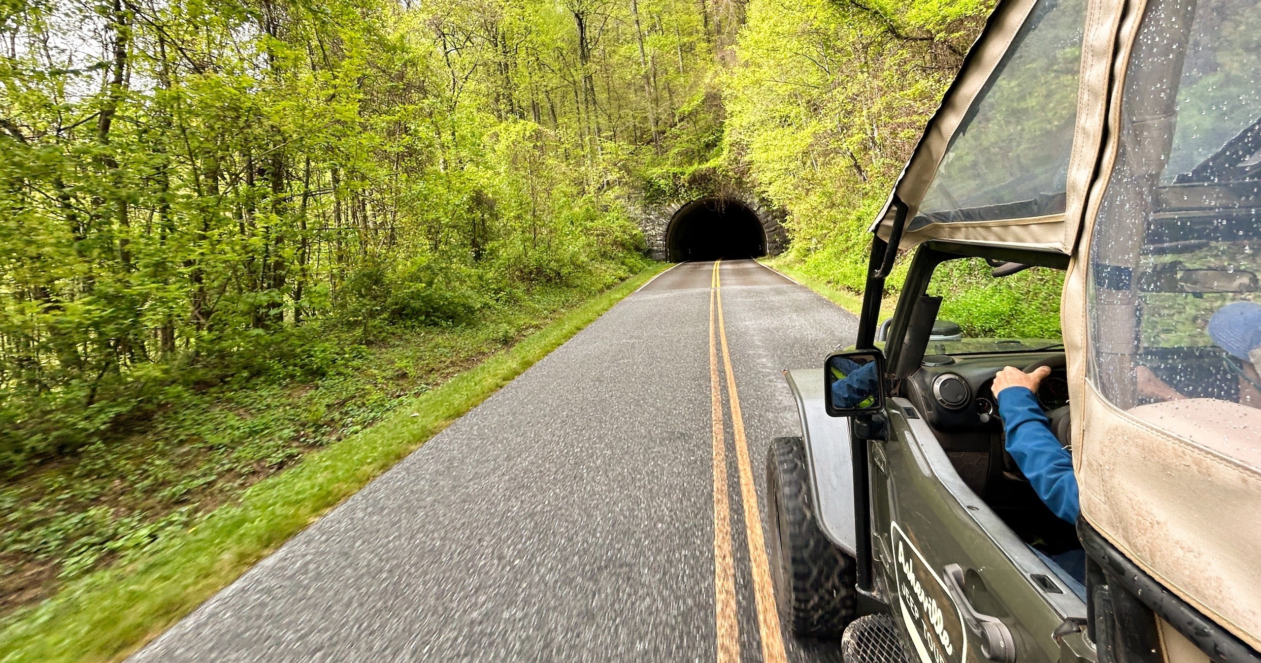
Morning settles over Asheville in soft bands of blue and gold, the kind of light that makes the Blue Ridge live up to its name. The Jeep noses east toward the Parkway, tires humming, and the city exhales behind you—riverfront warehouses giving way to rhododendron thickets and stratified rock cuts that seem to breathe with the day. Up here the mountains are awake early. Ridges shrug off the night, a breeze threads the spruce, and the road—America’s Favorite Drive—leans forward as if eager to show off what’s around the next bend.
Trail Wisdom
Layer Up for Elevation Swings
Temps can drop 10–20 degrees from Asheville to higher mileposts. Pack a light insulating layer even in summer.
Mind the Motion
Curvy roads are part of the charm. If you’re prone to motion sickness, take non-drowsy meds 30–60 minutes before departure.
Sun, Wind, Repeat
Open-air Jeeps mean extra exposure. Bring sunglasses and SPF; secure hats and loose items during drives.
Overlook Etiquette
Stay inside guardrails, respect signage, and share space with other visitors—especially during peak fall color.
Local Knowledge
Hidden Gems
- •Tanbark Ridge Overlook (MP 376.7) for sunrise with minimal crowds
- •Bull Gap Overlook (MP 375.2) for layered evening light toward the city
Wildlife
Peregrine falcon, White-tailed deer
Conservation Note
Stay on paved or designated paths at overlooks to protect fragile high-elevation plants. Pack out all trash and keep noise down to respect wildlife and other visitors.
The Blue Ridge Parkway was begun in 1935 as a New Deal project and completed in 1987 with the Linn Cove Viaduct, creating a 469-mile scenic drive linking Shenandoah and Great Smoky Mountains national parks.
Seasonal Guide
spring
Best for: Wildflowers, Cool, clear mornings
Challenges: Unpredictable showers, Gusty ridge winds
Rhododendron and laurel line the road, with frequent sun-and-mist intervals. Layers and a light rain jacket keep you comfortable.
summer
Best for: Lush greenery, Long daylight
Challenges: Afternoon thunderstorms, Haze during heat waves
Expect warm temps in town and cooler air on the crest. Afternoon departures can dodge mid-day haze for better views.
fall
Best for: Peak foliage, Crisp air and clear light
Challenges: Crowds at popular overlooks, Cooler, faster-changing weather
Colors roll downslope from high elevations. Book early; guides know quieter stops for crowd-free photos.
winter
Best for: Panoramic visibility, Quiet overlooks
Challenges: Icy patches and closures, Biting wind on ridges
Bluebird days reveal far-off ranges. Check for Parkway closures and dress for true windchill at elevation.
Photographer's Notes
What to Bring
Windproof LayerEssential
Keeps you comfortable when ridge-top breezes pick up during open-air segments.
Sunscreen and SunglassesEssential
High-elevation sun and reflective rock make UV protection a must.
Compact Binoculars
Spot raptors, distant peaks, and seasonal wildlife from overlooks.
Waterproof Shell
Quick passing showers are common; a lightweight shell keeps you dry without bulk.
Common Questions
Do I need to hike on this tour?
No. This is a driving tour with optional short strolls to overlooks. Guests with limited mobility may remain in the vehicle at stops.
Are children allowed?
Children 5 and older are welcome on public tours. For families with younger children, book a private tour to accommodate car seat needs.
What happens if it rains?
Tours run in light rain and provide ponchos. If weather becomes unsafe (lightning, ice, severe storms), trips are rescheduled or refunded.
Can I bring my dog?
Pets are not permitted on public tours for safety reasons.
Will there be restroom stops?
Yes. The route includes periodic stops with restroom access at visitor centers or facilities along the Parkway.
How many people are on the tour?
This is a public small-group tour. For private groups, corporate outings, or bachelorette parties, private bookings are available.
What to Pack
Light insulating layer for elevation changes; compact rain shell for sudden showers; sunglasses and SPF for open-air segments; charged phone or camera with extra memory for high-volume photo stops.
Did You Know
The Blue Ridge Parkway is 469 miles long and is consistently among the most visited units of the U.S. National Park Service, often drawing over 14 million visitors annually.
Quick Travel Tips
Book morning or late-afternoon tours for better light and fewer crowds; Check Blue Ridge Parkway closures before your date, especially in winter; Eat a light meal beforehand—curves are beautiful but constant; Bring a small daybag so you can keep layers and camera accessible at frequent stops.
Local Flavor
Post-tour, grab a wood-fired lager at Burial Beer Co. or a sour at Wicked Weed’s Funkatorium. For eats, White Duck Taco serves creative tacos near the river, and Rhubarb on Pack Square showcases regional ingredients with a modern spin. If you have time, detour to Sierra Nevada’s Mills River outpost for beer garden vibes.
Logistics Snapshot
Closest airport: Asheville Regional (AVL). Meeting point: 9 Midnight Drive, Asheville, NC. Drive time from downtown Asheville: roughly 10–20 minutes to the Parkway. Cell service is spotty along the route—download maps. No permits required for the tour; the Parkway is free to access. Dress in layers and confirm any seasonal closures the morning of your trip.
Sustainability Note
The Blue Ridge Parkway protects delicate high-elevation ecosystems—avoid stepping beyond overlook barriers, never pick plants, minimize idling at stops, and pack out all trash to keep this corridor pristine for wildlife and future travelers.