
What the day feels like
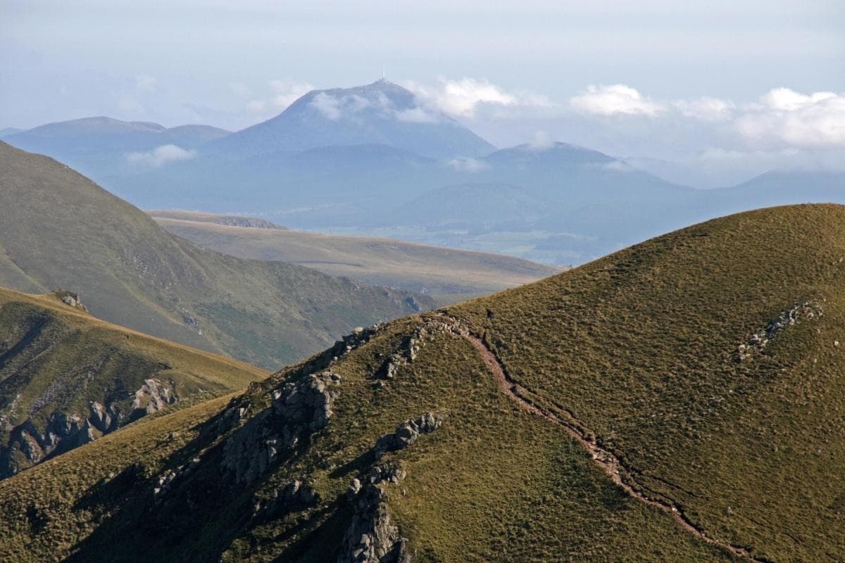
The wind on Montagne Noire arrives with a kind of purpose: it moves through chestnut groves, rakes pine needles off ancient schist slabs, and pushes low cloud across ridgelines where you can stand and watch the plain of Toulouse fold into the distant Pyrenees. On a clear morning the summit—marked by the squat silhouette of a radio mast and a scatter of cairns—feels like a natural amphitheater. Below, valleys seam together into rivers that go their separate ways; above, the air is a little thinner, a little cleaner, the kind of quiet that encourages you to walk slower, breathe deeper, and notice details you missed in the city.
Montagne Noire—literally the Black Mountain—is the dark, forested shoulder of southern France’s Massif Central, an abrupt, compact spine rising to Pic de Nore (about 1,210 meters). Geologically, it reads like a short chapter in a very old book: hard metamorphic schists and granite exposed and scoured over eons, a landscape shaped by uplift and erosion that now hosts a mosaic of beech, oak, pine, and chestnut. This geology gives the trails personality; one moment your boots are on packed forest loam, the next you’re skirting flagstone ribbons that keep a thousand tiny fossils hidden in their seams.
History here is understated but tangible. Small towns on the mountain’s flanks—Mazamet, Castres, Revel—grew on trade routes and textile mills, their lives threaded to rivers that begin in these slopes. For centuries Montagne Noire was a borderland of languages and loyalties: Occitan shepherding traditions, Cathar-era refuges hidden in gorges, and a rural culture that still marks the seasons with harvest fairs and chestnut festivals. Today the area belongs in part to the Parc naturel régional du Haut-Languedoc, which helps preserve the mountain’s woodlands and watercourses while supporting low-impact recreation.
What hikers and day-trippers come for is both immediate and slow-acting: short, layered hikes that reward attention. From forest tracks that rise gently for 300–600 meters, to steeper scrambles up ridgelines, routes vary in tone more than in technical demand. A classic day loop to Pic de Nore is roughly 10–14 km with 600–800 meters of elevation gain depending on the chosen approach—hard enough to feel earned, not so hard you miss the scenery. Trails switch from shaded singletrack to exposed ridges; on some high, open sections the wind will insist you tuck a layer into your pack. Mountain biking is common—expect forestry roads and smooth singletrack options—and there are spots wide enough for small bivouacs if you plan an overnight under the seagrass of stars.
The Montagne’s rivers personify intent: streams rush down gorges daring you to follow them to hidden pools, while broader watercourses slow and spread into meadowed floodplains that shelter warblers and dragonflies. Birdwatchers and wildlife enthusiasts will notice roe deer, wild boar tracks, and the occasional raptor wheel overhead. In autumn, the mountain’s dark clothing loosens into a patchwork of gold and russet; for photographers and hikers alike, it’s one of the most satisfying transitions in southern France.
Practicality: aim for a day that begins early and ends before sundown. Trails are well-marked in many places but carry a map or GPS—signage is better on main routes than on lesser-used paths. Footing is mostly stable; sturdy trail shoes with good tread will handle the mix of rounded bedrock and forest litter. Summer brings heat in the valleys, but the higher trails hold a breeze; spring and fall offer cool, comfortable hiking but can be wet and muddy. Winter snows are possible at the summit—clear your plans and kit accordingly.
Where to start: many hikes launch from small parking areas near village trailheads—Mazamet and Revel are common bases—though it’s perfectly feasible as a long day trip from Toulouse (about 1–1.5 hours’ drive). A common approach is to follow the forest roads up to a high saddle, then pick a singletrack that climbs to the ridge. On clear days the viewpoint from Pic de Nore slices a panorama across the rolling Languedoc plain to the Pyrenees; when clouds are low, the ridgeline disappears into mist and the forest becomes a place of private discovery.
Timing, weather, and logistics: late afternoon light in autumn and spring is exceptional; aim your summit for golden-hour vistas. Hydration matters—water sources exist but may be seasonal, so carry 1.5–2 liters for a day hike and treat or refill when possible. Mobile signal is intermittent—download maps and emergency info before you head out. Respect private land: many trails cross managed forestry and grazing areas; keep dogs under control and close gates behind you.
Why go? Montagne Noire is the kind of mountain that encourages repeat visits rather than a single box checked. It isn’t the Alps or the Pyrenees in scale, but it’s generous in character: intimate, forested ridges that reward curiosity, a geology that reveals itself underfoot, and a culture that still tastes of slow meals and local wine. It’s an accessible wilderness for people who want an honest mountain day—one that’s both workout and meditation, where the landscape doesn’t overwhelm, but asks you to walk with it.
If you plan it right, a day on Montagne Noire concludes with a descent into a village bistro over cassoulet or grilled trout, or with a quiet night under a wide, clear sky. The mountain will still be there in the morning, its dark shoulders patient and steady, waiting for your next visit.
Trail wisdom
Small choices, better day.
Start early for cooler temperatures and better light
Begin hikes before 9 a.m. to avoid valley heat in summer and catch the best visibility toward the Pyrenees.
Carry map and offline navigation
Mobile signal is intermittent on ridgelines—download maps or bring a paper map and compass.
Layer for wind and shade
Temperatures can change quickly between exposed ridges and shaded beech forests—pack a windshirt.
Respect trail closures and grazing areas
Some forestry operations and pastoral lands require detours—follow signs and close gates.
Local knowledge
Read the place, not just the route.
Watch for native species including Roe deer, Common buzzard.
Keep an eye out for wildlife during the transition between areas and habitats. Respect distance guidelines.
Parts of the range fall within the Parc naturel régional du Haut-Languedoc, which promotes sustainable recreation and protects water sources and forests.
Follow the guide's instructions on size limits, ethical handling, and leave-no-trace practices.
The narrow, ferned Porteilles de la Grave gorge with small cascades. High meadows on the western ridgeline above Mazamet with Pyrenean views
Locally recommended viewpoints and quiet spots known best to local operators.
Montagne Noire has long been a cultural borderland; medieval shepherding and textile industries shaped the small towns of its foothills.
Maritime roots and regional tradition shape the waterways and working coasts.
Seasonal guide
Four versions of the same landscape.
Spring
Best forWildflowers and birding · Cool, quiet hikes · Mountain biking before heat
ChallengesMud on lower tracks · Unpredictable showers
Spring brings fresh growth and comfortable temperatures, but expect wet trails after rains; don’t rely on every stream being dry.
Summer
Best forLonger daylight hours · High-ridge views · Evening stargazing
ChallengesValley heat and sun exposure · Busy weekends
Higher trails are breezy and pleasant, but pack sun protection and start early to avoid afternoon heat in the valleys.
Fall
Best forAutumn color · Crisp hiking conditions · Local harvest festivals
ChallengesShorter daylight · Cooler mornings
Fall is ideal—cool days and vivid foliage—though summits can be chilly; bring a warm layer for late afternoons.
Winter
Best forSnow-dusted vistas · Quiet trails · Short, crisp hikes
ChallengesSnow and ice near summits · Limited services in villages
Winters can bring snow to Pic de Nore; microspikes and winter layers are advised if conditions are icy.
Pack with intention
What to bring.
Good to know
Common questions.
A common round-trip route is about 10–14 km with roughly 600–800 m of elevation gain, depending on the starting point and route.
Plan the edges
The details that make the day easier.
Pic de Nore, the highest point of Montagne Noire, reaches approximately 1,210 meters and offers panoramic views across the Languedoc plain to the Pyrenees.
Occitanie hospitality plays out in village tables—look for cassoulet, grilled trout, chestnut desserts, and small family-run vineyards producing robust local reds.
- Nearest major hub
- Toulouse (1–1.5 hrs). Best access towns: Mazamet, Revel. Summit: Pic de Nore ~1,210 m. Difficulty: moderate. Bring 1.5–2L water and layers.
Respect the Parc naturel régional du Haut-Languedoc guidelines—stay on trails, pack out waste, and avoid disturbing nesting birds and grazed pastures to minimize impact.
Explore by topic
Follow the threads.
Keep exploring
Make the story part of the trip.
Set out from Bass Harbor for a private, customizable day on Blue Hill Bay — lighthouses, puffins, seals, and the chance to feel Acadia from the water. Small groups, local captains, unforgettable views.
In four hours you can move from shaded canyon ferns to wind-scoured coastal ridgelines, guided by someone who knows where the light—and the hidden views—live. This private half-day hike on the Monterey Peninsula or Big Sur is compact, curated, and perfect for travelers who want depth without a multiday commitment.
 Related story
Beneath a sky of shifting light, Skaftafell’s ice reads like a map of time. This three-hour guided glacier hike mixes technical instruction with geology and culture: compact, safe, and unforgettable.