
What the day feels like
You arrive in Munnar on a road that strips away the last of the lowland humidity and replaces it with a clean, dry kind of air that seems to catalog everything it touches. Tea terraces ripple off into misty valleys, and the scent of crushed cardamom and wet earth follows every turn. At the Rajamala gate the tarmac ends and a ranger booth marks the start of a place that feels less like a tourist stop and more like a staged entry into a different climate—one where the hillocks breathe and the grasslands move with a velocity all their own.
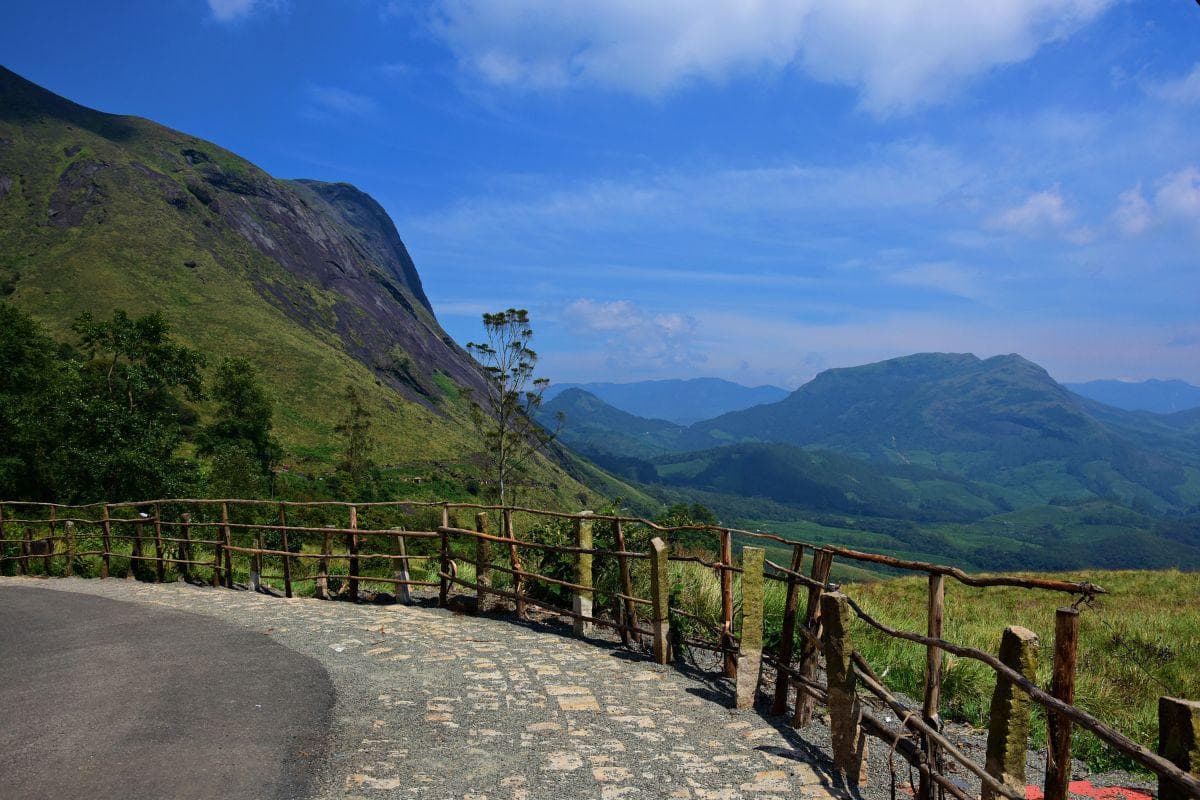
Eravikulam National Park sits like a crown on these hills, a protected patchwork of shola forests and high-elevation grasslands carved into the southern edge of the Western Ghats. Spread across roughly 97 square kilometers, its boundary brushes against Anamudi—the highest peak in South India at 2,695 meters—making the park both a sanctuary for wildlife and a weather machine that sculpts the seasons. You’ll feel the elevation in your chest: mornings are brittle and clear, afternoons can vanish into cloud, and the terrain changes from dense rhododendron-thick forest to open, wind-buffed plateaus where the Nilgiri tahr graze.
History and geology here pull from two different sources. Geologically, the Western Ghats are an ancient range of folded mountains; the ridgelines and rock outcrops of Eravikulam were shaped by millennia of uplift and erosion, leaving behind the unique shola-grassland mosaic you see today. Culturally, Munnar’s story is written in tea. British planters converted vast swathes of forest to estates in the 19th and early 20th centuries; the plantations that roll out beneath the park’s cliffs are a living legacy of that era. The National Park itself was set aside to protect the fragile upland ecosystem and its signature species—the Nilgiri tahr—from hunting and habitat loss.
The park’s most magnetic inhabitants are the Nilgiri tahr: a stocky, goat-like ungulate with a curved back and a wary stare. Where they cluster on rocky ledges, other species follow—the shy sambar deer, barking deer, and occasional packs of langurs. The vegetation alternates between banked sholas—stunted evergreen pockets tucked in valleys—and the grasslands that crown ridgelines. This contrast makes Eravikulam exceptionally biodiverse and visually dramatic: the forest pockets are velvet-dark; the grasslands are wind-swept and silver in the sun.
If you time it right, there’s another show: Neelakurinji (Strobilanthes kunthiana), a lavender bloom that carpets the hills roughly every 12 years. When it flowers, the slopes turn an otherworldly purple—a phenomenon that drew pilgrims, painters, and a sudden swell of visitors in previous cycles.
Practicalities matter here. Visitor access is controlled—tickets are issued and a park shuttle usually ferries people to the main viewing areas—to minimize impact. Trails range from easy, interpretive loops to more earnest scrambles that require permits. Anamudi itself is strictly regulated; attempts to summit without permission are both illegal and dangerous. For most visitors, the Rajamala trail and the viewpoint loop deliver the essentials: close Nilgiri tahr encounters, sweeping views over the tea estates, and a compact taste of the shola-grassland ecosystem without committing to multi-day trekking.
Timing makes the trip. The air is clearest in the dry months—December through February—when dawn light is sharp and visibility stretches to distant ridgelines. The monsoon (June–September) brings drenching rains and leeches; trails get sloppy and many services scale back. Shoulder months—October to November and March to May—offer warm sunlight and fewer crowds, though the midday heat can be surprisingly intense on open grasslands.
On the practical side, pack for layers and for a hike that alternates between soft leaf-litter and rocky ground. Expect steep steps cut into the earth, sudden exposures to wind, and a need for steady footwear. Bring water and snacks even if you plan on the short loop; ranger booths and kiosks sell tickets and information, but services beyond that are minimal. Keep a respectful distance from wildlife—the Nilgiri tahr are used to seeing people but will not hesitate to bolt—and avoid straying off marked tracks.
Eravikulam rewards patient observation. Sit quietly on a cairn of rocks and watch a tahr herd pick its way across the skyline, ears flicking like small flags. Catch the light when it slices through a shola canopy and turns dew into a constellation. Walk the boundary where tea estates end and wildland begins and feel the slight, comforting edge of human history dissolve back into geology.
This is not the place of adrenaline-fueled scrambling, but it is a terrain that asks for attention. It is best experienced slowly: with a morning spent watching wildlife and learning about conservation from a local ranger, an afternoon tasting roadside tea at a plantation, and a slow, cool evening back in Munnar absorbing the sunset above the valleys.
For travelers who want wildlife, wide views, and a deep sense of the Western Ghats’ ecological importance, Eravikulam is a compact, accessible, and unforgettable destination. It is both refuge and reminder—that these hills, and the species that depend on them, need protection, patience, and the measured footsteps of responsible visitors.
Trail wisdom
Small choices, better day.
Start at first light
Arrive early to catch wildlife activity and clear views before clouds build; parking and park buses fill up by mid-morning.
Layer for changeable weather
Temperatures can drop suddenly on the ridgelines; bring a windproof layer and a warm mid-layer even on warm days.
Stay on designated paths
The shola-grassland ecosystem is fragile—stay on marked trails to avoid trampling sensitive vegetation.
Bring water and snacks
There are limited services inside the park; pack at least 1–1.5 liters of water and energy snacks for the loop.
Local knowledge
Read the place, not just the route.
Watch for native species including Nilgiri tahr, Sambar deer.
Keep an eye out for wildlife during the transition between areas and habitats. Respect distance guidelines.
Eravikulam protects fragile shola-grassland mosaics; park management limits visitor numbers and routes to reduce habitat disturbance and support species recovery.
Follow the guide's instructions on size limits, ethical handling, and leave-no-trace practices.
Pothamedu Viewpoint—terraced tea views with fewer crowds. Mattupetty Dam and Echo Point—close-by spots with boating and panoramic vistas
Locally recommended viewpoints and quiet spots known best to local operators.
The Munnar region was developed as a British summer retreat with extensive tea plantations; the park was set aside to protect upland habitats and endemic species.
Maritime roots and regional tradition shape the waterways and working coasts.
Seasonal guide
Four versions of the same landscape.
Spring
Best forWildlife viewing · Cool hikes · Post-monsoon greenery
ChallengesUnpredictable showers · Muddy sections early in season
March–May brings warming days and clear mornings; trails are green after the monsoon but can be wet in places.
Summer
Best forOff-peak travel · Lush post-monsoon blooms
ChallengesMonsoon rains (June–September) make trails slippery and can limit access
The main monsoon months can be heavy—expect leeches, closed viewpoints, and limited ranger services.
Fall
Best forClear vistas · Nilgiri tahr sightings
ChallengesTourist crowds increase around festival periods
October–November is a strong window: clear skies, stable trails, and dramatic valley light for photography.
Winter
Best forCrisp visibility · Photography · Wildlife during cooler hours
ChallengesCold mornings require warm gear · Shorter daylight hours
December–February is peak for clear, cold mornings and the best overall visibility of the year.
Pack with intention
What to bring.
Good to know
Common questions.
Eravikulam is about 10–15 km from Munnar town; taxis and local buses run regularly, and many visitors arrange a morning transfer through their hotel or a local guide.
Plan the edges
The details that make the day easier.
Neelakurinji (Strobilanthes kunthiana) blooms in the high Western Ghats roughly every 12 years—when it flowers the hills around Munnar turn a striking blue-purple.
Munnar’s cafes pour strong, locally grown tea and roadside stalls sell spiced snacks; venture into town for Malabar-influenced Kerala dishes and freshly roasted cardamom.
- Location
- Rajamala, 10–15 km from Munnar; Hours: gates open early—arrive at opening for best wildlife viewing; Access: regulated entry with park buses; Best time: Dec–Feb for visibility.
Stick to marked trails, carry out all trash, and use local guides and services to help support conservation efforts and community livelihoods.
Explore by topic
Follow the threads.
Keep exploring
Make the story part of the trip.
Set out from Bass Harbor for a private, customizable day on Blue Hill Bay — lighthouses, puffins, seals, and the chance to feel Acadia from the water. Small groups, local captains, unforgettable views.
In four hours you can move from shaded canyon ferns to wind-scoured coastal ridgelines, guided by someone who knows where the light—and the hidden views—live. This private half-day hike on the Monterey Peninsula or Big Sur is compact, curated, and perfect for travelers who want depth without a multiday commitment.
 Related story
Beneath a sky of shifting light, Skaftafell’s ice reads like a map of time. This three-hour guided glacier hike mixes technical instruction with geology and culture: compact, safe, and unforgettable.