The Whitefish Trail Hootenanny in Montana delivers a satisfying blend of challenge and beauty, inviting hikers into rugged forest landscapes and scenic valley overlooks. Discover practical details and firsthand insight to plan your adventure along this dynamic 4.5-mile loop that’s made to test and inspire.
Gear Up With Good Footwear
Traction is crucial on the mix of rocky and root-covered trail surfaces. Invest in hiking boots with solid ankle support to handle the undulating terrain safely.
Stay Hydrated
Carry at least two liters of water; the elevation gain and forest humidity can increase dehydration risks on this mid-length hike.
Early or Late Starts Are Best
Avoid the midday sun and enjoy more vivid forest colors and wildlife activity with a morning or late afternoon hike.
Use Trail Markers & Maps
Several junctions can lead off-track. Keep a map or GPS app active and follow the orange markers to stay on course.
Whitefish Trail Hootenanny: Your Gateway to Montana’s Rugged Forest Adventure
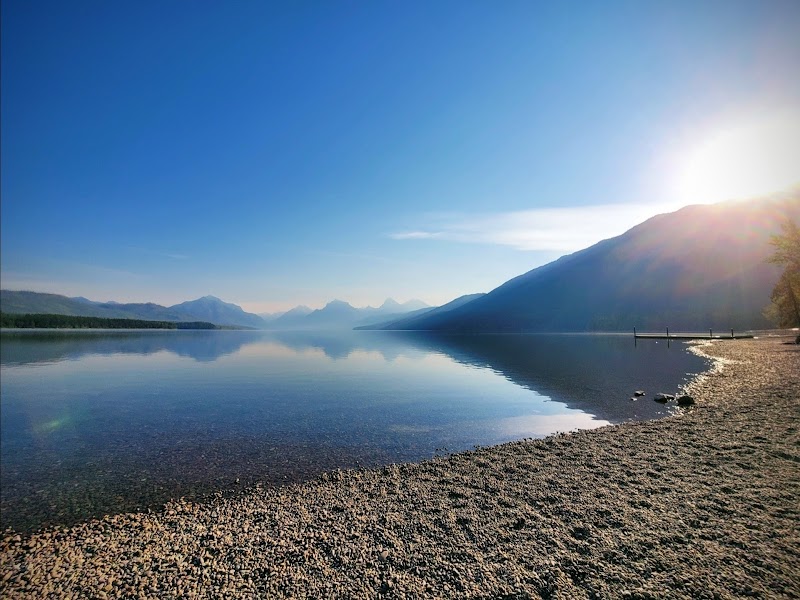
Stretching over 42 miles of well-maintained paths and singletrack, the Whitefish Trail offers plenty of options for every level of hiker, but the Hootenanny segment stands out as a robust introduction to the area’s fierce natural character. Starting just outside Whitefish, Montana, the Hootenanny invites you into a landscape where the forest shakes the earth underfoot and the wind whistles through cedar and pine like a call to action. This 4.5-mile loop packs a punch with roughly 750 feet of elevation gain, demanding steady legs but rewarding with crisp mountain air and sweeping valley views that command respect rather than awe.
The terrain is a blend of compacted earth and granite cobbles, threaded with roots that challenge your footing and remind you this is nature, uncompromising and alive. Creek crossings dare you to test your balance, their waters pushing forward with quiet insistence. Expect forest paths lined with huckleberry bushes and thickets of red osier dogwood, which seem to lean in, watching your progress as you move deeper into the wild. The trail’s midpoints reveal open meadows where sunlight bursts through the canopy, warming stone outcrops that invite brief rests and keen observation of alpine birds on the wing.
Practicality is key here. Sturdy hiking boots with good tread are essential — sneakers will quickly feel the sting of uneven ground. Bring at least two liters of water; the trail’s invigorating climb will push your hydration needs higher than you might guess. Timing your hike for morning or late afternoon not only beats the midday sun but also enhances the mood: morning mist clings to pine needles, and the late light sharpens textures in the underbrush.
Navigating the Hootenanny is straightforward, but keep your map app handy; several intersecting trails offer tempting detours but can confuse first-timers. Watch for trail markers, dusted in vibrant orange, which stand firm against wind and rain. This hike isn’t about conquering the mountain but dialoguing with its fiercely distinct personality — the creaks of ancient trees, the hurried whispers of a chipmunk, the subtle scrape of your boots carving out a track through earth that’s been here long before you.
Whether you’re pushing for fitness or moving at a reflective pace, the Whitefish Trail Hootenanny holds something genuine. It strips away the noise of the everyday and replaces it with the simple, unfiltered presence of wilderness. Coming prepared means you get to stay present, meet the trail on its terms, and leave with your boots heavy but your spirit lighter.
Nearby Trips
All Adventures
Boat Charters
Water Activities
Adventures near Whitefish, Montana
Discover the unique and memorable adventures that make Whitefish, Montana special.
Frequently Asked Questions
What wildlife might I encounter on the Hootenanny trail?
The trail is home to deer, red squirrels, and a variety of birds including Steller’s jays and mountain chickadees. You might also spot signs of black bears, so stay alert and make noise when hiking.
Are dogs allowed on the Whitefish Trail Hootenanny?
Yes, dogs are welcome but must be kept on a leash to protect local wildlife and trail users. Always bring waste bags to maintain trail cleanliness.
Is the trail suitable for mountain biking or horseback riding?
While sections of the wider Whitefish Trail system allow mountain biking, the Hootenanny loop is primarily designed for hiking and trail running due to its technical terrain and narrower paths.
Where can I find lesser-known viewpoints or features on this trail?
Near the midpoint meadow, veer slightly off the path northwest to discover a rocky outcrop with panoramic views of Whitefish Valley, often missed by casual hikers.
What is the historical significance of the area surrounding the Whitefish Trail?
This land was historically inhabited by the Kootenai and Salish peoples. The trail passes near old trade routes and natural resource sites important to indigenous cultures.
Are there any environmental concerns I should be aware of before hiking?
The area is undergoing active habitat restoration to preserve native plant species and prevent erosion. Stick to marked trails to minimize your impact on sensitive areas.
Recommended Gear
Sturdy Hiking Boots
Provide essential ankle support and traction for rocky, root-laden sections of the trail.
Hydration System
Necessary for maintaining electrolyte balance and stamina during warmer weather and exertion.
Layered Clothing
Allows adjusting to fluctuating temperatures common in the mountain environment.
Trail Map or GPS Device
Helpful for navigating junctions and staying on course throughout multiple intersecting trails.
Local Insights
Hidden Gems
- "Mid-trail meadow overlooking Whitefish Valley"
- "Quiet side paths with wild huckleberries"
- "Rock ledge west of the trail ideal for sunrise views"
Wildlife
- "Black bears"
- "Mountain lions (rare sightings)"
- "Steller’s jay"
- "Mountain chickadee"
- "Red squirrels"
History
"The Whitefish region’s forests were once traversed by indigenous tribes for hunting and trading. Later, the area played a role in logging and conservation history, with the trail built to reconnect people to these lands sustainably."