The Lost Coast Trek: Navigating California’s Untamed Shoreline
The Lost Coast Trek offers a rare chance to walk California’s most untouched shoreline, where rocky cliffs clash with the Pacific and ancient forests hold deep secrets. This guide equips hikers with essential knowledge to navigate terrain, tides, and wilderness for an unforgettable coastal adventure.
Plan Around Tides
Crossing certain beach sections is only safe at low tide. Check tide charts daily to avoid being stranded or forced onto dangerous cliff paths.
Carry Ample Water
Fresh water sources are scarce along the route. Bring at least 3 liters per day and a reliable water filter or purification tablets.
Wear Durable Footwear
Expect wet rocks, mud, and rough terrain. Waterproof hiking boots with solid tread provide stability and comfort over varied surfaces.
Prepare for Limited Cell Service
The Lost Coast is remote with little to no phone coverage. Carry a map, compass, or GPS device and inform someone of your route and schedule.
The Lost Coast Trek: Navigating California’s Untamed Shoreline
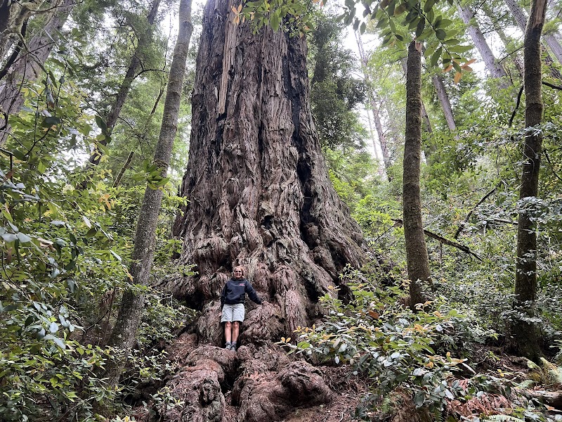
Stretching roughly 25 miles from the rugged cliffs of Shelter Cove to the windswept beaches near Mattole Beach, the Lost Coast Trek is a raw encounter with California’s wildest shoreline. This trek demands respect; the landscape is fiercely itself—untamed, isolated, and wildly beautiful. Expect a mix of forested trails where redwoods lean in like old guardians and coastal paths where the Pacific Ocean dares you with crashing waves and shifting sands.
The route’s terrain is varied: rocky headlands, slippery seaweed-strewn beaches, and steep climbs with a cumulative elevation gain of about 3,000 feet. Each step alternates between dense forests humming with cicadas and open coastal ridges offering panoramic ocean views that sweep all the way to the horizon. Ravens wheel overhead, their calls carried by the sea breeze, while the tide testily pushes against your path at low points.
Planning this trek means preparing for true backcountry conditions. Water is scarce and unpredictable, so carrying at least three liters each day is non-negotiable, along with purification tools. Footwear must be rugged and waterproof, ready for wet rocks and muddy patches. Keep an eye on tides; some beach stretches only open during low tides, requiring careful timing and tide charts.
Camping along the trail requires permits and a readiness to embrace minimal facilities—this is a place where nature leads, and conveniences fade. Early mornings reward hikers with misty coastal sunrises, while evenings bring brisk ocean winds and starry skies unhindered by city lights.
For logistics, Petrolia is the nearest town offering basic supplies and lodging—a quiet gateway before entering the wild edge of the Lost Coast. The trek usually takes three to four days, giving ample time to engage with the landscape without rushing.
Expect challenges. Slippery rocks demand steady footing; sudden coastal fog tests navigation skills. But the payoff is profound: a genuine sense of solitude, a land pushed to the edge, still governing itself with relentless energy.
This is not a casual stroll; the Lost Coast calls to those who have the readiness to move steadily, observe closely, and welcome a shoreline that’s fiercely alive and unapologetically wild.
Nearby Trips
All Adventures
Boat Charters
Water Activities
Adventures near Petrolia, California
Discover the unique and memorable adventures that make Petrolia, California special.
Frequently Asked Questions
Do you need a permit for camping on the Lost Coast?
Yes, camping requires a permit from the California Department of Parks and Recreation. Permits help regulate the limited sites and preserve the environment.
How difficult is the Lost Coast Trek?
The trek is challenging due to rugged terrain, elevation changes, and the need to time tide crossings. Fitness, preparation, and backcountry skills are necessary.
Are there reliable water sources along the trail?
Water is limited and seasonal. Some small streams flow in spring, but in drier months you must carry your own supply and know how to purify natural sources.
Is the Lost Coast suitable for solo hikers?
Solo hikers can tackle it with experience in remote wilderness travel. Communication devices and thorough planning are essential to safety.
What wildlife can I expect to see?
Watch for black-tailed deer, river otters along the shore, coastal birds like ravens and pelicans, and possibly black bears in more forested sections.
What time of year is best to hike the Lost Coast?
Late spring through early fall offers the most stable weather and accessible trails. Avoid winter due to storm risks and hazardous conditions.
Recommended Gear
Waterproof Hiking Boots
Protect feet on wet rocks and muddy terrain, providing support during steep ascents and descents.
Water Filtration System
Ensures access to safe drinking water when natural sources are ephemeral or uncertain.
Tide Chart / Tide App
Crucial for planning beach crossings and avoiding dangerous tides.
Layered Clothing
Adjust for changing temperatures and coastal winds; moisture-wicking base layers paired with windproof shells work best.
Local Insights
Hidden Gems
- "Black Sands Beach Tide Pools"
- "Shipman Creek Overlook"
- "Hidden forest groves near Needle Rock"
- "Ancient buried terraces along Usal Beach"
Wildlife
- "Northern Spotted Owl"
- "Pacific Giant Salamander"
- "Harbor Seals sunning on coastal rocks"
- "Migrating humpback whales visible offshore"
History
"The Lost Coast was home to the Wiyot and Sinkyone Tribes, whose connection to the region is deep and ongoing. Remnants of old logging towns dot parts of the interior, telling stories of early industrial impacts."