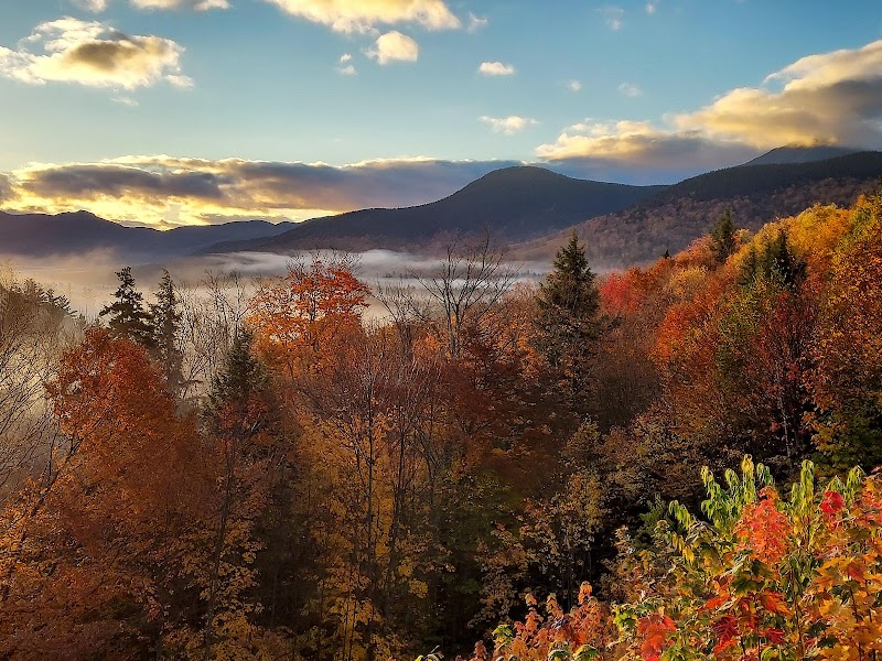
Scenic Backpacking Beyond Crawford Notch: Exploring the Presidential Range Trails
Venture beyond the well-traveled paths of Crawford Notch to discover the Presidential Range’s most scenic backpacking routes. These trails combine challenging terrain with sweeping views, inviting hikers to experience New Hampshire’s wild heart with both excitement and preparedness.
Hydrate Smartly and Often
Carry a lightweight water filter and refill from fast-moving mountain streams; they push you forward and keep you refreshed, but always purify before drinking.
Wear Supportive, Weather-Ready Footwear
Choose boots with strong ankle support and good traction to handle mossy rocks and wet, uneven terrain; invest in breathable materials to prevent overheating.
Start Early to Beat Afternoon Showers
Weather in the Presidential peaks can shift rapidly—begin hiking before dawn to enjoy cooler temperatures and reduce exposure to afternoon storms.
Prepare for Exposure on the Ridge
Bring wind-resistant clothing and sun protection where paths crest near summits; the wind here has a personality of its own, testing your resilience.
Scenic Backpacking Beyond Crawford Notch: Exploring the Presidential Range Trails
Stretching northward from the rugged Crawford Notch, the Presidential Range invites backpackers to engage with a landscape both challenging and richly rewarding. Beyond the more crowded routes, these trails unfold in varied textures—from dense northern hardwood forests to high-alpine zones where wind and weather craft a landscape fiercely itself. Your journey moves alongside streams daring you forward, across rocky ridges that demand steady footing, and onto summit views that stretch toward New Hampshire’s raw horizon.
Start with the Glen Boulder Trail to the Gulfside Trail loop, a demanding 12-mile trek offering a 3,500-foot elevation gain. The trail ascends steadily through forest coated in moss and ancient pines, converging at the Gulfside Trail—a ridge path with constant panoramic encounters across the Presidential peaks. The terrain tests your balance and endurance, with sections of exposed rock and occasional scree where caution is key.
Another option is the Kilkenny Ridge Trail, a quieter, 9-mile passage gaining roughly 3,000 feet elevation, which weaves through spruce-fir forests before unfurling spectacular views near Mount Waumbek and Mount Cabot. Its solitude contrasts the busier southern circuits, providing moments to connect deeply with the wilderness.
Preparation is essential. Hydration strategies include filtering water from mountain streams that pulse energetically, but always ensure your system is reliable. Footwear should be rugged yet breathable, ready for both wet moss and abrasive granite. Timing-wise, early fall brings stable weather and fewer crowds, while spring requires vigilance against residual snow and soggy underfoot conditions.
These trails are more than routes; they are dynamic engagements with terrain shaped by wind and water. Respect the effort each step demands and stay alert to shifting weather that the range enacts without warning. Each summit unveils not just views but moments earned, offering a sense of achievement balanced by an appreciation for the mountain’s persistent character.
Backpacking beyond Crawford Notch in the Presidential Range offers a blend of rigorous physical challenge and inspiring natural beauty. Whether winding through whispering forests or climbing toward the open sky, these trails offer reliable adventure and caution in equal measure.
Nearby Trips
All Adventures
Boat Charters
Water Activities
Adventures near North Conway
Discover the unique and memorable adventures that make North Conway special.
Frequently Asked Questions
Are the trails beyond Crawford Notch well-marked and safe for solo hikers?
While main routes like the Glen Boulder and Kilkenny Ridge Trails are marked, more remote sections can be less defined. Solo hikers should have solid navigation skills, a map, compass, or GPS, and let someone know their itinerary.
What wildlife might I encounter in this section of the Presidential Range?
Expect to see white-tailed deer, red squirrels, and a variety of birds like warblers and thrushes. Bears are present but usually avoid hikers; secure food properly and remain alert.
Is camping allowed along these backpacking routes?
Designated camping areas exist, particularly near Gulfside and on Mount Cabot’s approaches. Overnight permits may be required; check with White Mountain National Forest regulations before planning your trip.
How much water should I carry for these hikes?
Carry at least 2 liters at start and refill whenever possible from fresh streams, filtering on the spot. The Presidential Range’s currents rarely stand still, but always purify before drinking.
Are there any significant historical sites near these trails?
The Presidential Range has a rich history tied to early American forestry and mountain warfare training during WWI. Some trail areas include remnants of old logging roads and early 20th-century cabins.
What is the best way to avoid afternoon thunderstorms on summer hikes?
Begin hiking early in the morning and plan to be off exposed ridges by early afternoon. Always carry waterproof layers and be ready to seek shelter if storms develop.
Recommended Gear
Water Filter System
Essential for safe hydration from mountain streams that constantly push water along your route.
Sturdy Hiking Boots
Critical for support and grip on slippery, uneven ground and exposed ridge sections.
Layered Clothing
Protects against temperature changes and wind exposure, particularly on ridges during colder months.
Daylight Headlamp
Helpful for early starts or late finishes as daylight lengthens or shortens during spring and fall.
Local Insights
Hidden Gems
- "An overlooked viewpoint on the Kilkenny Ridge trail offers quiet sunrise views without the usual crowd."
- "The glacial boulder field near Glen Boulder trail’s higher elevations exposes ancient rock formations rarely discussed."
Wildlife
- "Black bear"
- "White-tailed deer"
- "Pine marten"
- "Various migratory songbirds"
History
"Logging shaped much of the lowland forest before conservation efforts preserved this wilderness. Trails often follow old logging roads that hint at the region’s economic past."

