Coronado National Memorial offers hikers a powerful blend of rugged terrain, history, and views that stretch boldly into Mexico. Just outside Nogales, Arizona, this trail invites adventurers to explore a landscape defined by sharp contrasts and quiet resilience.
Start Early to Beat the Heat
Begin your hike before 9 a.m. to avoid the intense midday sun typical of Arizona’s desert climate, especially in summer months.
Wear Sturdy Footwear
Trail surfaces are rocky and uneven; hiking boots with good ankle support will help prevent injury and improve stability.
Carry More Water Than You Think
There are no water sources on the trail, so bring at least 2 liters per person, adjusting for temperature and exertion levels.
Use a Trail Map or GPS
Mobile coverage is unreliable; an offline map or a GPS device ensures you stay on course and helps you locate viewpoints easily.
Crossing Horizons: Hiking the Coronado National Memorial with Views into Mexico
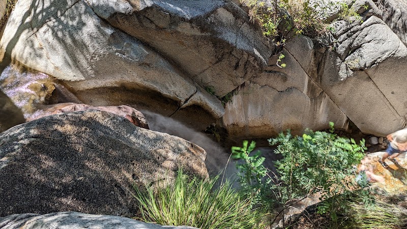
Rough-edged and quietly imposing, Coronado National Memorial demands a sturdy pair of boots and an open mind. Located just south of Nogales, Arizona, this rugged foothill park offers an adventure that’s as much about the terrain as it is about its history and sweeping views. The key trail, the 1.5-mile Arizona Trail segment here, presents steady elevation gain through pine and juniper, winding over rocky soil that presses your footing firm against the earth’s grip. The path draws you upward, where the Arizona sky blooms wide, and the border spines out below, a subtle but powerful reminder of the geography’s human complexity.
As you ascend, wind teases the dry branches to whisper stories from across the border. Trees and scrub work like watchful guardians, holding their ground under the sun’s watchful eye. The air carries a hint of juniper sharpness and desert warmth, daring hikers to press on with steady steps. At the summit outlook, the panorama opens wide: rolling hills fade into the rugged expanse of northern Sonora, Mexico, where the land folds and layers in every shade of brown and green.
The trail is moderate but demands respect. The switchbacks can test ankles and lungs alike, with about 750 feet of elevation gain in just under two miles roundtrip. Trails can be loose and uneven, so solid hiking shoes are a must. Morning or late afternoon hikes avoid the mid-day blaze, when desert heat pushes its limits. Hydration is non-negotiable here; water sources are nonexistent, so carry ample fluids and a hat to guard against the sun’s push.
Weather plays a quiet but impactful role. The dry heat and sharp sun of summer require early starts and extra sun protection. Winter often chills the higher reaches, while spring brings a breath of renewal with mild temperatures and the chance to spot wildflowers peeking through rocky cracks. Fall’s cooler days invite longer explorations, with fewer crowds but a reminder that the trail’s dry terrain can still surprise the unwary.
Beyond the physical challenge, Coronado National Memorial offers a chance to connect with the land’s layered past—from the expedition of Francisco Vásquez de Coronado in the 16th century to the present-day borderland vigilance. The area’s sparse signage preserves a sense of wild openness, where the boundary is felt more than seen.
Before you embark, ensure your pack has sturdy water containers, sun protection, and a map or app with offline GPS. Mobile coverage is spotty, and the landscape demands your full attention. The trail intersects with historic sites and quiet overlooks, each a reminder that this land is fiercely itself: a meeting ground for cultures, climates, and the patient forces of nature.
Nearby Trips
All Adventures
Boat Charters
Water Activities
Adventures near Nogales, Arizona
Discover the unique and memorable adventures that make Nogales, Arizona special.
Frequently Asked Questions
How long is the main hiking trail in Coronado National Memorial?
The primary hiking route, part of the Arizona Trail, is roughly 1.5 miles one-way with around 750 feet of elevation gain, typically taking 1.5 to 2 hours roundtrip.
Is the Coronado National Memorial trail suitable for beginners?
The trail is rated moderate due to elevation and rocky terrain, making it appropriate for hikers with basic fitness and some experience on uneven paths.
Are there any water sources available on the trail?
No, the trail lacks natural water sources, so hikers must bring sufficient water for their entire hike.
Is the trail pet-friendly?
Pets are allowed but must be leashed. Remember that temperatures can get very high, and the rocky terrain can be tough on paws.
What wildlife might be encountered on this trail?
Visitors might spot mule deer, various bird species including hawks and jays, and smaller mammals like rock squirrels. Be mindful and keep a safe distance.
Is there any cell phone signal on the trail?
Cell reception is spotty to non-existent in parts of the trail, so download maps and prepare for limited connectivity.
Recommended Gear
Hiking Boots
Provides necessary ankle support and traction for the rocky, uneven trail surface.
Hydration Pack or Water Bottles
Critical for carrying sufficient water as no sources are available on the trail.
Sun Protection (Hat, Sunscreen)
Shield your skin and head from intense sun exposure during midday hikes.
Light Layered Clothing
Helps manage variable temperatures and wind, especially in cooler seasons.
Local Insights
Hidden Gems
- "Vista Point near the upper trail provides a quieter overlook with clear sightlines into Mexico."
- "The Coronado Cave, accessible via a short detour, offers a glimpse into the geology of the region."
Wildlife
- "Look for the white-tailed deer at dawn and dusk."
- "Birders can spot the elegant Harris’s hawk soaring along the ridge."
History
"Named after Spanish explorer Francisco Vásquez de Coronado, the memorial commemorates his 1540 expedition—which crossed these borderlands in search of mythical cities."