Navigating Sevier County’s Storm Aftermath: Flooding, Landslides, and Road Closures
Heavy rains in Sevier County, Tennessee, have triggered flooding, landslides, and multiple road closures, including the crucial Gatlinburg Bypass. Travelers and outdoor enthusiasts need practical updates and safety tips to navigate these shifting conditions and still safely experience the rugged beauty of the region.
Monitor Road Closures Continuously
Roads can shut without much notice during severe weather; regularly check the Sevier County EMA and Great Smoky Mountains National Park updates before heading out.
Pack Rain-Resistant Gear
Expect wet conditions—waterproof jackets, shoes, and protective covers for electronics are crucial to stay comfortable and safe.
Plan for Detours and Extra Travel Time
With several roads closed, drive times will increase. Have alternative routes planned and remain flexible with your schedule.
Use Sturdy Footwear with Good Traction
Slippery, muddy terrain demands hiking boots or shoes designed to handle challenging grip conditions to avoid accidents.
Navigating Sevier County’s Storm Aftermath: Flooding, Landslides, and Road Closures
Sevier County, Tennessee, faces a formidable showdown as relentless heavy rains unleashed flooding, landslides, and widespread road closures. The earth here is fiercely alive, shifting and pushing back with every downpour, reminding adventurers and residents alike that nature commands respect. By late morning, the Sevier County Emergency Management Agency issued urgent updates confirming closures on key roads—Wiley Oakley Drive/Sunset Lane, Ridge Road near the Compost Plant, and Burden Hill Road/Eastgate Road—each swamped by rising waters or debris.
The tension escalates further at the Gatlinburg Bypass, a vital artery for travelers near the Great Smoky Mountains National Park. Here, a significant landslide swept across the road, blanketing it in mud and uprooted trees, effectively cutting off access until conditions stabilize. The park authorities and county officials have made it clear: this closure remains indefinite, leaving a scar across the familiar mountain passage. These disruptions are not only logistical hurdles but sharp reminders of the intense force water and earth wield in these mountains.
For adventurers planning trips through Sevier County, these current conditions require flexibility and preparedness. Roads that normally connect quaint neighborhoods, trailheads, and scenic routes are either impassable or seriously compromised. Travelers must account for detours and delays, keeping updated via Sevier County EMA bulletins or the Great Smoky Mountains National Park communications.
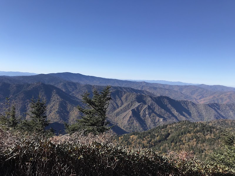
Yet, amid this challenge, the region’s wild, rugged beauty presses forward. The swollen rivers dare you with their powerful currents, the saturated forestgrounds echo the crack of shifting soil, and the fog-thickened mountain slopes feel more elemental than ever. It's a landscape fiercely itself, demanding vigilance but offering its characteristic awe for those equipped and informed.
Practical considerations include carrying waterproof gear and sturdy boots, planning alternate routes, and monitoring weather shifts closely. Safety takes precedence, but mobility and awareness can keep the spirit of adventure alive even when nature imposes its own conditions.
The landslide on Gatlinburg Bypass serves as a vivid case study in natural forces at work—earth contracting and expanding, water pushing forward with reckless intent, trees surrendering to gravity’s pull. This area’s topography is no static backdrop but a dynamic challenge to be respected. In these moments, Sevier County transforms from a casual getaway destination to a living, breathing landscape of survival and adaptation.
As you plan your journey here, embrace the pragmatic edge: watch official updates, pack laterally (with rain gear, emergency supplies), and adjust your itinerary with patience. The adventure continues, though altered — a test of resilience in a landscape defiantly wild.
Nearby Trips
All Adventures
Boat Charters
Water Activities
Adventures near Gatlinburg, Tennessee
Discover the unique and memorable adventures that make Gatlinburg, Tennessee special.
Frequently Asked Questions
Which roads in Sevier County are currently closed due to flooding and landslides?
As of the latest updates, Wiley Oakley Drive/Sunset Lane, Ridge Road near the Compost Plant, Burden Hill Road/Eastgate Road, and the Gatlinburg Bypass are closed to traffic due to flooding and a significant landslide.
When is the Gatlinburg Bypass expected to reopen?
The Gatlinburg Bypass remains closed until further notice. Reopening depends on debris clearance and slope stability checks, which can take days or weeks, depending on weather conditions.
Are there safe alternative routes for accessing Great Smoky Mountains National Park?
Yes, visitors should use US Highway 441 or other main roads to enter the park. Always ensure current road conditions via official sources before travel, as some secondary roads may be affected.
What should I do if caught outdoors during sudden flooding or landslide conditions?
Seek higher ground immediately. Avoid crossing flooded roads or streams as currents can be deceptively strong. Call emergency services if stranded or injured.
What wildlife might be more visible after heavy rains in Sevier County?
The lush conditions bring out white-tailed deer, elk in higher park elevations, and various birds like wild turkeys and woodpeckers, drawn to replenished water sources.
Are there any historical sites impacted by these weather events?
Several cultural landmarks and historic trails exist in Sevier County and the Great Smoky Mountains National Park. While none have been reported damaged recently, conditions may limit access, so verify before visiting.
Recommended Gear
Waterproof Hiking Boots
Keeps feet dry and provides traction in muddy, slippery conditions typical after heavy rain.
Waterproof Jacket
Essential for staying dry and maintaining body heat during sudden rainstorms or persistent drizzle.
Portable Weather Radio or Smartphone Weather App
Crucial for receiving real-time weather alerts and emergency updates in a rapidly changing environment.
Walking Stick or Trekking Poles
Helpful for maintaining balance on uneven, muddy terrain and navigating steep or slippery slopes.
Local Insights
Hidden Gems
- "Twin Creeks Trail - Less traveled trail featuring overlooked waterfall views"
- "Greenbrier Picnic Area - A peaceful spot usually quiet even in peak seasons"
Wildlife
- "black bear"
- "white-tailed deer"
- "elk"
- "wild turkey"
History
"Sevier County’s terrain played a key role in early Appalachian settlement and logging history, with remnants of old cabins and mills scattered near some trailheads."