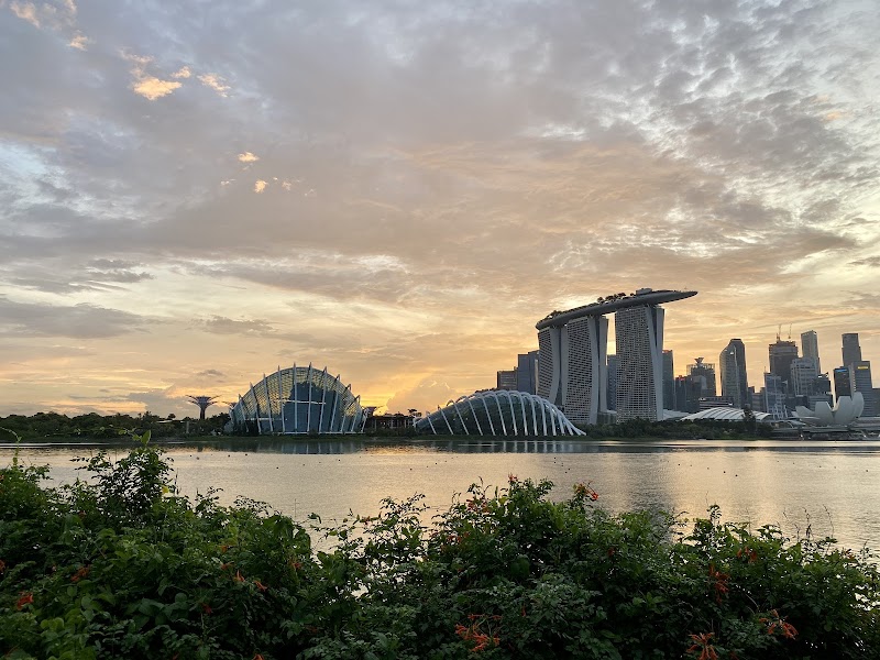
Tracking to Pic de Gleize: Alpine Vistas Above Gap, France
Hike to Pic de Gleize for commanding views over the Alps near Gap, France. Discover a trail that balances natural beauty with a satisfying challenge, offering expansive panoramas that reward every step.
Start Early for Clear Views
Begin your hike in the morning to avoid afternoon fog and enjoy optimal lighting for stunning vistas at the summit.
Footwear Matters
Wear sturdy hiking boots with ankle support to handle rocky and uneven terrain safely.
Hydrate Before and During
Carry at least 2 liters of water as there are no reliable water points after leaving the forest.
Check Weather Forecasts
Mountain weather can change rapidly; plan your hike on clear days to avoid sudden storms and strong winds.
Tracking to Pic de Gleize: Alpine Vistas Above Gap, France
Standing tall above Gap, the Pic de Gleize challenges hikers to rise through forests where pine needles carpet the path and shadows shift with the sun’s slow march. The trail stretches about 8 kilometers round trip with an elevation gain of approximately 600 meters, demanding steady effort over rocky terrain that tests both steadiness and will. Early in your ascent, the forest greets you like a living presence, branches leaning in with a quiet encouragement, while streams nearby seem to murmur, daring you onward.
As you break above the treeline, the alpine air sharpens your senses. The mountains around the Ecrins massif emerge like ancient giants, their jagged peaks cloaked in snow or bathed in sunlight, stretching wide in every direction. This is no casual stroll; the trail is uneven with occasional loose stones and steep sections that require firm footing and focus but reward the effort with sweeping panoramas of the surrounding Alps.
Timing your hike matters. Mid to late morning offers a balance of warmth and clarity, while afternoon shadows begin to pull the landscape into cooler tones. Pack enough water—there’s no reliable source once you leave the forest—and wear shoes with good ankle support; the sporadic scree sections are unforgiving. Weather can shift fast here, with mountain winds that seem to push back against your progress, reminding you that nature is fiercely itself.
At the summit, the world unfurls beneath you in staggering detail. Villages cluster in valleys far below, rivers curve like silver threads, and the horizon presses boldly against the sky. Take a moment to listen: the breeze hums softly, pine trees whisper behind you, and the distant call of alpine birds punctuates the stillness. This viewpoint is an honest encounter with the Alps, one that rewards preparation as much as perseverance.
Heading back, retrace your steps with care—fatigue creeps up just as the terrain demands precise footing. Plan 4 to 5 hours total for the round trip at a moderate pace to fully appreciate the ascent and descent without rush. Pic de Gleize isn’t just a destination; it’s a conversation with the mountains that challenges you to meet their steady pulse with your own.
Nearby Trips
All Adventures
Boat Charters
Water Activities
Adventures near Gap
Discover the unique and memorable adventures that make Gap special.
Frequently Asked Questions
How long is the hike to Pic de Gleize?
The trail is roughly 8 kilometers round trip, with an elevation gain of about 600 meters. Expect to spend around 4 to 5 hours completing the hike at a moderate pace.
Is the trail suitable for beginners?
While the trail is moderate in difficulty, it does involve steep and rocky sections that require sure footing and some hiking experience. Beginners with good fitness can attempt it but should be cautious and well-prepared.
Are there any water sources along the route?
There are no reliable water points beyond the initial forested area, so it’s essential to bring sufficient water for the entire hike.
What clothing is recommended for the hike?
Wear layers appropriate for changing mountain temperatures, including moisture-wicking base layers, a warm mid-layer, and a waterproof outer shell to protect from sudden weather shifts.
Can you see other mountain ranges from the summit?
Yes, the summit offers expansive views of the surrounding Alps, including impressive sights of the Ecrins massif and nearby valleys.
Is there mobile phone coverage on the trail?
Mobile coverage can be spotty above the treeline, so it’s best not to rely on your phone for navigation or emergencies.
Recommended Gear
Hiking boots with ankle support
Provides stability and protection on rocky, uneven terrain.
Water bottle or hydration pack
Critical to stay hydrated—no water sources after the forest stretch.
Light rain jacket
Weather changes quickly; a waterproof layer keeps you dry and warm.
Trekking poles
Helpful for balance on steep or loose sections, reducing fatigue on descent.
Local Insights
Hidden Gems
- "A small nearby viewpoint called Les Crêtes de Gleize offers quieter, intimate perspectives of the valley."
- "Look for alpine wildflowers along the upper trail edges in late spring and early summer."
Wildlife
- "Chamois often graze in higher alpine meadows and may be spotted at dawn or dusk."
- "Golden eagles occasionally soar overhead, adding life to the vast sky."
History
"Pic de Gleize has long been a landmark for local shepherds guiding flocks between alpine pastures, anchoring it in the pastoral traditions of Hautes-Alpes."