Float the Missouri River Breaks: A Journey Through the Lewis & Clark Backcountry
Experience the rugged thrill of floating the Missouri River Breaks, where the river challenges you with shifting currents and towering cliffs. This guide prepares you to navigate Montana’s Lewis & Clark backcountry with essential tips and insights for an unforgettable river journey.
Monitor River Levels Before Launch
Water conditions can change daily due to snowmelt and rainfall. Check USGS river gauges or local ranger updates before planning your trip to ensure safe flow and manageable obstacles.
Pack for Variable Weather
Montana’s weather can swing rapidly, even in summer. Layered clothing, waterproof gear, and sun protection are critical for comfort and safety on the water.
Prepare for Navigation Challenges
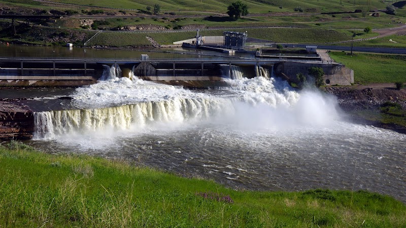
The river is punctuated with hidden rocks and shifting sandbars. A detailed map, GPS, and paddling experience are necessary to safely navigate the Breaks.
Respect Wildlife and Leave No Trace
This stretch supports sensitive species including bison and raptors. Maintain distance, store food securely, and minimize campfire impact during stops.
Float the Missouri River Breaks: A Journey Through the Lewis & Clark Backcountry
The Missouri River Breaks demand respect. Here, the river carves fiercely into Montana’s rugged landscape, daring you to match its unpredictable tempo. Floating through this wilderness is not a gentle drift; it’s a dynamic engagement with a land fiercely itself. As you launch your craft near Fort Benton—the gateway to the Lewis & Clark backcountry—the river’s current begins to push forward, tugging you past towering cliffs, weathered badlands, and whispering cottonwoods.
This is no simple float trip. Stretching roughly 150 miles from Fort Benton to Judith Landing, the Breaks test your endurance and decision-making in equal measure. The river’s flow varies with season and precipitation, shifting sandbars and exposing rocky shoals that require constant attention and skill. Expect to navigate a mix of placid pools and rolling rapids, with the occasional sudden surge that snaps you to alertness.
Elevation changes are subtle on this ride—about 600 feet drop over the entire stretch—but the terrain’s drama comes from the jagged cliffs rising 400 feet above water level and the vast open skies that seem to press down, pushing the river through ancient, slow-moving channels.
The riverbanks are alive: sagebrush and ponderosa pine claim the hillsides while eagles and hawks circle overhead, like guardians sizing up your passage. At night, stars spill across the sky with a brilliance only freed from city lights can offer. Wildlife frequently comes to the shores—bison in the distance, deer slipping into the shadows, the occasional wolf’s call threading the quiet.
Planning is crucial. Water levels change, so timing your launch around steady flow from spring runoff or early summer rains helps avoid dangerous skerries and exposes desirable campsites. Pack sturdy footwear for rocky portages and a reliable water filtration system; the river tempts but does not guarantee safe drinking water. Bring a map, GPS, and know the emergency exit points—cell service is scarce.
Despite its challenges, this float rewards with immersive solitude and history. Following routes tied to Lewis and Clark’s expedition, you trace passages where explorers met the river’s temperament face-to-face. Every bend tells the story of shifting earth and enduring waterways.
For those ready to meet the Missouri River Breaks on its own terms, this float is a raw, brilliant adventure. It’s less about conquering than listening—to the river’s push, the call of wildlife, the hush of ancient hills—as you carve your own path through this unforgettable backcountry.
Nearby Trips
All Adventures
Boat Charters
Water Activities
Adventures near Fort Benton, Montana
Discover the unique and memorable adventures that make Fort Benton, Montana special.
Frequently Asked Questions
Do I need permits to float the Missouri River Breaks?
Permits are required from the Bureau of Land Management (BLM) for overnight camping in certain areas along the river. It’s recommended to check current regulations and obtain permits in advance through the BLM's local office.
What level of paddling experience is required?
A moderate to advanced paddling skill is necessary to handle the river’s variable currents, rapids, and portages. Beginners should not attempt this float without prior experience and possibly a guide.
Where are the best places to launch and exit?
Fort Benton is the primary launch point, with Judith Landing often used as the exit. Both locations have road access and limited facilities. Other access points are remote and require careful planning.
Is cell phone service available along the route?
Cell coverage is very limited to nonexistent in most parts of the Breaks. It’s important to carry satellite communication devices or inform someone of your itinerary before departure.
What wildlife might I encounter?
Expect to see deer, elk, bison in distant ranges, and a variety of birds including bald eagles and osprey. Wolves and coyotes are present but rarely seen. Observe quietly and from a distance.
How should I prepare for emergencies?
Carry a first aid kit, means to communicate off-grid, and know how to perform river rescues. Understanding the river’s flow and hazards is crucial. Have an exit or bailout plan and share your itinerary.
Recommended Gear
Whitewater-rated raft or kayak
Durable, stable watercraft designed to handle rapids and rocky shoals common in the Missouri Breaks.
Water filtration system
Essential for ensuring safe drinking water; untreated river water can contain harmful pathogens or sediment.
Layered clothing with waterproof shell
Weather in the Breaks changes rapidly; waterproof and insulating layers keep you comfortable throughout varied conditions.
GPS device or river map
Helps in navigating shifting channels and marking safe campsites and emergency exits along the remote river corridor.
Local Insights
Hidden Gems
- "The rarely visited Highwood River confluence – a spot of quiet crystal-clear water and rich fishing opportunities"
- "Rocky bluffs near Wigwam Bend offering panoramic views and natural rock formations"
- "Small islands peppered along the river that serve as peaceful campgrounds away from the main current"
Wildlife
- "Bald eagles nesting sites along the cliffs"
- "Mink and river otters near beaver ponds"
- "Pronghorn antelope sightings on open prairie flats"
History
"The Missouri River Breaks were a critical passage for Lewis and Clark's Corps of Discovery in 1805. The rugged terrain played a decisive role in how they navigated and mapped the western frontier. Fort Benton became a key trading post during the 19th century steamboat era."