Chasing the Roar: A Practical Guide to Hiking Dray Nur Waterfall, Buon Ma Thuot
Dray Nur Waterfall offers a thrilling day hike framed by Vietnam’s dense Central Highlands forest. Recognizable for its commanding 30-meter drop and roaring waters, this trail balances natural power with manageable terrain, making it an ideal adventure for varied skill levels.
Start Early to Beat the Heat
Begin your hike in the morning hours to avoid intense heat and maximize comfort on the humid trail.
Wear Sturdy Footwear
The trail includes slippery rocks and exposed roots, so hiking boots with good grip are recommended for safety and stability.
Carry Adequate Water
Pack at least 2 liters of water to stay hydrated, as the tropical climate and steady incline can quickly sap energy.
Prepare for Rainy Conditions
Between May and October, rain can create muddy and slippery sections; waterproof gear and caution will help prevent injuries.
Chasing the Roar: A Practical Guide to Hiking Dray Nur Waterfall, Buon Ma Thuot
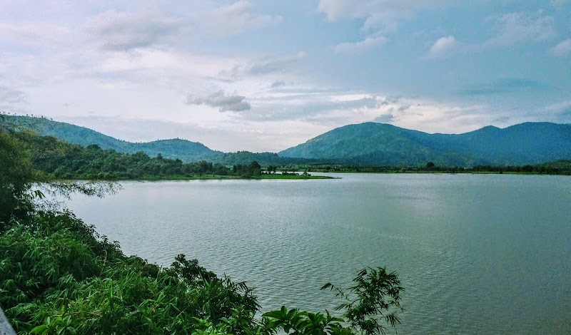
Embarking on a day hike to Dray Nur Waterfall in Buon Ma Thuot offers a vivid encounter with Vietnam’s untamed Central Highlands. The trail stretches roughly 4 kilometers round-trip, with an elevation gain of about 250 meters over uneven, forested terrain. Trees crowd the path, their leaves whispering above as the waterfalls ahead roar like a fierce force challenging your approach.
Start early to avoid the midday heat, as the forest canopy shelters you but also traps humidity. The trail’s roots and occasional slick rocks demand steady footing—good hiking shoes are a must. The air carries the scent of wet earth, and the river alongside dares you to keep pace with its current as it pushes forward relentlessly.
The moment Dray Nur Waterfall comes into view, the surroundings shift. Water plunges 30 meters down a sheer cliff, spraying fresh mist that cools the skin and renews your spirit. A wooden viewing platform offers a solid spot to rest, snap photos, and absorb the powerful energy of this fiercely alive feature.
Hydration is critical; pack at least 2 liters of water. Lightweight, breathable clothing helps manage the tropical warmth. In the rainy months, waterproof gear and caution for slippery paths become essential. The hike can be completed comfortably in three to four hours, including time to explore the base and enjoy the sounds of the cascade.
Local guides from Buon Ma Thuot offer insight into the waterfall’s role in regional culture and how the surrounding forest supports a variety of wildlife. Respecting the environment means staying on marked trails and avoiding disrupting the delicate ecosystem where rare birds and orchids find refuge.
Whether you’re a casual hiker or an outdoor enthusiast seeking a fresh challenge, Dray Nur Waterfall delivers both perspective and exhilaration. It’s an opportunity to engage with nature that is fiercely itself—dynamic, demanding, and rewarding in equal measure.
Nearby Trips
All Adventures
Boat Charters
Water Activities
Adventures near Buon Ma Thuot
Discover the unique and memorable adventures that make Buon Ma Thuot special.
Frequently Asked Questions
How difficult is the hike to Dray Nur Waterfall?
The hike is moderate, suitable for most with a basic fitness level. The trail includes uneven ground and an elevation gain of about 250 meters, requiring good footwear and steady pace.
When is the best time to visit Dray Nur Waterfall?
The best time is during dry seasons—spring and fall—when trail conditions are stable and the waterfall’s flow is impressive without the complications of heavy rain.
Are there any local guides available for the hike?
Yes, local guides from Buon Ma Thuot offer hikes that include cultural insights and ensure safe navigation through forest areas, especially useful during wetter months.
What wildlife might I see along the trail?
The forest hosts diverse species such as hornbills, colorful butterflies, and occasionally even shy mammals like civets. Early mornings increase your chance of spotting wildlife.
Is it safe to swim at the base of the waterfall?
Swimming is not recommended due to strong currents and sudden changes in water depth. The area is best enjoyed from designated viewing points.
How can I reach the trailhead from Buon Ma Thuot city?
The trailhead is about 25 kilometers from Buon Ma Thuot, accessible by motorbike or taxi. The route is straightforward, mostly following provincial roads through rural landscapes.
Recommended Gear
Hiking Boots
Provides necessary grip and ankle support on rocky and slippery forest paths.
Water Bottle (2L minimum)
Maintains hydration in humid, tropical conditions, essential for safety and comfort.
Light Rain Jacket
Protects against sudden tropical showers common during the rainy season.
Insect Repellent
Necessary to guard against mosquitoes in dense forested areas.
Local Insights
Hidden Gems
- "A rarely visited viewpoint east of the falls offers a panoramic glimpse of the entire cascade framed by dense jungle."
- "A small bamboo grove just past the main viewing platform known for early-morning mist and quiet solitude."
Wildlife
- "Vietnamese pheasants that emit distinctive calls at dawn."
- "The elusive Asian golden cat, primarily nocturnal but tracks may be spotted by observant hikers."
History
"Dray Nur Waterfall is part of the traditional lands of the Ede and M'Nong ethnic groups, who regard the falls as a spiritual site connected to water spirits and natural balance."