Scaling San Bernardino: Pacific Crest Trail Segments with Spectacular Vistas and Diverse Terrain
The San Bernardino stretch of the Pacific Crest Trail delivers expansive mountain views and a striking transition from lush forest to rugged desert. It’s an ideal choice for hikers seeking varied landscapes paired with practical challenges like elevation gain and water management.
Plan Water Resupply Carefully
Water availability is limited in the desert section and unpredictable during hotter months. Carry at least 3 liters and identify reliable water sources in advance.
Wear Supportive Footwear
Expect rocky, uneven terrain mixed with steep ascents and descents. Hiking boots with good ankle support will prevent injuries.
Start Early to Avoid Peak Heat
Desert exposure can intensify midday; begin hikes early and take breaks in shaded or cooler areas to stay energized.
Carry a Map and Compass
Cell coverage may be spotty; physical navigation tools ensure you stay on track through remote stretches.
Scaling San Bernardino: Pacific Crest Trail Segments with Spectacular Vistas and Diverse Terrain
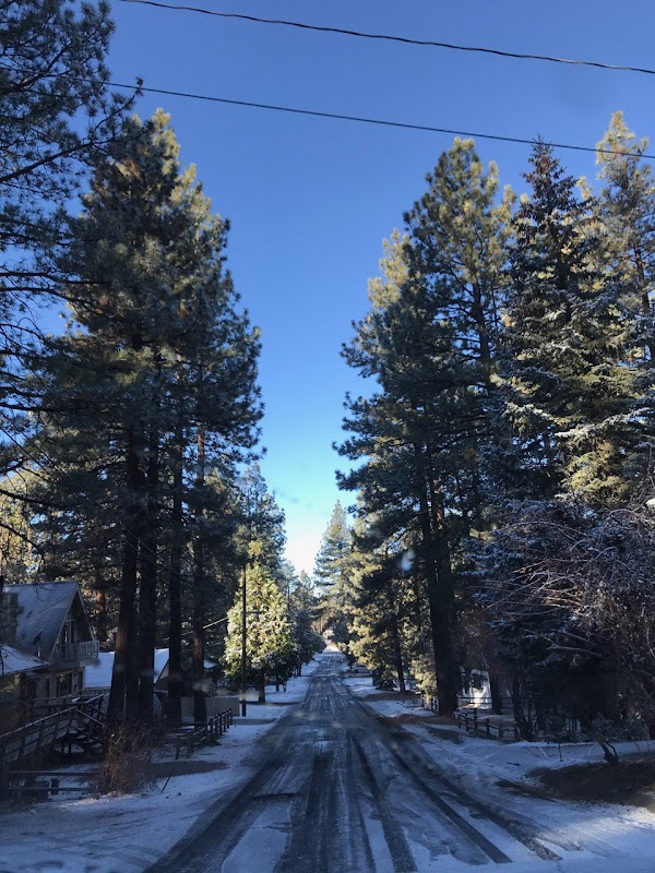
The San Bernardino segment of the Pacific Crest Trail (PCT) presents hikers with a dynamic journey where expansive views meet diverse landscapes, all forged by the region’s shifting elevations and changing vegetation. This portion of the PCT, spanning roughly 40 miles between the south edge of Big Bear Lake and the Mojave Desert’s fringe, challenges and rewards with every step.
Begin near the Angeles National Forest boundary, where towering Jeffrey pines sway in the mountain breeze, daring you deeper into the forest’s embrace. The trail climbs steadily here, gaining over 3,000 feet in elevation across mixed terrain—rocky stretches, pine-needle soft paths, and occasional patches of loose scree requiring careful footing.
As you push higher, the scenery opens. Peaks thrust upward with rugged confidence while below, valleys and ridges fan out into the distance. The San Gorgonio Wilderness punctuates the horizon, its ridges fiercely holding the line between wild and accessible. The wind carries whispers of ancient journeys, pressing you onward.
Midway, the PCT skirts along high ridge lines that reveal the Mojave Desert’s vast expanse against the eastern horizon. The sharp contrast from forest to desert is a tangible shift in climate and ecosystem—here, chaparral scrubs fight for space in rocky soil, and the sun challenges your endurance. Shade can be scarce; water sources are fewer and often seasonal.
Approaching the desert’s edge, the trail threads through juniper and manzanita, their twisted forms like guardians watching over the transition between worlds. This segment offers a panoramic showdown—mountains bowing out to endless desert flats.
Hydration strategy becomes key. Carry ample water, use filtration for dependable spring and stream sources in cooler months, and know the locations of reliable water caches. Footwear with firm ankle support helps on mixed terrain, where loose rock and steep grades demand sure footing. Timing your hike from late spring to early fall maximizes weather reliability but prepare for sun exposure and sudden winds.
From the crisp mountain air to the sprawling desert views, this San Bernardino section is an adventure scripted by nature’s dual personalities: the forest that invites with shade and freshness, and the desert that tests your grit under an open sky. Both demand respect and preparation.
For hikers ready to engage with landscapes that are fiercely themselves, this PCT segment offers vital lessons in stamina and observation. Each step unfolds with a new vista or terrain challenge, making this stretch not only a test of hiking ability but a profound encounter with nature’s contrasting forces.
Nearby Trips
All Adventures
Boat Charters
Water Activities
Adventures near Big Bear Lake, California
Discover the unique and memorable adventures that make Big Bear Lake, California special.
Frequently Asked Questions
How long does it typically take to hike the San Bernardino PCT segment?
Most hikers take between 3 to 4 days to cover the approximately 40-mile stretch, depending on pace, weather, and stops for water or rest.
Are there reliable water sources along this trail segment?
Water sources are limited and seasonal. Early spring may provide flowing streams, but summer conditions make reliable water scarce. Carry sufficient water and check recent trail reports for water availability.
What kind of wildlife might I encounter on this hike?
Expect to see mule deer, birds of prey like red-tailed hawks, and smaller mammals such as squirrels and rabbits. Rattlesnakes are present in desert areas and should be respected.
Is camping allowed along this section of the PCT?
Yes, dispersed backcountry camping is allowed, but camping near water sources is discouraged to protect the environment. Use Leave No Trace practices.
What is the best time of day to start hiking?
Start early in the morning to take advantage of cooler temperatures, particularly in summer. Aim to reach desert sections by late morning, before heat peaks.
Are there any permits required for hiking this trail segment?
No permits are typically needed for day hikes, but if intending to stay overnight in the San Gorgonio Wilderness, a backcountry permit is required.
Recommended Gear
Hydration System (e.g., Camelbak or water bottles)
Ample water capacity is critical due to scarce sources and hot, dry conditions in desert portions.
Hiking Boots with Ankle Support
Protects against sprains and provides stability on rocky, uneven terrain.
Lightweight Sun Hat and UV Protection
Prevents sunburn and heatstroke during exposed desert stretches.
Map and Compass or GPS Device
Essential for navigation when cell signals fail or for confirming route choices.
Local Insights
Hidden Gems
- "High Point overlook for expansive views of the Mojave Desert basin"
- "Quiet juniper clusters near the desert transition offering peaceful rest spots"
Wildlife
- "Look for the elusive San Bernardino flying squirrel active at dusk"
- "Beware of rattlesnakes in rocky, sun-exposed terrain"
History
"The San Bernardino Mountains have long been a corridor for Native American tribes like the Serrano, whose trails predate modern paths. Mineral springs nearby served early settlers and hikers alike."