
What the day feels like
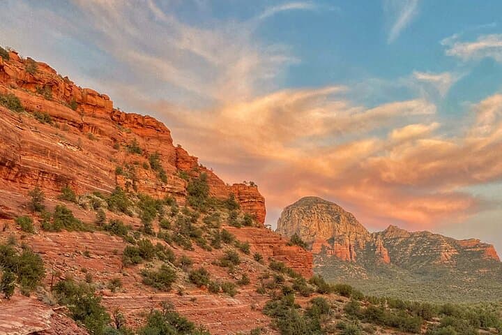
At first light, Sedona’s sandstone wakes up slow. The buttes blush, the canyons exhale cool air, and a hush settles over the juniper flats as if the desert has asked for one more quiet minute before the day begins. This is when the Sacred Canyons Loop comes alive—when the rock glows from within and a private guide slips you onto a sinuous path that feels cut for your stride. The loop is more concept than single trail, a customizable network of classics and lesser-known connectors that stitch together pockets of silence, sweeping overlooks, and shady canyon bends. With a private guide, pace and path are yours: an easy ramble on firm slickrock, a steady climb to a view ledge where the wind nudges you forward, or a sandy wash where cacti stand like sentries and lizards patrol your steps.
In Sedona, hiking is a conversation with stone. The bedrock here—the Schnebly Hill Formation—wears its story openly. Cross-bedded layers of ancient desert dunes, iron oxide staining the grains a saturated red, hold the bones of a landscape that predates the Grand Canyon’s incision. Your guide will point to the lines in the rock, a sentence of geology: wind-built ridges hardened into sandstone, uplifted, then carved by water and time. Even the sand underfoot is restless, a soft-spoken narrator that keeps the past close.
The Sacred Canyons Loop moves through the landlike that narrative does—fluid, responsive, built on context. You might wander into a shallow canyon where cottonwoods sip from hidden seeps, their leaves flickering like signals; turn onto a slip of slickrock with views toward Capitol Butte and the White Line; then follow a sandy path that threads juniper and manzanita, the air carrying the dry sweetness of crushed sage. In summer, monsoon clouds muscle in by afternoon, building anvil-topped towers that throw moving shade across the buttes. In winter, a dusting of snow can turn the red rock into a painter’s study in contrast. Spring puts penstemon and desert marigold along the margins. Fall tucks golden cottonwoods into creek bottoms. Whatever the season, the terrain stays honest: grippy sandstone steps, occasional loose pebbles, sandy stretches that ask a little more of the calves. You’ll feel the day without being flattened by it.
Sedona’s human story threads the loop as well. Long before trail signs, this was Yavapai–Apache homeland, and earlier still, the Sinagua left rock art and masonry tucked in alcoves between A.D. 900 and 1400. Your guide may gesture toward a cliff band where petroglyphs—if present and viewable within legal, ethical guidelines—remind hikers that the land was storied before it was scenic. Respect is the rule here: look, learn, leave no trace. Today, Sedona also carries the lore of energy vortexes. Whether or not you feel a hum beneath your boots, the juniper sometimes twist in ways that make you consider the possibility, and the quiet in these canyons has a way of adjusting your internal meter.
What makes this loop special is the private pace. Without the drumbeat of a group agenda, you can linger where the view asks for silence or move steadily where the trail invites rhythm. Good guides read both the terrain and the traveler. On a typical outing of three to four hours, expect three to six miles and 500 to 900 feet of elevation gain—adjusted up or down based on your interests, time, and how the day feels. Beginners get coaching on foot placement and hydration. Families get micro-adventures: a detour to a natural arch, a sandy wash where kids can name lizards. Experienced hikers can string together more elevation and longer vantage points. The canyons give you options, and the guide sharpens them.
Timing matters. Early starts beat both heat and crowds, and the rocks are at their best in the low-angle light. Summer hikers should aim to be off exposed ridges before monsoon thunderheads turn from decoration to threat—your guide will watch the sky and adjust accordingly. In winter, the shaded corners of north-facing trails can hold ice; microspikes sometimes find their way onto packs when cold snaps dip in. Year-round, bring more water than you think you need—about one liter per hour is a solid baseline in dry desert air—and commit to sun protection even on breezy days.
The practical edge of the Sacred Canyons Loop is its flexibility. The guide handles the micro-navigation—choosing shade when the sun presses, seeking views when clouds cool the air, picking slickrock ribs over loose gravel so your ankles stay happy. There’s no need to measure every junction; your job is to keep your eyes up where the landscape puts on a slow-motion show. Birds ride thermals above you—red-tailed hawks writing lazy circles in blue—and somewhere below, the desert keeps time: ants working a precise line, a breeze moving through grasses like a quiet audience applause.
By the time you step back to the trailhead, your boots holding a fine memory of red dust, the loop will feel less like a route and more like a guided conversation with a place that prefers to be learned at walking speed. The canyons won’t tell you everything, but they’ll tell you enough to want to come back and ask better questions next time—earlier start, different light, maybe a longer line on the map. Sedona has a way of doing that: it nudges you forward and leaves the door open behind you.
If you go, bring curiosity and respect in equal measure. The rock is ready, the canyons are listening, and the day will meet you where you are.
Trail wisdom
Small choices, better day.
Start at First Light
An early departure beats heat and crowds while delivering the best color on the red rock. Aim for sunrise or within the first hour of daylight.
Hydrate Like You Mean It
Plan for about 1 liter of water per hour in warm months; electrolyte tabs help on longer, sunnier stretches.
Step Smart on Sandstone
Sedona’s slickrock is grippy when dry but sandy corners can roll underfoot—keep steps deliberate and consider light trekking poles.
Stay on Durable Surfaces
Protect fragile desert soils and plants by sticking to established trails and slickrock; avoid cutting switchbacks.
Local knowledge
Read the place, not just the route.
Watch for native species including Javelina, Red-tailed hawk.
Keep an eye out for wildlife during the transition between areas and habitats. Respect distance guidelines.
Sedona’s popularity strains desert soils and vegetation—stay on established trails, pack out all trash (including microtrash), and leave cultural sites undisturbed.
Follow the guide's instructions on size limits, ethical handling, and leave-no-trace practices.
The spur to Fay Canyon Arch for a tucked-away window on the canyon. Quiet slickrock knolls near Long Canyon with sweeping views of Capitol Butte
Locally recommended viewpoints and quiet spots known best to local operators.
The Sinagua people inhabited this region between A.D. 900–1400, leaving rock art and masonry sites; modern trails cross ancestral homelands of the Yavapai–Apache Nation.
Maritime roots and regional tradition shape the waterways and working coasts.
Seasonal guide
Four versions of the same landscape.
Spring
Best forWildflowers · Mild temps
ChallengesWindy afternoons · Crowds during peak holidays
March–May brings comfortable hiking weather and blooming desert marigold, penstemon, and prickly pear. Mornings are crisp; layers help.
Summer
Best forEarly-morning light · Long daylight hours
ChallengesHigh heat · Monsoon thunderstorms and flash-flood risk
Start at dawn to avoid heat and plan to be off exposed ridges by early afternoon when storms can build quickly.
Fall
Best forStable weather · Golden cottonwoods in canyons
ChallengesPopular weekends · Cooler mornings
September–November is prime: clearer air, pleasant temps, and reliable footing. Bring a light layer for early starts.
Winter
Best forCrowd-free trails · Striking snow-on-red-rock contrast
ChallengesShort days · Icy shaded sections
Expect chilly mornings and occasional ice on north-facing slopes; traction aids may be helpful after storms.
Operator details
What the booking data adds.
Included
- ✓Private transportation
- ✓Air-conditioned vehicle
- ✓Warm Weather Extras Included: 50UPF Hoodies, 30SPF Sunscreen, Cooling Spray, and Insect Repellant
- ✓Private Hiking Guide
- ✓LaCroix Sparkling Water
- ✓Bottled Water for All Hikers Attending
- ✓Healthy Packaged Trail Snacks: Granola bar, Fruit Leather, Fruit Bar, Almond Butter, Trail Cookies, Applesauce, Mixed Nuts, and Beef Jerky. Note: Snack Substitutions Are Made for Dietary Restrictions.
- ✓Cold Weather Extras Included: Beanies, Gloves, Neck Gaiters, and Micro Spikes
- ✓Red Rock Pass Parking Fee
- ✓Hiking Gear Included: Osprey Backpack, Headlamps, Rain Ponchos, Binoculars, and Trekking Poles
Not included
- —Optional gratuity for your guide is not included in tour cost
Good to know
- ✓Service animals allowed
- ✓Not recommended for travelers with poor cardiovascular health
- ✓Suitable for all physical fitness levels
Pack with intention
What to bring.
Good to know
Common questions.
Because this is a private, customizable hike, expect roughly 3–6 miles with 500–900 feet of elevation gain, adjusted to your pace and interests.
Plan the edges
The details that make the day easier.
Sedona’s signature red rocks get their color from iron oxide in the Permian-age Schnebly Hill Formation, and the city was designated an International Dark Sky Community in 2014.
Post-hike, refuel at Elote Café for modern Southwestern plates (arrive early or expect a wait), then stroll Tlaquepaque Arts & Shopping Village for galleries and shaded courtyards. For a local pint, Oak Creek Brewery’s tasting room pours easy-drinking ales perfect for a dusty-boot debrief.
- Closest major airport
- Phoenix Sky Harbor (PHX), ~120 miles
These trails traverse Coconino National Forest—stay on established paths, pack out all trash, and never touch or remove artifacts. After rain, avoid muddy singletrack to prevent rutting and trail widening.
Explore by topic
Follow the threads.
Keep exploring
Make the story part of the trip.
Set out from Bass Harbor for a private, customizable day on Blue Hill Bay — lighthouses, puffins, seals, and the chance to feel Acadia from the water. Small groups, local captains, unforgettable views.
In four hours you can move from shaded canyon ferns to wind-scoured coastal ridgelines, guided by someone who knows where the light—and the hidden views—live. This private half-day hike on the Monterey Peninsula or Big Sur is compact, curated, and perfect for travelers who want depth without a multiday commitment.
 Related story
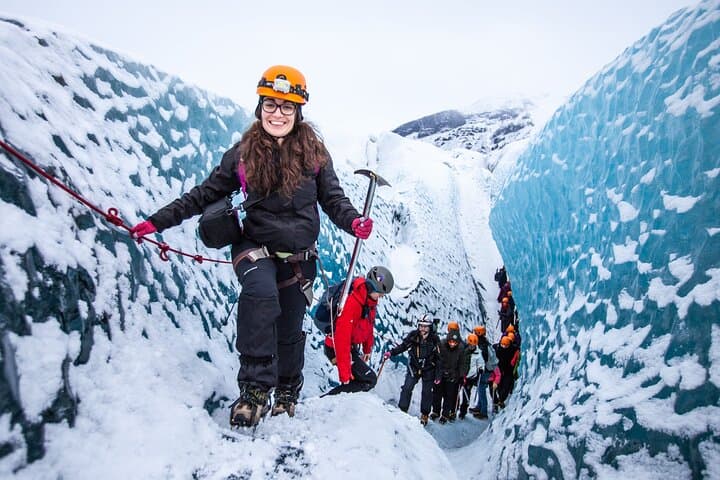
Beneath a sky of shifting light, Skaftafell’s ice reads like a map of time. This three-hour guided glacier hike mixes technical instruction with geology and culture: compact, safe, and unforgettable.