
What the day feels like
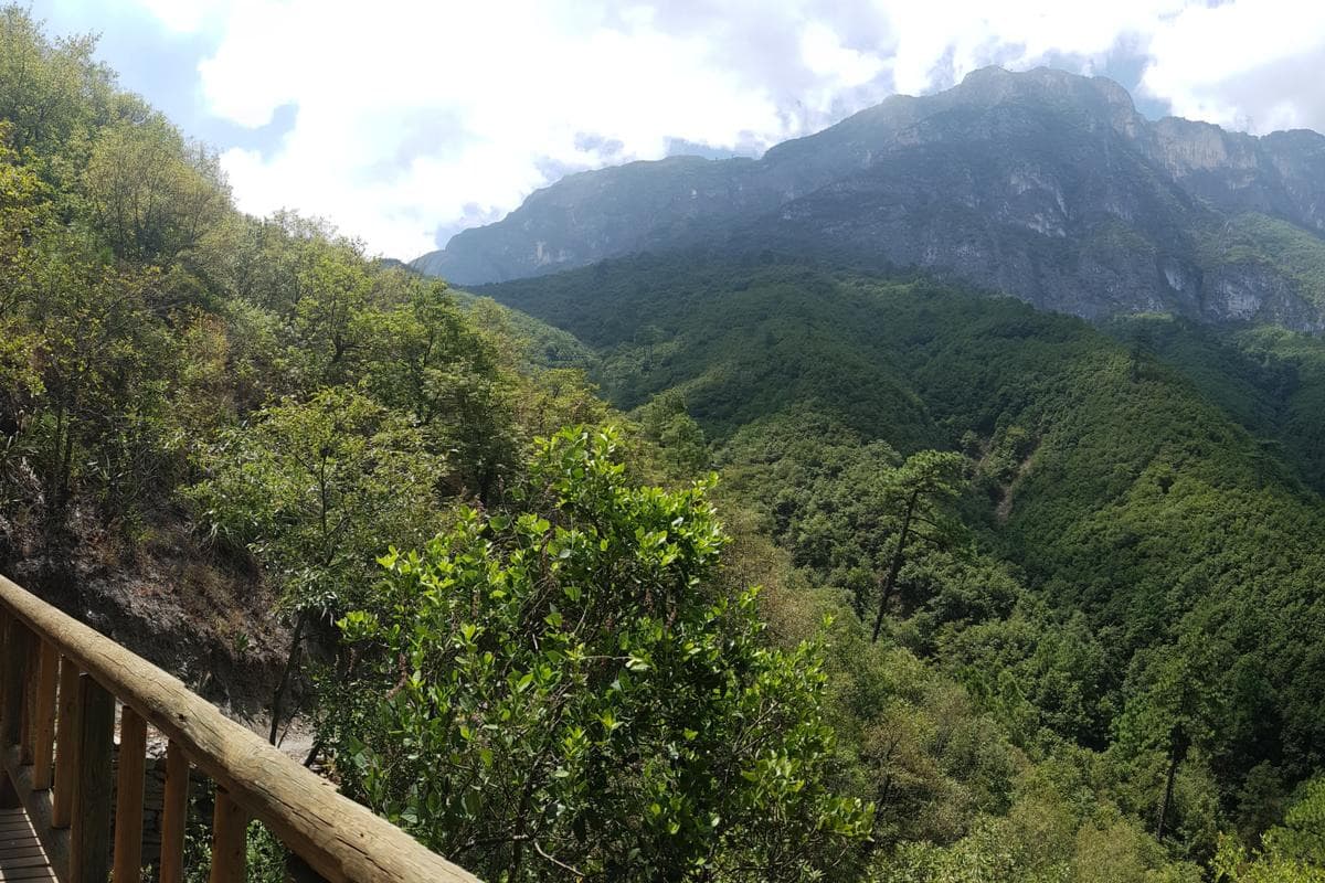
At dawn the ridge exhales cool air that smells faintly of pine resin and dry earth. Monterrey lies folded below—an urban grid boxed by the serrated teeth of the Sierra Madre Oriental—but here on the slopes of Chipinque, the city feels like a distant rumor. You climb through a patchwork of oak and pine, the trail alternating between soft loam and sections of blasted limestone steps; sunlight filters through the canopy in strips and, every so often, the forest opens to reveal the city sprawled against a skyline of jagged summits. If you time it right, you’ll pass families walking dogs, local runners setting a steady pace uphill, and, with luck, a pair of curious squirrels flitting between trunks.
Chipinque Ecological Park (Parque Ecológico Chipinque) is the green hinge on Monterrey’s eastern rim—part urban escape, part working conservation area—and it’s a place where accessible hiking and technical ascents coexist. The park’s range of routes suits the casual day hiker who wants panoramic views and wildlife sightings as much as the climber targeting the emblematic summit known locally as La EME. That ascent blends trail, blast steps, and a short, exposed scramble secured with metal staples; it’s a different rhythm from the more forgiving ridgeline walks that peel out of the visitor center.
Geology here is legible underfoot. The Sierra Madre Oriental is a folded, uplifted spine of limestone and shale; rain has carved its flanks into narrow valleys and steep escarpments that force trails into switchbacks and exposed ledges. The forest is a resilient mosaic of pines and oaks adapted to the dry, continental climate of northern Mexico. In spring, the understory brightens with low shrubs and seasonal blooms; in the dry heat of summer, the trees provide welcome shade and hummingbirds dart between flowering agaves.
Culture and conservation overlap at Chipinque. Monterrey calls itself La Sultana del Norte and chips of that proud industrial history are visible from the park’s miradors—steel plants, modern neighborhoods, and the dominant Cerro de la Silla. For locals, Chipinque is both recreation and identity: weekend rituals of family walks, morning runs, and sunset photography. Several tour operators offer guided morning and afternoon hikes, and there are experiences that bundle transportation and entrance tickets for visitors who want seamless logistics. For climbers, certified guides lead the more technical La EME route, adding safety on the metal-backed pitches and handling logistics like photography at key viewpoints.
Practicalities matter here. Trails vary from short loop tracks to longer ridge hikes; expect outings of roughly 2–6 hours depending on route and pace. Elevation gain ranges widely—moderate climbs can be 300–500 meters, while La EME and some summit routes push 700–900 meters of sustained ascent and brief exposure. The park is popular on weekends and holidays; arrive early to secure parking or join a guided tour that includes pickup. Carry at least two liters of water, sun protection, and a solid pair of hiking shoes with good traction—many of the steeper approaches use metal staples and have short exposed sections that reward careful foot placement.
Wildlife is low-key but rewarding: squirrels are frequent, and deer sometimes appear in the quieter ravines. Birdwatchers will notice steady movement in the canopy—keep binoculars ready. Leave no trace is more than a slogan; the park’s preservation depends on visitors respecting trails and disposal rules. Entrance fees and guided-tour revenues support trail maintenance, reforestation, and conservation education in the park.
For photographers, the light is best in the hours after sunrise and before sunset—the city below catches a warm glow and the ridges carve long shadows across the valley. If you’re chasing a technical experience, book the La EME ascent with certified guides: it combines the physical challenge of climbing with the reward of a high, exposed viewpoint of Monterrey.
Chipinque is an accessible slice of the Sierra Madre that asks only for reasonable preparation: steady footwear, sufficient water, and respect for the terrain. Whether you’re here for a peaceful loop through pine-scented forest, an afternoon run that ends at a wide mirador, or a guided ascent up metal-staked rock, you’ll leave with a clearer sense of why Monterrey calls itself the City of Mountains—and how closely urban life intertwines with wild, rugged landscape.
Practical snapshot: plan for early starts to avoid afternoon heat and crowds; check with local operators for combined transport-and-ticket options if you prefer not to drive; and pack boots, layers, and a small first-aid kit for technical routes. The park’s trails offer a compact but varied mountain experience—close to the city, big on views, and grounded in conservation.
Trail wisdom
Small choices, better day.
Start early for light and solitude
Arrive at the visitor center at or just after opening to avoid crowds, secure parking, and catch the clearest morning light on the miradors.
Bring at least 2 liters of water
Trail shade can be intermittent and summer heat is strong—carry more water than you think you'll need.
Wear grippy hiking shoes
Steeper routes and the La EME section use metal staples and exposed rock—sturdy footwear with good traction reduces slips.
Hire a certified guide for La EME
The ascent includes technical moves; a certified local guide provides safety, route-finding, and photos at key viewpoints.
Local knowledge
Read the place, not just the route.
Watch for native species including Eastern gray squirrels, White-tailed deer.
Keep an eye out for wildlife during the transition between areas and habitats. Respect distance guidelines.
Park revenues and guide fees support trail maintenance and habitat protection; follow marked trails and pack out waste to protect sensitive highland ecology.
Follow the guide's instructions on size limits, ethical handling, and leave-no-trace practices.
La EME summit route (the park’s more technical ascent). El Mirador de la Montaña and the giant 'Parque Chipinque' letters – best photographed in morning light
Locally recommended viewpoints and quiet spots known best to local operators.
Chipinque sits on the foothills of the Sierra Madre Oriental and is a focal point for Monterrey’s outdoor culture—its trails and miradors have long connected the city to the mountains.
Maritime roots and regional tradition shape the waterways and working coasts.
Seasonal guide
Four versions of the same landscape.
Spring
Best forwildflowers · mild temperatures · birdwatching
Challengespatchy muddy sections after rains · variable weather
Spring brings milder temps and seasonal blooms—trails can be lush but expect some muddy stretches after rain.
Summer
Best forearly-morning hikes · lush canopy shade · long daylight hours
Challengeshigh heat and sun exposure in midday · possible afternoon storms
Summer heat is real—plan hikes for early morning or late afternoon and watch for sudden showers.
Fall
Best forclear skies · comfortable hiking temps · cityscapes with crisp light
Challengesoccasional windy days at ridgelines
Fall offers some of the best visibility and comfortable conditions for longer ridge hikes and photography.
Winter
Best forcool-weather hiking · clear panoramic views · less crowded trails
Challengescolder mornings and cooler exposure on ridgelines
Winters are cool and dry—bring layers for chilly starts, and you’ll likely find quieter trails and sharp views.
Pack with intention
What to bring.
Good to know
Common questions.
No for general trails—the park is well-marked and popular for self-guided hikes. For La EME or technical ascents, a certified guide is strongly recommended for safety and route guidance.
Plan the edges
The details that make the day easier.
From Chipinque’s main miradors you can see Monterrey and the iconic Cerro de la Silla—a skyline that has defined the city’s nickname, 'La Sultana del Norte.'
Monterrey’s mountain culture pairs perfectly with Chipinque—refuel after a hike with local specialties like cabrito or carne asada and a strong coffee in San Pedro neighborhoods that slope toward the park.
- Park type
- ecological reserve; entrance fee: required (varies by visitor status); hours: open daily (check current times); best access: drive or book tours offering pickup; nearest city: Monterrey.
Stick to marked trails, carry out all trash, and consider booking local certified guides—tour fees contribute directly to trail upkeep and conservation programs.
Explore by topic
Follow the threads.
Keep exploring
Make the story part of the trip.
 Related story
Less than two hours from Nairobi, Kereita Forest pairs hands-on canopy adventure with quiet montane trails and a sobering colonial history—perfect for families, teams, and curious travelers seeking a full-day pulse of nature.
Set out from Bass Harbor for a private, customizable day on Blue Hill Bay — lighthouses, puffins, seals, and the chance to feel Acadia from the water. Small groups, local captains, unforgettable views.
In four hours you can move from shaded canyon ferns to wind-scoured coastal ridgelines, guided by someone who knows where the light—and the hidden views—live. This private half-day hike on the Monterey Peninsula or Big Sur is compact, curated, and perfect for travelers who want depth without a multiday commitment.