About this landmark
Introduction
This short, mostly level nature walk at Yellowstone National Park threads a boardwalk across marsh and riparian willow before opening onto a sandy edge of Yellowstone Lake. The route is described in the supplied park-focused account as a boardwalk that crosses straight through wet areas rather than circumnavigating them, and it forms a small loop that returns hikers to the trailhead via a secondary route. Along the way the trail affords a close-up view of wetland habitat, a beach-like lakeshore, and distant sightlines across the lake to features such as Mount Sheridan.
The boardwalk and shore sequence encapsulate the trail’s editorial logic: a compact, accessible progression from upland road-side to marsh to lakeshore that concentrates different water‑land interfaces into a brief outing. The route’s appeal in the primary source is ecological and observational—wetland vegetation and shore processes, limnological access to Yellowstone Lake, and a named bird species, the white pelican. Visitors weighing a stop should continue reading to learn how the boardwalk, the lake shore, and practical conditions (parking, surface, seasonal greenery) fit together for a short, contemplative walk rather than a long backcountry excursion.
Boardwalk Through the Wetland
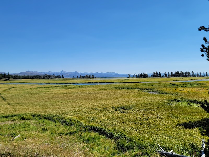
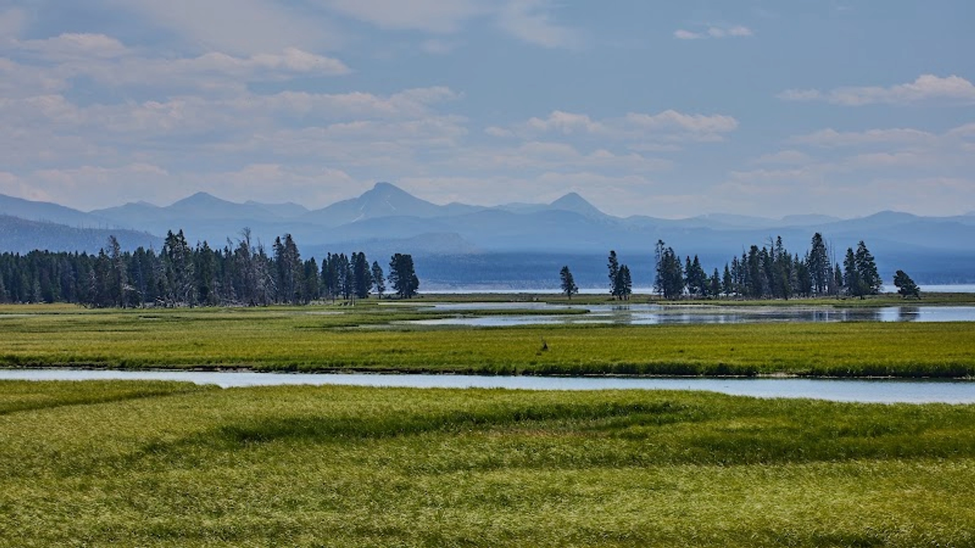
The trail’s defining structural feature is the boardwalk: a raised walking surface that crosses marshy riparian habitat and gives hikers a closer perspective on wetland plants and shallow open water than an earthen trail would. The primary article emphasizes that the boardwalk crosses straight through wet areas rather than routing around them, and that it reconnects to the trailhead on a secondary leg to form a small loop. This concentrated crossing means the outing compresses marsh-edge observation into a short route, so time on the boardwalk is the core of the experience.
A boardwalk also shapes access: the primary source notes the surface is flat and level, making the route more approachable than uneven forest tread. That accessibility is intrinsic to the trail’s character in the supplied account, not an added amenity; the boardwalk is the reason the article recommends the trail to those seeking a short, level walk through lush riparian vegetation.
Shoreline and Geology
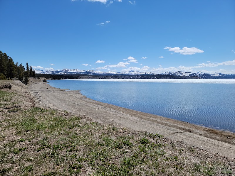
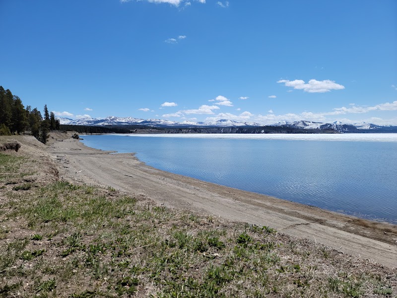
Beyond the wetland, the trail reaches the shore of Yellowstone Lake, described in the primary source as a vast body of water that can read like an inland sea; the shore adjacent to the Pelican Creek route is noted for its sandy edge. The article links the lakeshore to regional geothermal and geologic context: the lake and its basin sit within the Yellowstone caldera, and the piece recounts the commonly cited estimate that the eruption and collapse that formed the caldera occurred roughly 640,000 years ago.
The shore segment is presented as a counterpoint to the boardwalk: where the boardwalk focuses on marsh plants and shallow water, the lakeshore opens the landscape into long sightlines and geologic interpretation—faults, hot springs, and other hydrothermal features inform how the lake’s floor and shore are understood in the primary source.
Wildlife and Ecology
The trail is named for a species singled out in the article: the white pelican. The primary source describes white pelicans using Yellowstone Lake—scooping fish with their pouched bills—and lists them among animals a walker should keep an eye out for along the shore. That species-level note frames part of the trail’s ecological interest, particularly for observers focused on waterbird behavior or limnological conditions.
Practical visitor reports in the supplied reviews temper expectations: one reviewer described the hike as "not too many visitors on the trail" while another cautioned that one season’s visit did not produce notable wildlife sightings. Use the species mention in the primary account as an indicative ecological interest, and treat visitor reports as anecdotal: sightings are possible but not guaranteed.
What the Walk Feels Like — Conditions and Variability
In the supplied article the walk is repeatedly characterized as short and lush: riparian zones around the trail retain late-season green even when upland grasses have gone gold. That seasonal persistence is presented as a visual contrast to other park areas in late summer. The narrative emphasizes texture—marsh grass, boardwalk planks, and a sandy shore—over long-distance exertion.
The reviews supplied with the source offer additional, first‑hand variability: one reviewer reported mosquitos during their visit, another reported fallen trees blocking the trail a short distance in, and others described the route as an easy, level stroll of under a mile. These observations should be read as episodic visitor conditions rather than enduring facts of the route; they do, however, affect planning and comfort for a short lakeside walk.
Access, Parking, and Traveler Fit
The primary source gives a succinct approach: from the Fishing Bridge area drive east about 1.5 miles and use a small pullout on the south side of the park road; parking is described as free with a valid park entrance pass. That roadside, short‑trip character—small pullout parking and a short boardwalk loop—defines the trail as an option for visitors seeking a brief stop rather than a long hike.
Who the trail suits follows directly from those details: the supplied article recommends it for people wanting a short, flat walk in a lush environment and for those with an interest in lakes and limnology. The boardwalk’s flat surface and loop geometry make the outing appropriate for visitors looking for an accessible nature walk; at the same time, reviewers’ notes about insects and occasional obstructions indicate the route can present typical, seasonal backcountry nuisance conditions.
Conclusion
Pelican Creek Nature Trailhead condenses several aquatic interfaces—marsh, shoreline, and open lake—into a brief, largely level outing described in the supplied account. Its value, as framed in the primary source, lies in that compressed progression: a boardwalk that brings casual walkers into the riparian edge and then out onto a sandy stretch of Yellowstone Lake for a concentrated ecological and visual sequence.
For visitors who want a short, accessible nature observation stop with lakeshore context and the chance to spot waterbirds like white pelicans, the trail is an efficient, low-commitment option; those seeking longer backcountry hiking or guaranteed wildlife encounters should treat this route as a complementary stop rather than their main outing.
Adventure Guide
Practical Planner
- Getting there & parking: From Fishing Bridge drive east about 1.5 miles and use the small pullout on the south side of the park road; the primary source states parking is free with a valid park entrance pass.
- Trail surface & accessibility: The trail uses a raised boardwalk that crosses marsh and forms a small loop; the primary article notes the surface is flat and level, making it more approachable than uneven earthen trails.
- Seasonal comfort: One recent reviewer reported heavy mosquitos; bring insect protection during warmer months and be prepared for variable conditions.
- Trail variability: A supplied reviewer reported fallen trees blocking the trail a short distance in on their visit; expect occasional obstructions and consult current park notices if available.
Directions & Logistics: Small roadside pullout east of Fishing Bridge; park with valid entrance pass (per primary source).
Frequently Asked Questions
Q: How long is the Pelican Creek Nature Trail?
The primary source describes the route as a short walk but does not state a formal distance; supplied visitor reports describe walks of roughly 0.7 to about 1 mile on individual visits. Treat these as anecdotal estimates rather than an official measurement.
Q: Is the trail wheelchair- or stroller-friendly?
The primary article highlights a raised boardwalk and describes the surface as flat and level, which suggests greater accessibility than uneven tread. The account frames the route as suitable for those needing a level walking surface.
Q: Will I see pelicans or other wildlife?
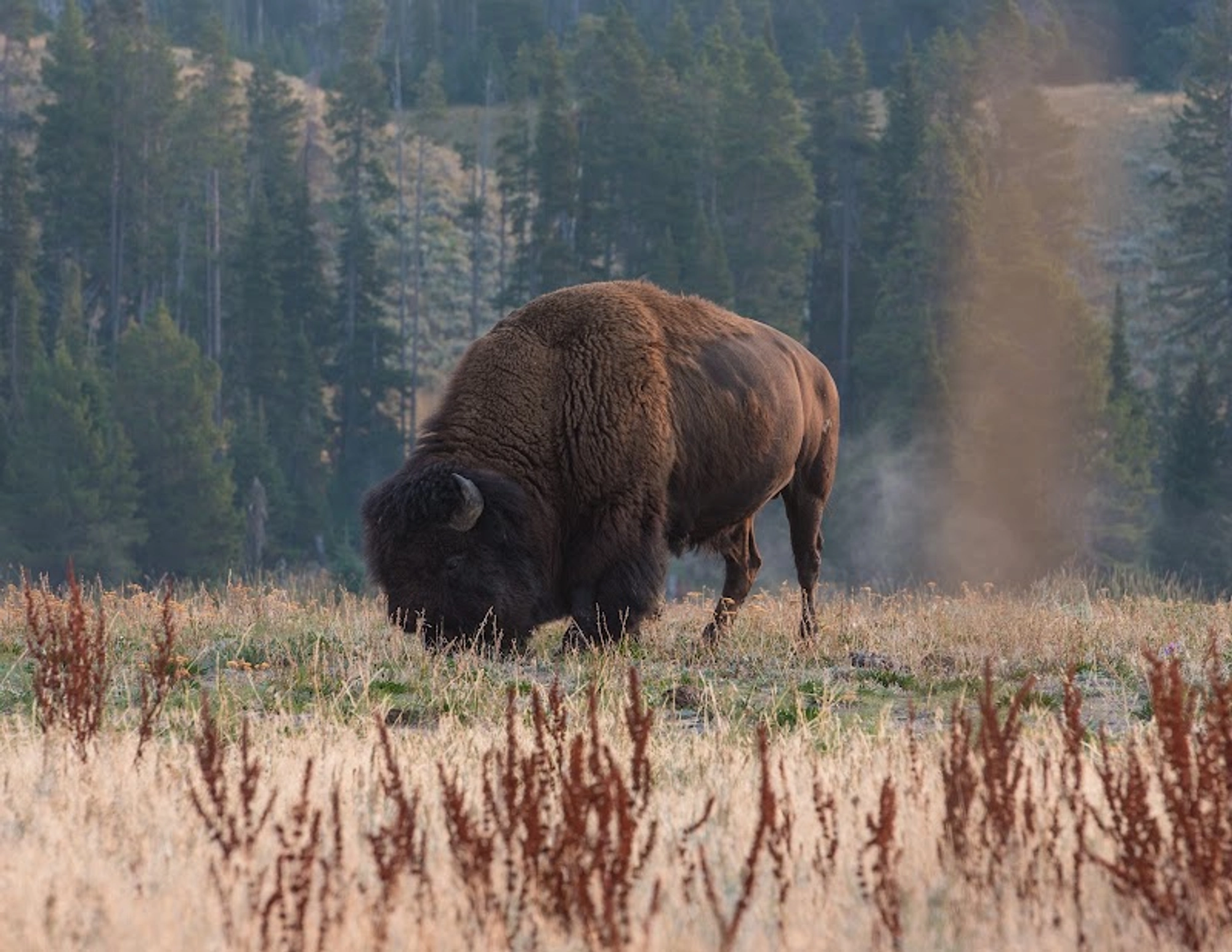
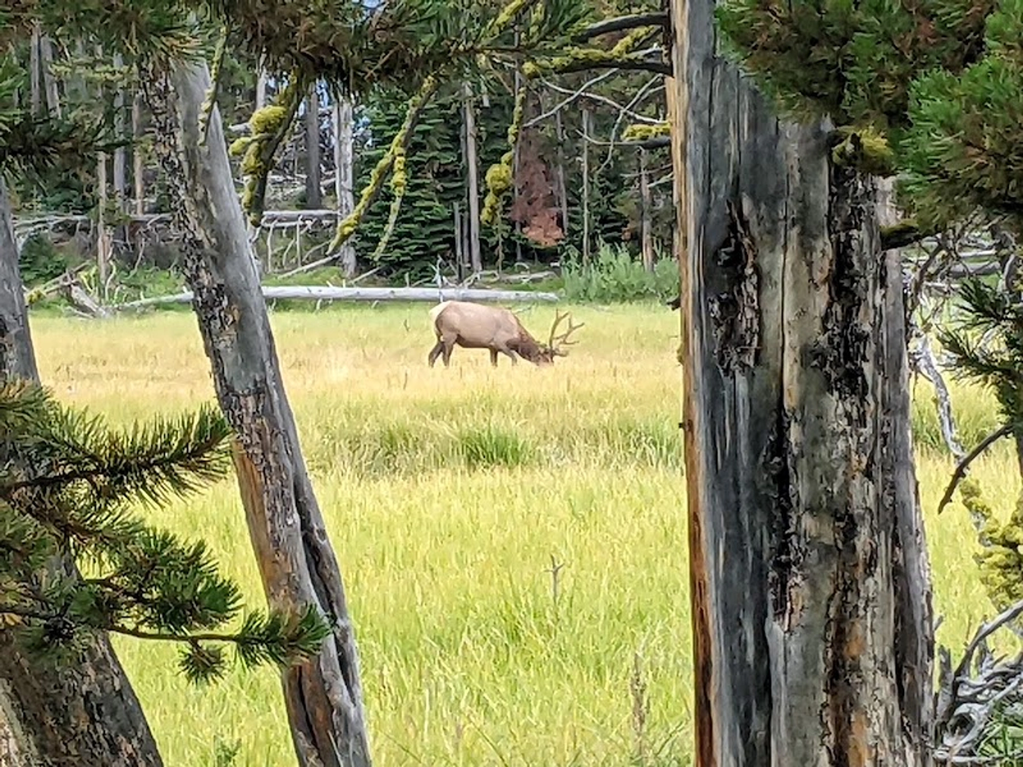
The primary source names the white pelican as a species to watch for along the lake shore; visitor reports are mixed, so sightings are possible but not guaranteed on any given visit.
Q: Where do I park and is there a fee?
The supplied article directs visitors to a small pullout east of Fishing Bridge on the south side of the park road and notes parking is free with a valid park entrance pass.
Adventure Guide
Practical Planner
- Getting there & parking: From Fishing Bridge drive east about 1.5 miles and use the small pullout on the south side of the park road; the primary source states parking is free with a valid park entrance pass.
- Trail surface & accessibility: The trail uses a raised boardwalk that crosses marsh and forms a small loop; the primary article notes the surface is flat and level, making it more approachable than uneven earthen trails.
- Seasonal comfort: One recent reviewer reported heavy mosquitos; bring insect protection during warmer months and be prepared for variable conditions.
- Trail variability: A supplied reviewer reported fallen trees blocking the trail a short distance in on their visit; expect occasional obstructions and consult current park notices if available.
Directions & Logistics: Small roadside pullout east of Fishing Bridge; park with valid entrance pass (per primary source).
Frequently Asked Questions
Q: How long is the Pelican Creek Nature Trail?
The primary source describes the route as a short walk but does not state a formal distance; supplied visitor reports describe walks of roughly 0.7 to about 1 mile on individual visits. Treat these as anecdotal estimates rather than an official measurement.
Q: Is the trail wheelchair- or stroller-friendly?
The primary article highlights a raised boardwalk and describes the surface as flat and level, which suggests greater accessibility than uneven tread. The account frames the route as suitable for those needing a level walking surface.
Q: Will I see pelicans or other wildlife?
The primary source names the white pelican as a species to watch for along the lake shore; visitor reports are mixed, so sightings are possible but not guaranteed on any given visit.
Q: Where do I park and is there a fee?
The supplied article directs visitors to a small pullout east of Fishing Bridge on the south side of the park road and notes parking is free with a valid park entrance pass.
Visitor Tips
- Best Times:Spring & Summer & Fall for favorable conditions and optimal lighting.
- What to Bring:Plenty of water, sun protection, a camera, and respectful Leave-No-Trace mindset.