Hiking to Gaylor Lakes along Tioga Road, near Tioga Pass
Hiking to Gaylor Lakes along Tioga Road, near Tioga Pass
Category
Natural Landmark
Typical Duration
1 hour
Difficulty
Easy
Photo Gallery
Hiking to Gaylor Lakes along Tioga Road, near Tioga Pass - Tioga Road, near Tioga Pass
Hiking to Gaylor Lakes along Tioga Road, near Tioga Pass - Tioga Road, near Tioga Pass
Hiking to Gaylor Lakes along Tioga Road, near Tioga Pass - Tioga Road, near Tioga Pass
About This Landmark
Hiking to Gaylor Lakes along Tioga Road, near Tioga Pass
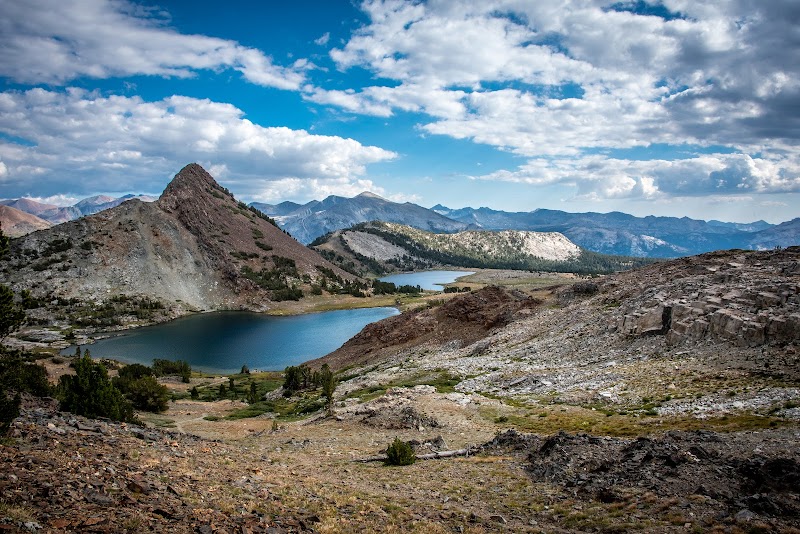
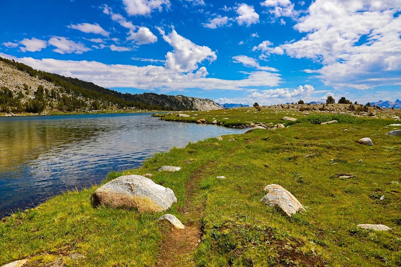
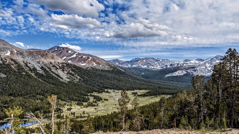
Hiking to Gaylor Lakes offers an extraordinary blend of pristine alpine beauty, historical significance, and relative tranquility. Located near Tioga Pass, just east of Yosemite Valley, this high-altitude hike is one of the lesser-traveled gems in the region. With spectacular vistas over subalpine meadows, crystal-clear lakes, and remnants of old mining operations, the Gaylor Lakes Trail is ideal for those seeking a moderate yet rewarding hiking experience.
Adventure Guide to Hiking to Gaylor Lakes
-
Trailhead Location:
The trail begins at the Gaylor Lakes Trailhead, conveniently located just outside Tioga Pass Entrance Station at an elevation of roughly 9,950 feet. Ample parking is available, especially in the earlier hours. -
What to Expect:
The hike is approximately 2 miles round trip (to the first lake) but can be extended if you explore the area further. The initial stretch climbs steeply for about half a mile, but the effort is well-compensated by panoramic views of Dana Meadows and surrounding peaks. Once you crest the ridge, the serene upper Gaylor Lake comes into view, flanked by granite cliffs and alpine vegetation. A further short trek can take you to Lower Gaylor Lake or a nearby old mining cabin and ruins from the Great Sierra Mine, offering a touch of history amidst the wilderness. -
Key Features:
- Stunning alpine scenery, with turquoise lakes set against granite peaks.
- Abundant wildflowers during late summer months.
- Opportunities for birdwatching and peaceful photography.
Local Insights
Gaylor Lakes exist within the shadow of Mount Dana, Yosemite's second-highest peak. The region sits above 10,000 feet, so acclimatization is advised for anyone new to high-altitude hiking. Wildlife such as marmots and pikas are frequently spotted here, and it's common to hear their distinctive squeaks echoing through the rocks. The area’s mining history from the late 19th century adds an intriguing cultural aspect to the hike.
Visitor Tips
-
Best Time to Visit: Late June through early October when Tioga Road is fully accessible.
-
What to Bring:
- Sturdy hiking boots.
- Layers to account for swiftly changing weather.
- Sunscreen and plenty of water to combat high-altitude dryness.
-
Driving Directions: From Yosemite Valley, take CA-120 east for approximately 1 hour 20 minutes (47 miles) to the Tioga Pass Entrance Station.
- Best Times: Spring and Fall for cooler temperatures and amazing lighting.
- What to Bring: Water, sunscreen, and a camera!
Ratings
Overall
Experience Level
Experience Needed: This natural landmark is recommended for those with minimal outdoor experience. Perfect for families and beginners.