Skip to main content
Hiking to Dewey Point via Glacier Point Road
Glacier Point Road
•10.0/10
•Easy
Hiking to Dewey Point via Glacier Point Road
Category
Natural Landmark
Typical Duration
30 minutes
Difficulty
Easy
Photo Gallery
Hiking to Dewey Point via Glacier Point Road - Glacier Point Road
Hiking to Dewey Point via Glacier Point Road - Glacier Point Road
Hiking to Dewey Point via Glacier Point Road - Glacier Point Road
About This Landmark
Hiking to Dewey Point via Glacier Point Road
Introductory Overview
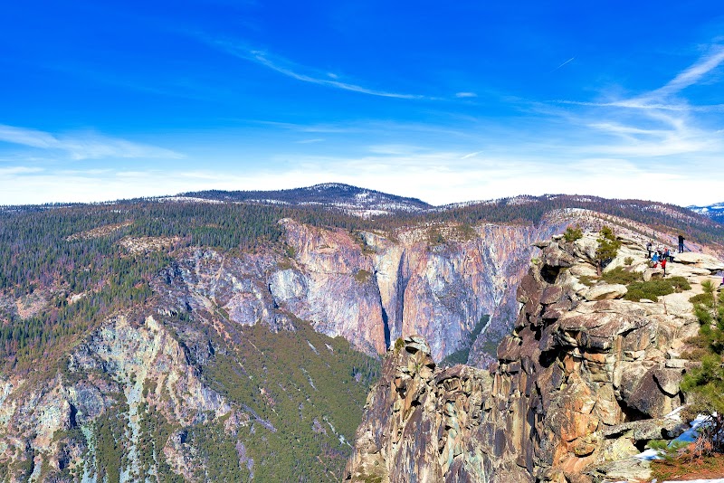
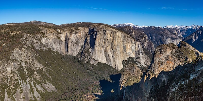
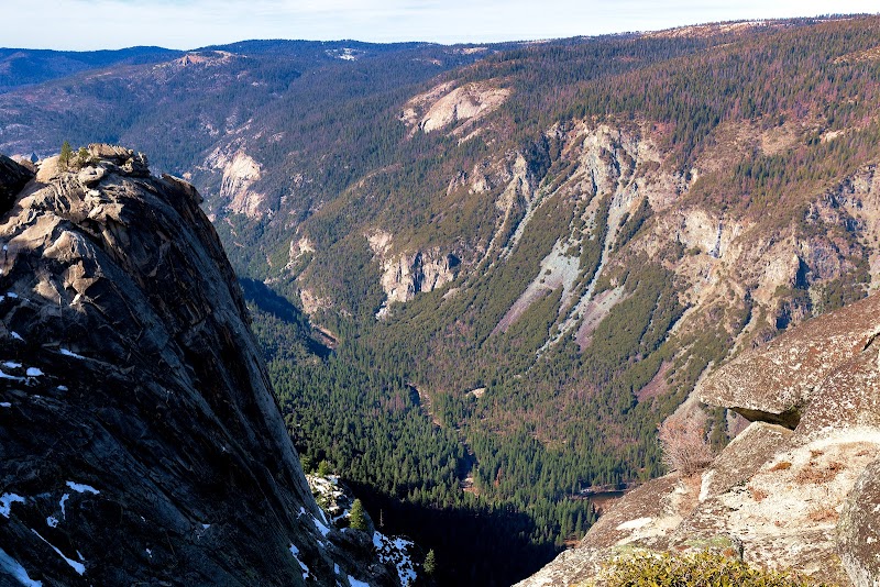
Hiking to Dewey Point is an iconic Yosemite experience that combines moderate physical activity with unparalleled views of the Sierra Nevada landscape. Located off Glacier Point Road, Dewey Point offers dramatic vistas of El Capitan, Yosemite Valley, and surrounding peaks. The hike is particularly beloved for its accessibility and diversity across seasons, serving as a snowshoeing trail in winter and a picturesque route in warmer months. This hike stands out for its broad appeal, encompassing both beginner and seasoned hikers aiming to witness Yosemite’s breathtaking beauty.
### Adventure Guide to Hiking to Dewey Point
1. Location and Route Details
- Starting Point: McGurk Meadow Trailhead on Glacier Point Road.
- Distance: 7.8 miles roundtrip with a moderate elevation gain of approximately 800 feet.
- Trail Highlights: After passing through serene forests and open meadows, hikers are rewarded with Dewey Point’s stunning, unobstructed views of landmarks such as Bridalveil Fall and El Capitan.
2. Winter Appeal
- Dewey Point is a popular snowshoeing destination in winter. Special ski and snowshoe paths are maintained, with rentals available at Badger Pass Ski Area nearby.
- For winter adventurers, the snow-covered landscape adds an ethereal charm, amplifying the solitude and beauty of the ridge views.
3. Wildlife and Flora
- Along the trail, hikers may encounter mule deer, squirrels, or even a peregrine falcon soaring near the cliffs. During spring, wildflowers bloom along the meadows, creating idyllic settings for photography and picnicking.
Local Insights
Historically, Dewey Point was named after Admiral George Dewey to honor his naval victory in 1898. Glacier Point Road itself has played a pivotal role in opening the less-accessed regions of Yosemite National Park to visitors. Additionally, the ridgeline at Dewey Point gives hikers a unique sense of the granite expanse that characterizes Yosemite.
Visitor Tips
- Best Time to Visit: Spring for wildflowers, or winter for snowshoeing. Check road status during winter months, as Glacier Point Road closes after snowfall.
- What to Bring: Layered clothing, sturdy hiking boots, snacks, water, and a camera for the views! Winter visitors should bring snowshoes or rent on-site.
- Driving Directions: From Yosemite Valley, drive approximately 30 minutes (16 miles) via Wawona Road/Highway 41 to the Glacier Point Road turnoff.
Visitor Tips:
- Best Times: Spring and Fall for cooler temperatures and amazing lighting.
- What to Bring: Water, sunscreen, and a camera!
Ratings
Overall
10.0/10User rating
Experience Level
Easy
Experience Needed: This natural landmark is recommended for those with minimal outdoor experience. Perfect for families and beginners.